La route des cretes des gorges du Verdon

The Verdon Gorge Ridge Road

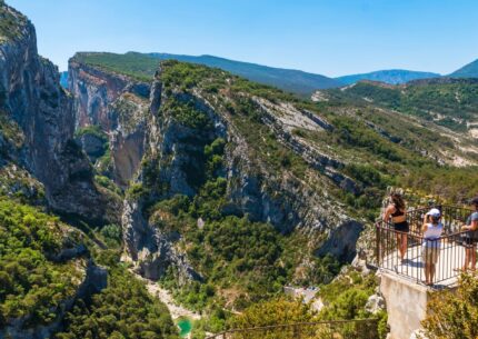
The Verdon Ridge Road: spectacular views of the Verdon Gorges, a deep and steep canyon carved out by the Verdon River. This road winds through the mountains and cliffs, offering travelers breathtaking panoramic views of the surrounding landscapes.

It was built in the mid-20th century primarily for tourism purposes. It was designed to allow visitors to admire the breathtaking scenery of the Verdon Gorges, while also providing easier access to the region. Building the road was a technical challenge due to the rugged topography and steep slopes of the gorges.

The Route des Crêtes, a project spearheaded by the elected officials of the time and local residents, wasn’t built in a day! It took more than 20 years to complete.

Construction began in 1949; by 1953, it was possible to reach the Chalet de la Maline, and more than 10 years later, the Dent d’Aire lookout. The loop was completed in 1972.

The architects Moreau and Prola, as well as the chief engineer of public works, Gaston Armanet—after whom one of the observation decks is named—played an active role in its construction.

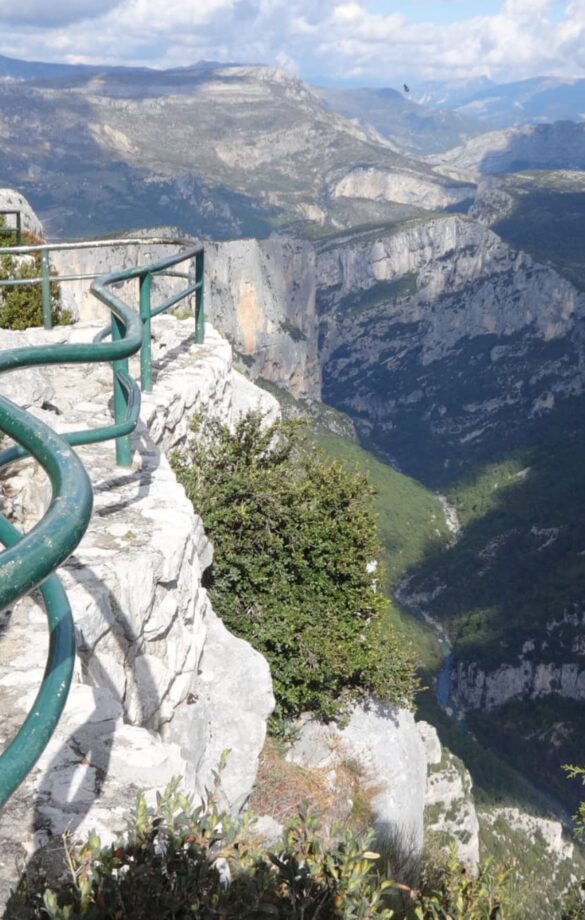
Vue depuis un belvédére sur la route des crêtes
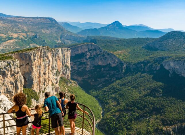
Famille sur un belvédère de la Route des Crêtes face aux Gorges du Verdon

The Route des Crêtes: 24 km of wonders

The road is open from late March to late November.

The central section is one-way.
To experience the entire route, you must travel clockwise.
So start at the Auberge des Crêtes and end in La Palud-sur-Verdon.

There are about fifteen lookout points along the route. We’ve decided to highlight the most notable ones. At each of these lookout points, you’ll find a small parking lot just a few meters away.

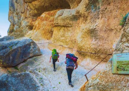
During your journey, you’ll pass by the Chalet de Maline, the starting point of the legendary Blanc Martel Trail.

Some information about the Route des Crêtes

The Route des Crêtes du Verdon invites you on an unforgettable adventure through the Gorges du Verdon, one of the world’s most spectacular canyons.

This legendary route combines the raw beauty of the landscape with the comfort of exploration by bike or car. Immerse yourself in the majesty of the canyon shaped by the Verdon River, where every bend reveals vertiginous rock faces and emerald waters.

Start 800 meters from the exit of La Palud-sur-Verdon heading toward Castellane, soak up its charm, and then set off on a journey where new panoramic views await around every bend.

Whether you’re a cyclist looking for adventure or a traveler looking for tranquility, this route offers a memorable experience. Lookouts dot the route, offering spectacular views to capture unforgettable memories.

Get ready for an extraordinary vacation, where nature, excitement and exploration await you.

A little anecdote

For these projects (and those involving the dams), workers were hired for periods of several years, including Italians, who were known to be skilled builders. Some stayed and married local women. (Source: “La Route des Crêtes”)
Questions about the Verdon Ridge Route

Why is this one-way section closed in the winter?

Frost is common in winter.
We’re in Provence, but at a higher elevation and with the humidity brought by the Verdon River.
In addition, the road is very steep and doesn’t always have guardrails, which makes it quite dangerous.

Why is it one-way in the middle section?

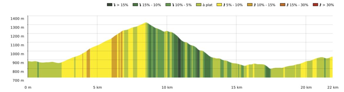
It is very narrow, steep (15%), and dizzying in this area.
The one-way rule also applies to bicycles (as required by the Highway Code!).

What is a one-way street?

A one-way street is a road on which traffic is permitted to travel in only one direction. Therefore, if you are on this type of street, you will never encounter other road users coming from the opposite direction. In fact, a no-entry sign placed at the entrance opposite the direction of permitted traffic informs other drivers that they are not allowed to enter this street.

You won’t encounter any red lights on the Route des Crêtes…


Can we go there by RV or bus?

It’s all about length and height!
It’s limited to 12 meters in length and 3.6 meters in height.
And you can’t be afraid of mountain roads!

Will I feel dizzy or nauseous?

The road is dizzying in the middle section; if you’re afraid of heights, we recommend sticking to just the first part of the route—a round trip—up to the Dent d’Aire lookout point.

Motion sickness: It’s possible, but stopping at the lookouts to admire the views usually helps alleviate it somewhat.

When is the best time to drive the Route des Crêtes?

The road is very busy during the summer season: from July 15 to August 30…
During the day, it’s best to go before 10 a.m. and after 6 p.m. The sunrise from the first lookout points is magnificent… The sunset is also worth seeing.

I don't understand—where's the starting point?

Starting from the Tourist Office, head toward Castellane or Rougon. You’ll pass the convenience store with the gas station, then the church. You’ll leave the village and pass the municipal campground on your right. Take the first road immediately to the right after the campground: you’ve arrived! Then continue on until you reach the first lookouts at Trescaire.

Is there anywhere to eat along the way?

The Chalet de la Maline offers excellent dining; if you arrive a little early, you can get a table with a breathtaking view of the Gorges. They have a menu featuring all-homemade dishes made with high-quality ingredients.
Please note: the water from the faucets at the Chalet de la Maline is not drinkable, so you won’t be able to fill your water bottles there.

By bicycle or electric bicycle

The road isn’t flat!
A 500-meter climb to the Pas de la Baou lookout point, followed by a 700-meter descent to La Maline. The final section is gently sloping, with a 200-meter climb.

For a more leisurely and eco-friendly way to explore, Verdon-e-bike offers electric bike rentals.
Book your tour.

You'll also like