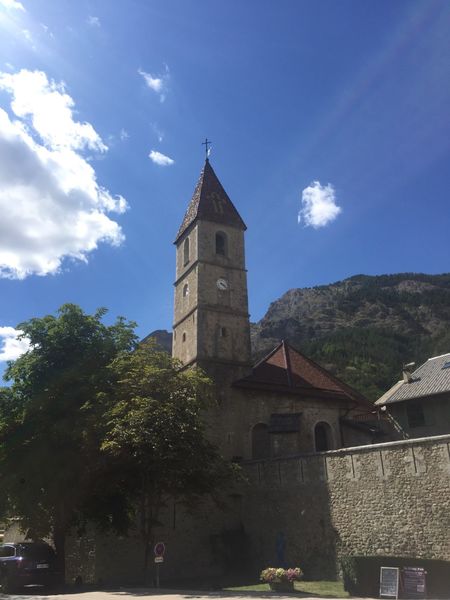
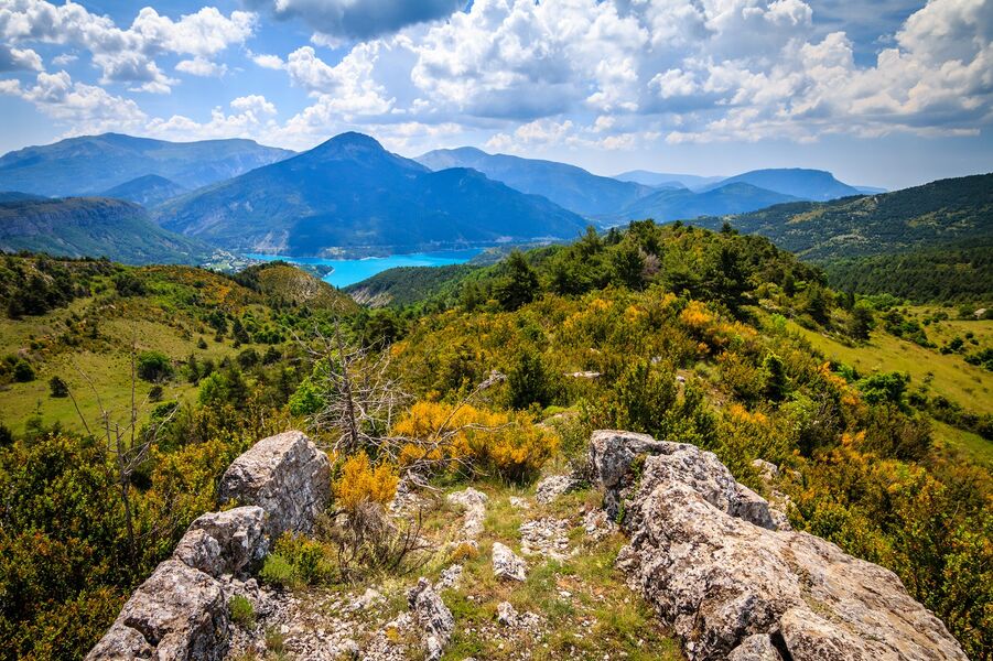
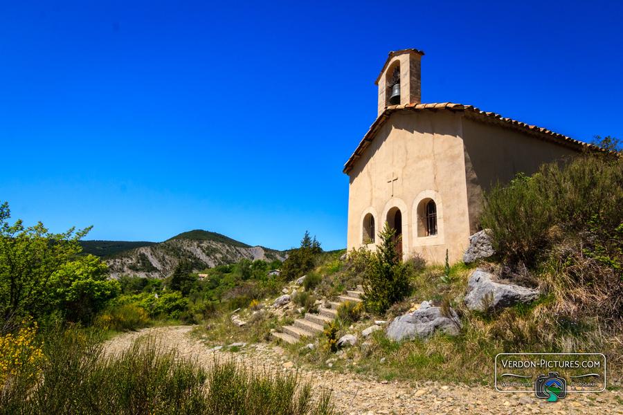
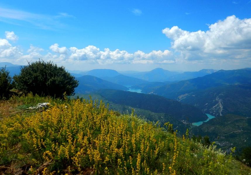
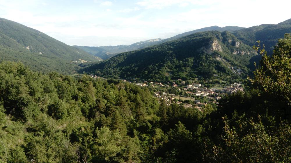
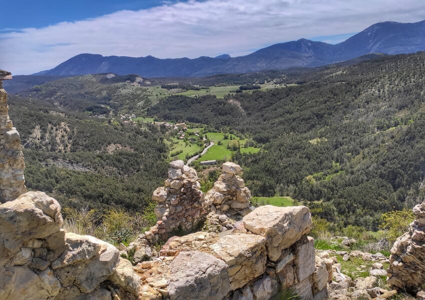
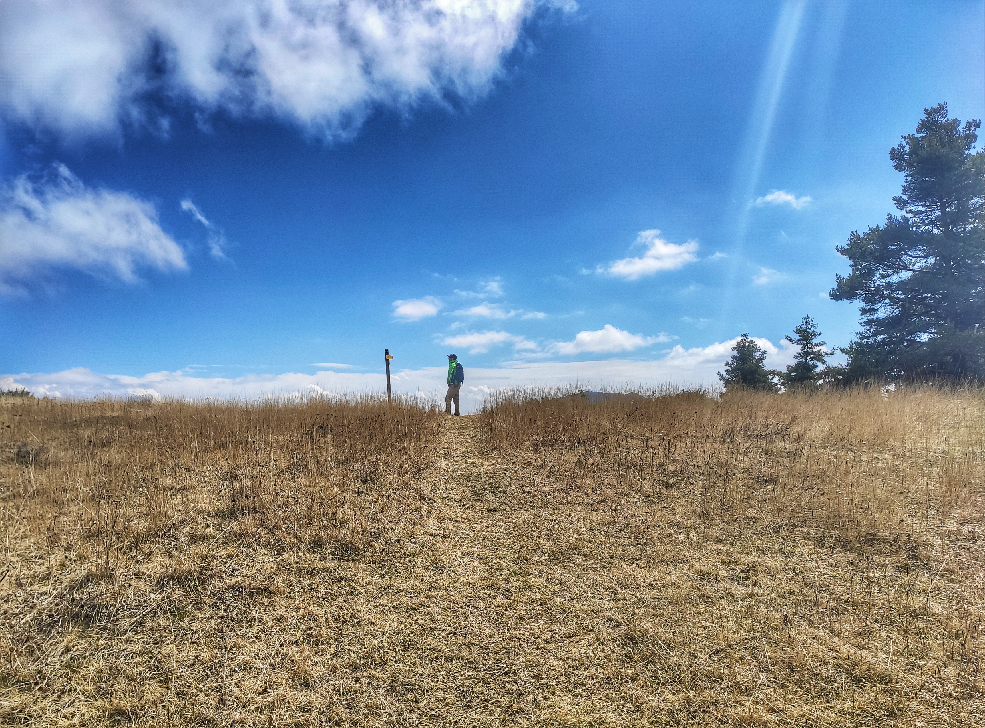
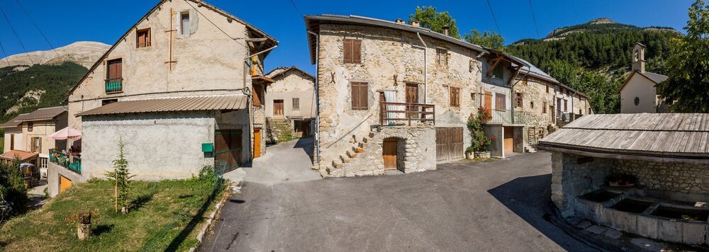
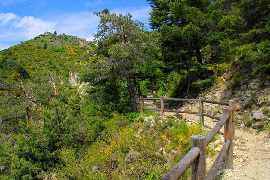
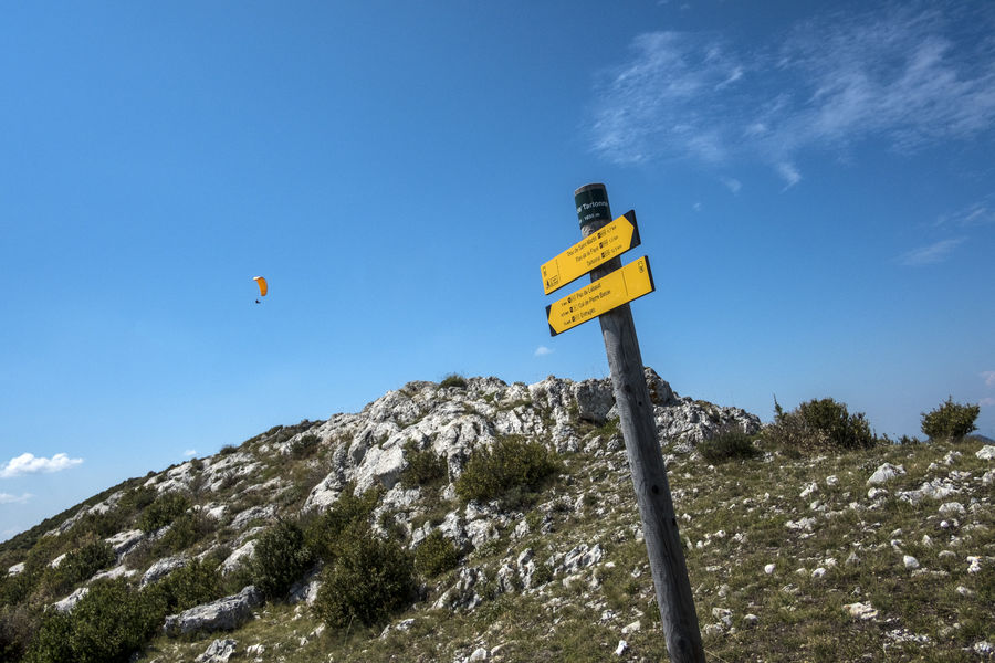
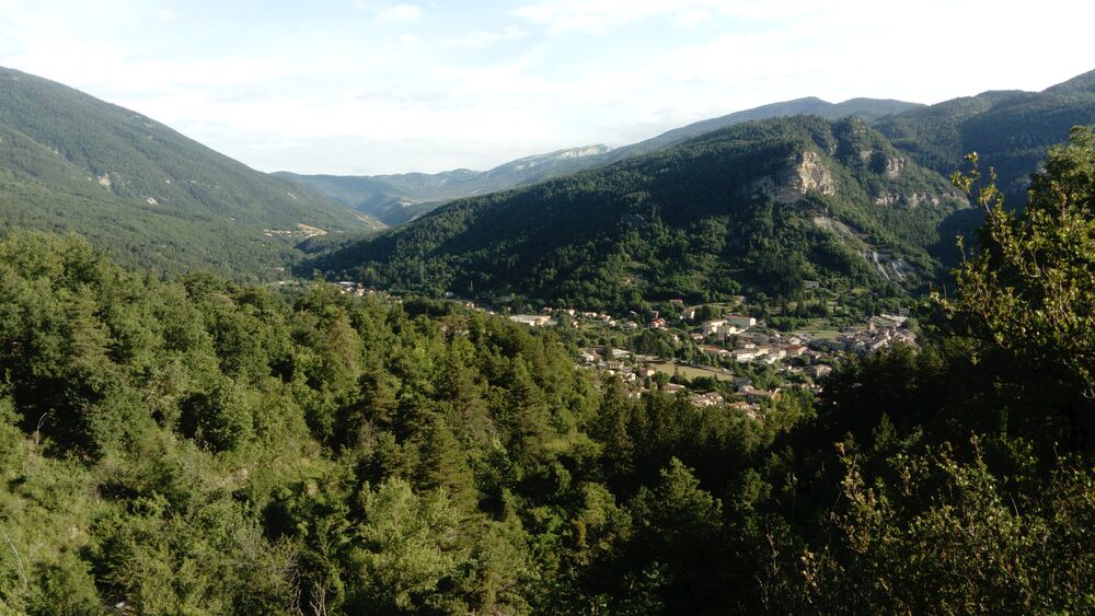
The trail of Blanc Martel
Details for this property are no longer available.

-
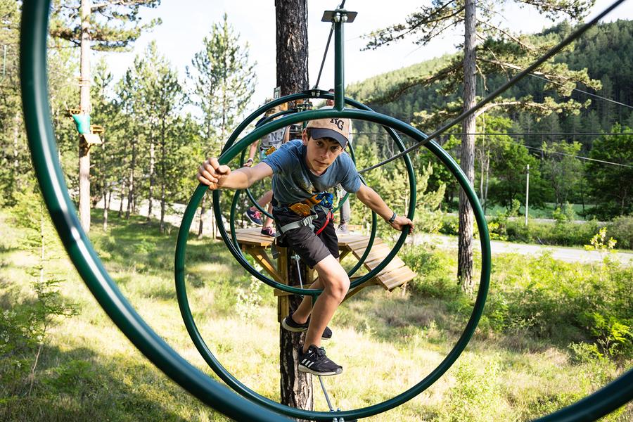
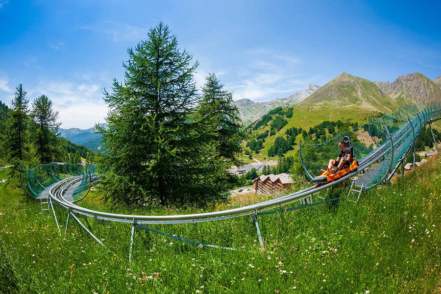
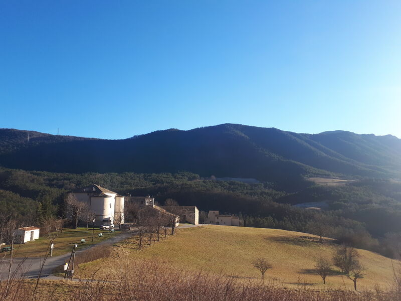
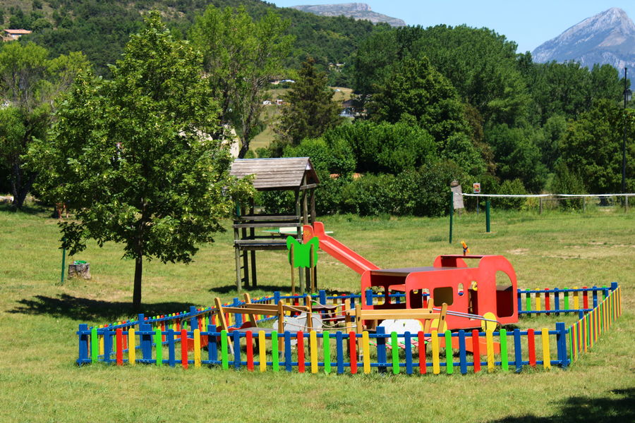
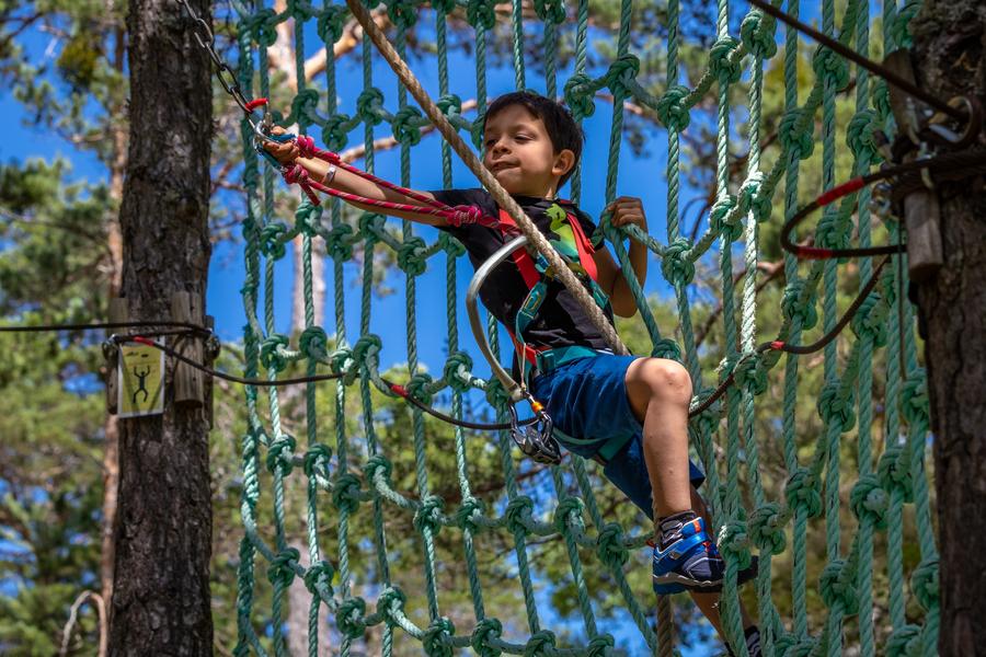
 Barca Parc is a multi-activity leisure park featuring high wire courses, a children's net area, orienteering on the theme of forest animals, nature escape games, archery touch, gelly tag and axe throwing!EQUIPMENTBarca ParcBarrême-en
 -
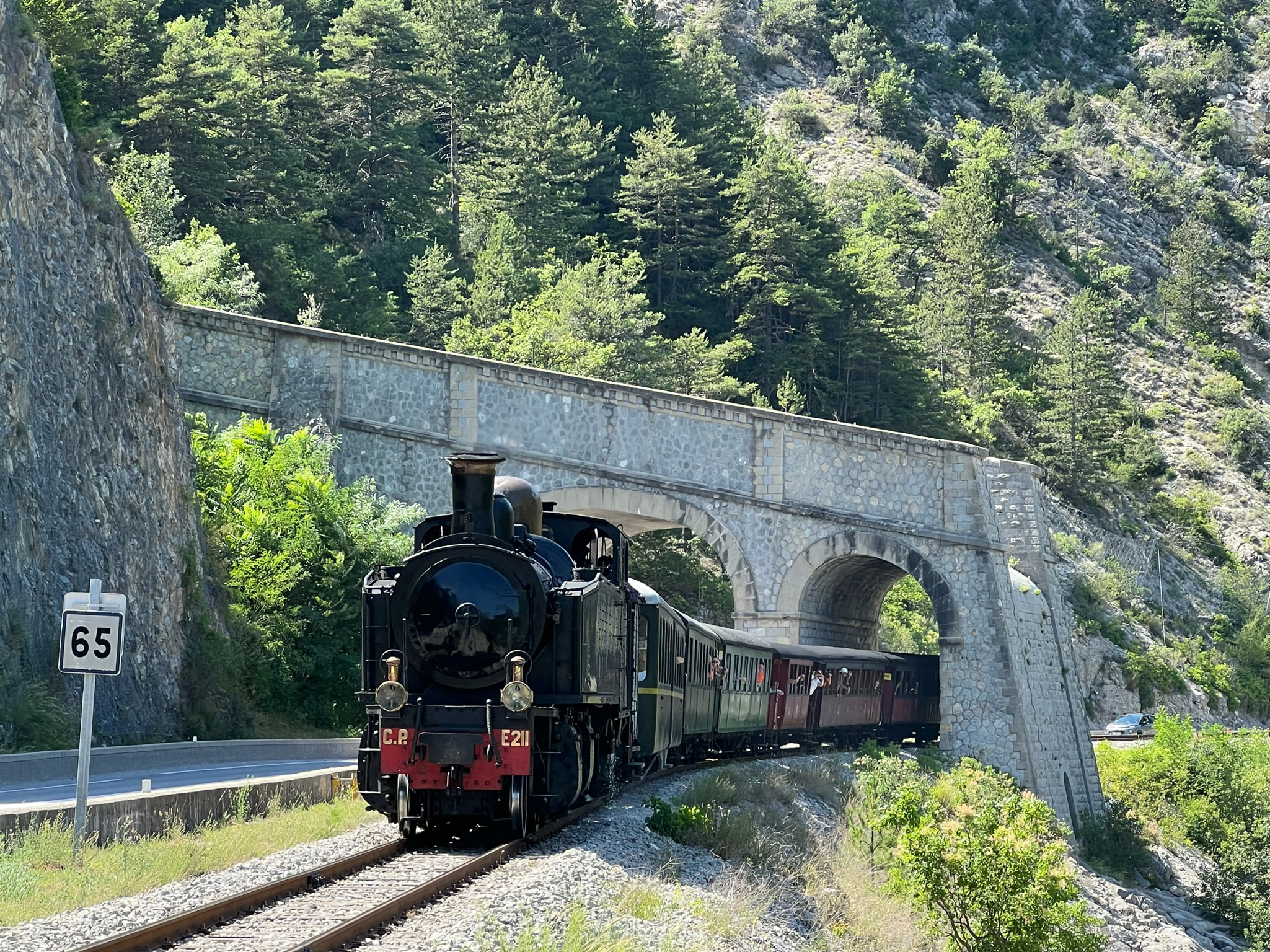
An unforgettable ride through the Haut Pays Niçois and Haute Provence on the steam Train des Pignes or the Micheline. From the land of the olive tree to that of the chestnut tree, via Entrevaux and its citadel, immerse yourself in the charm of travel in days gone by.EQUIPMENTTrain des Pignes historiquePuget-Théniers-en
-
Une randonnée qui vous emmènera sur les hauteurs de Rougon et en point d'orgue la vue sur son point SublimeEQUIPMENTLA PALUD-SUR-VERDON - La Palud - Rougon point sublime + AutocarRougon-en
-
Skateboard rampEQUIPMENTSkateparkLa Palud-sur-Verdon-en
-
This route connects Peyroules to the hamlet of La Bâtie on a beautiful, steep downhill ride.EQUIPMENTPeyroules - La BatiePeyroules-en
-
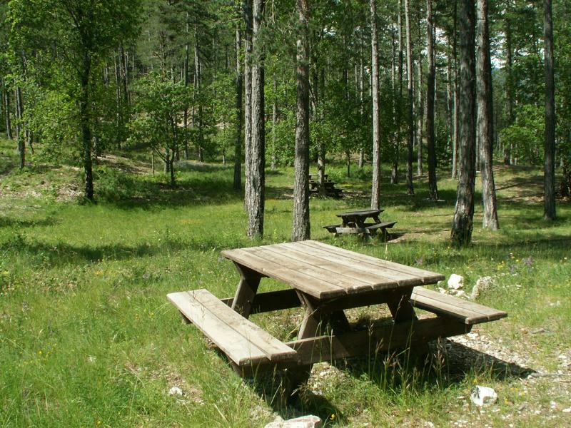
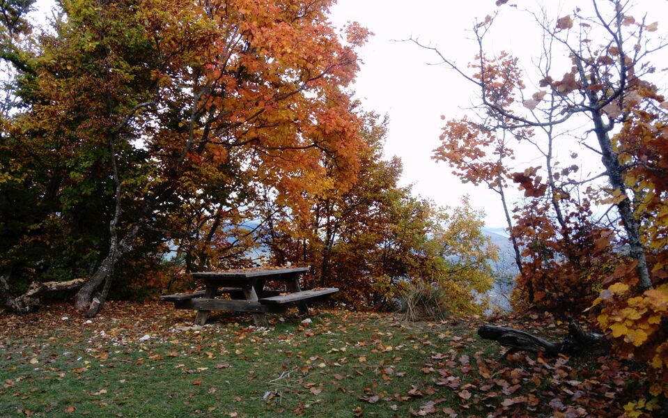
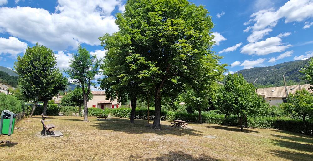
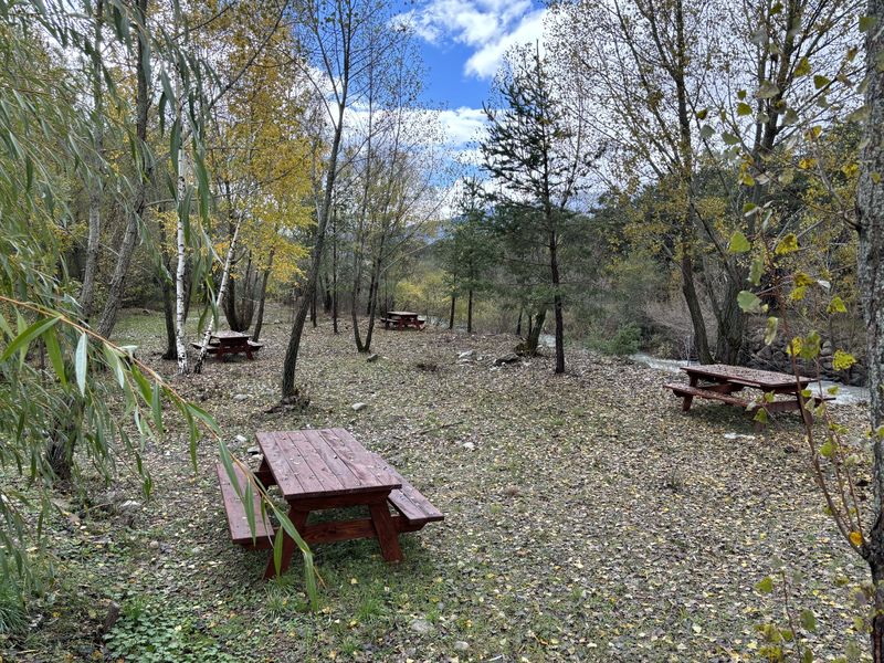
5km from the village center, a well-shaded table next to the Verdre spring and a few meters further on, a lovely area with 4 tables, ideal for groups.EQUIPMENTPicnic area at the Verdre springAnnot-en
-
Starting out in the same way as circuit no. 15, this loop leaves it shortly before the hamlet of Riou d'Ourgeas for a long climb on forest tracks towards Haut Ourgeas and Montagne de la Barre.EQUIPMENTLe Tour des BarresBarrême-en
-
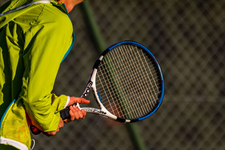
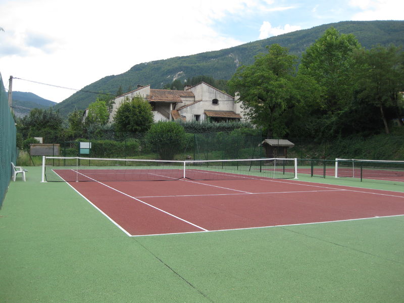
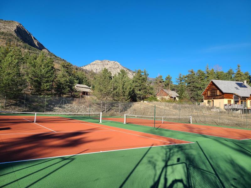
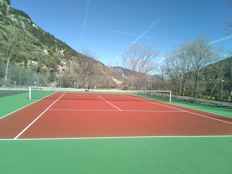
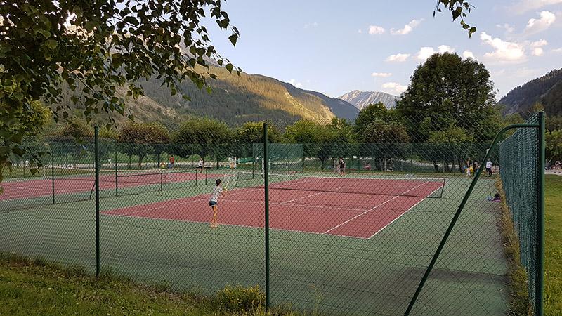
Three self-service courts and a training wall.EQUIPMENTCastellane municipal tennis courtsCastellane-en
-
Mostly shaded at the start, the path joins the Pont Saint-Joseph. It climbs up the St-Jean ravine, at the foot of the cliffs of the Educh plateau, to the ruins of the hamlet of Ourges. The climb is steeper up to the chapel of Saint-Jean-du-Désert.EQUIPMENTLa Chapelle Saint-Jean-du-Désert depuis AnnotAnnot-en
-
A trailhead that winds through a larch forest, arriving at a summit open to all 4 cardinal points. Panoramic view of the Vaïre and Verdon valleys.EQUIPMENTLe Puy de Rent depuis la Colle-Saint-MichelThorame-Haute-en
-
Le départ de ce sentier se trouve au parking des gorges de Saint-Pierre à Beauvezer. Il est accessible depuis le hameau de Villars-Heyssier via une piste forestière carrossable de 1,3 kmEQUIPMENTSentier Botanique des Gorges de Saint-PierreBeauvezer-en
-
The last "mountain" section climbs on track and then path to the Mondenier crests. The panorama that unfolds is breathtaking: Provence awaits you! A long, steep and technical descent takes you back to Moustiers.EQUIPMENT11 TransVerdon Tronçon - Des Chauvets à Moustiers-Sainte-MarieLa Palud-sur-Verdon-en
-
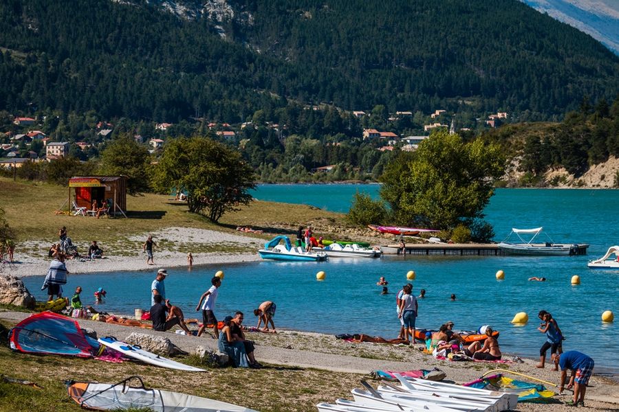
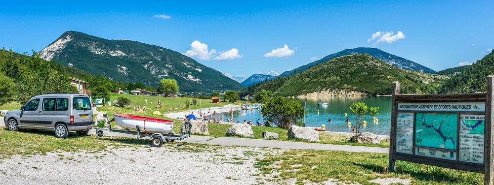
The Plage du Plan in Saint André les Alpes is located 2 km from the village center on the road to Nice.EQUIPMENTPlage du plan in Saint André les AlpesSaint-André-les-Alpes-en
-
From the Basse d'Angles pass (1577 m), you reach the Serres ridge, overlooking the Ivoire and Verdon valleys.EQUIPMENTLa Basse d'AnglesAngles-en
-
A long hike on the imposing Crête des Serres (mountain crest). We will benefit from its 1,777m of remarkable views of the peaks of the Southern Alps and the Castillon lake and the peaks of the Haut-Verdon in the background.EQUIPMENTCrête des SerresSaint-André-les-Alpes-en
-
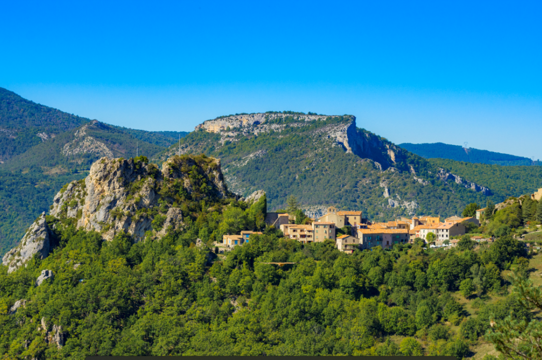
A visit to the picturesque village of Le Poil, clinging to the slopes of the rocky outcrop from which it derives its name "lou péu", "stake" in Provencal.EQUIPMENTLe Hameau du PoilSenez-en
-
At the summit is a pyramid that served as a sighting point for the Train des Pignes tunnel. Enjoy views over the villages of La Colle-Saint-Michel and Peyresq, and the summits of Grand Coyer, Ruch, Rent and Grand Cordoeil.EQUIPMENTMontruvel 2Thorame-Haute-en
-
This route, reserved for the more athletic, combines loops 12 and 13. The most athletic will complete this itinerary in 3 hoursEQUIPMENTDe Maurel au ChalvetSaint-André-les-Alpes-en
-
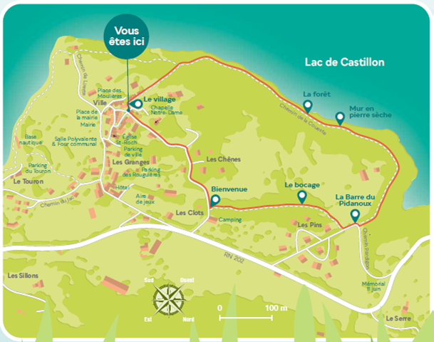
This hike, easy and very pleasant, is ideal during spring and offers multiple viewpoints on the Castillon lake.EQUIPMENTBarre du PidanouxSaint-Julien-du-Verdon-en
-
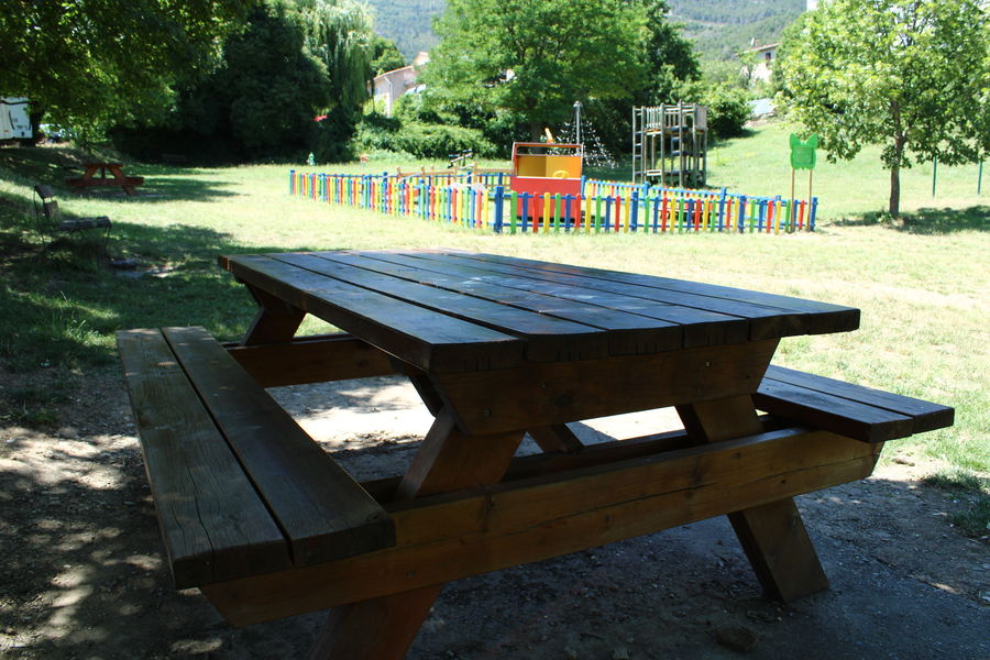
4 picnic tables set in a play area.EQUIPMENTPlayground picnic areaAnnot-en
-
At the departure of Val d'allos - The Village, this walk, at the same time family and playful, will make you follow the river.EQUIPMENTLe Plan et le Circuit TrappeurAllos-en
-
From the plateau, the route rises to its highest point: the Baisse de Détroit, at 2472 m! The scenery is simply sumptuous, and a change of scenery is guaranteed. Once over the pass, it's a long single climb up the mountainside to La Colle-Saint-Michel.EQUIPMENT004 TransVerdon Tronçon - Des Lacs de Lignin à la Colle-Saint-MichelColmars-en
-
This themed trail takes you on a tour of the various fragrant, aromatic and medicinal plants found in our mountains.EQUIPMENTSentier des Plantes AromatiquesLa Mure-Argens-en
-
Chauffée par panneaux solaires mais non couverte, la piscine dispose d'un bassin de 25m et d'une pataugeoire ainsi que d'un snack. Sont proposés cours de natation et d'aquagym.EQUIPMENTPiscine municipaleAnnot-en
-
Take a stroll through the village streets, and discover the buildings, customs and traditions that make up the history of Colmars.EQUIPMENTHeritage trailColmars-en
-
From Lac de Castillon to Castellane, at the entrance to the Gorges du Verdon, and on to Vauplane and Saint-Auban, take in the exceptional panoramas that characterize the Middle Verdon, between mountains and valleys.EQUIPMENTChemins du Soleil - De Saint-André-les-Alpes à Saint-Auban - Des gorges du Verdon aux rives de l'Estéron (A18)Saint-André-les-Alpes-en
-
From the summit of Chalvet (1613 m), a mecca for hang-gliding, the panoramic view allows you to spot more than 50 remarkable peaks, which can be identified from an orientation table.EQUIPMENTLe Sommet de Chalvet (1613 m)Saint-André-les-Alpes-en
-
Le parcours se déroule entre grès et châtaigniers dans sa première moitié avant de rejoindre Le Fugeret. Il passe ensuite en rive droite de la Vaïre et monte jusqu'aux sources de Roncharel avant de redescendre vers Annot après une portion en balcon.EQUIPMENTParcours 13 - Les 2 rivesAnnot-en
-
The path passes through a forest of ancient fir trees before leading into the Sapée meadow, offering a magnificent panorama.EQUIPMENTLe Sommet de la Sapée (1701 m)Tartonne-en
-
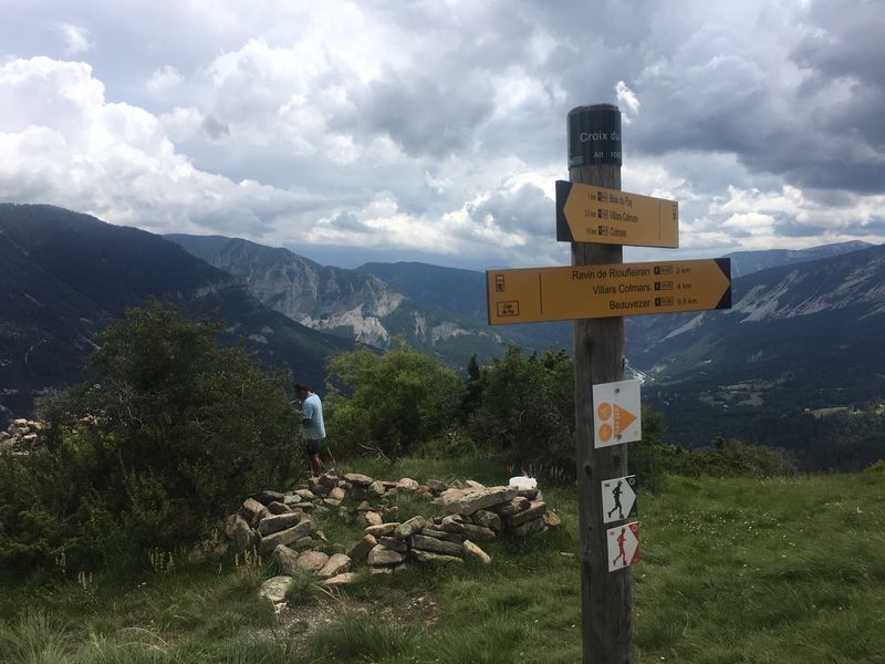
The Croix du Puy site is accessible by an easy hiking trail, from which you can admire a remarkable panorama of the Verdon valley.EQUIPMENTLa Croix du PuyVillars-Colmars-en
-
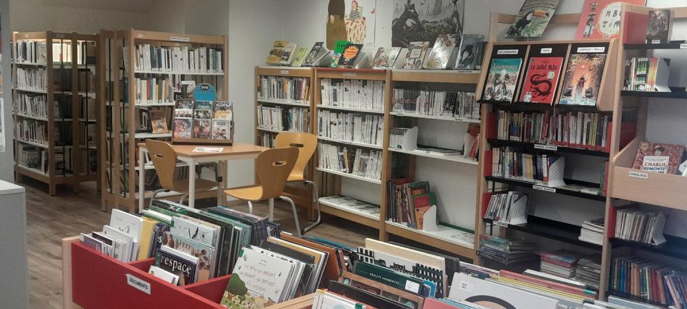
For young, medium and old, for those who like a good story, those who prefer bubbles or those who are looking for something specific. Not forgetting those who don't know what they like and need a little guidance.EQUIPMENTMédiathèque de SaussesSausses-en
-
Nice climb to the cirque de Juan, mostly shaded. You'll pass close to the Juan climbing site (approved climbing site).EQUIPMENTCirque de JuanVillars-Colmars-en
-
A superb route through the Issole national forest. Climb alternating road and track to the summit of Chalvet, a world-famous site for hang-gliding.EQUIPMENTLe Tour du VillardSaint-André-les-Alpes-en
-
Entre Chaudon et Norante, profitez d’une lecture de paysage offrant une vue remarquable sur le Château Plus Haut.EQUIPMENTParcours patrimoine entre Chaudon et NoranteChaudon-Norante-en
-
This path, mostly in chestnut forest, offers a beautiful panorama of the sandstone and the village. The start of the route follows the Roman road along the Beïte valley.EQUIPMENTLe Baou de ParouAnnot-en
-
Gain height at Bla Magnan and discover Colmars from another angle. Cross over to the forest track overlooking the course of the Verdon and descend through the Scots pines. Return to the left bank of the Verdon.EQUIPMENTBla MagnanColmars-en
-
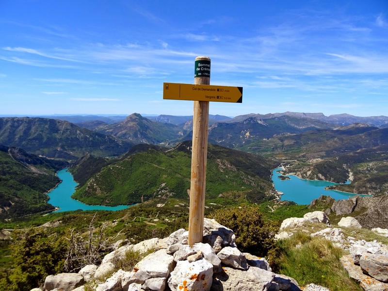
View of Lac de Castillon. Early in the morning and on a clear day, from the summit you can see Corsica, the gap in the Gorges du Verdon to the south-west, Mont-Chiran to the west and the highest point in the area to the north-west, the Cheval Blanc massif.EQUIPMENTLe Sommet de CrémonSaint-Julien-du-Verdon-en
-
With its 360° panoramic view, the summit of Le Laupon offers a magnificent panorama of the region's landscapes.EQUIPMENTLe LauponColmars-en
-
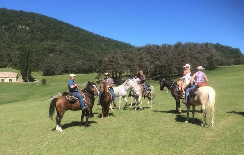
Une 1ère étape départementale de la Route Napoléon à Cheval, labellisée Grand Itinéraire Equestre, permet de commencer en douceur la découverte de ce parcours dans les Alpes de Haute-ProvenceEQUIPMENTPEYROULES - La route Napoléon à ChevalPeyroules-en
-
La Rotonde peut vous accueillir à l’occasion de réunions familiales ou de groupes. Sont mis à disposition tables et bancs ainsi que le nécessaire de cuisine, frigo, cuisinière four, lave-vaisselle.EQUIPMENTSalle des fêtes "La Rotonde"Villars-Colmars-en
-
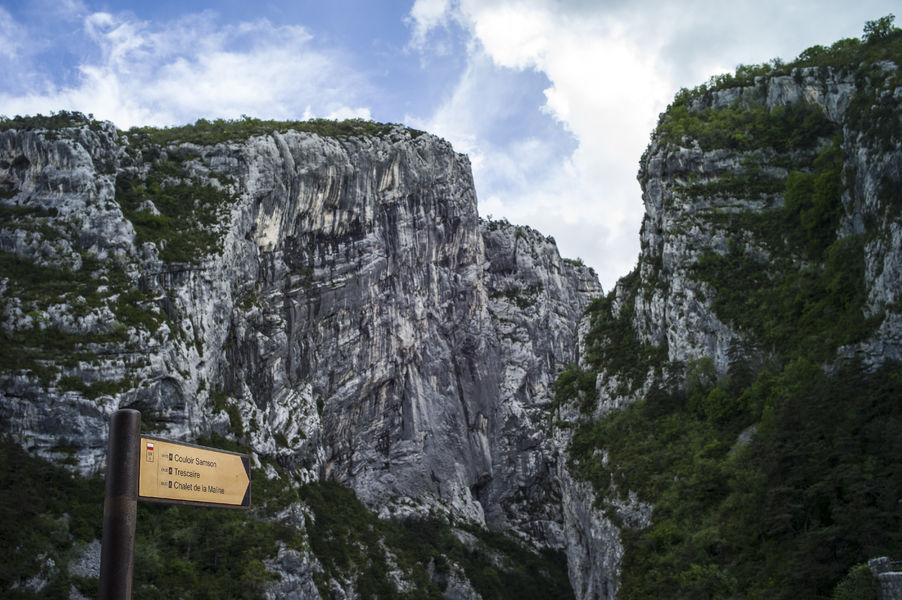
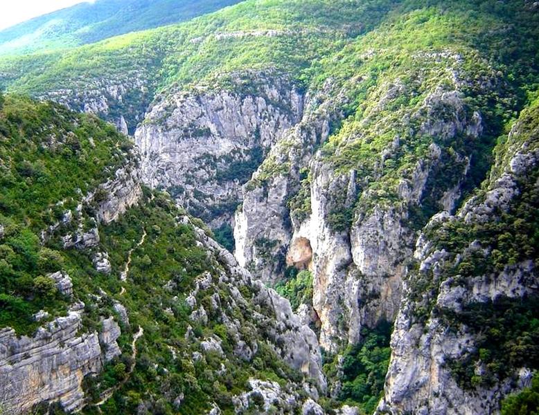
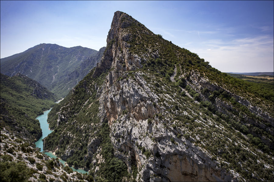
The couloir Samson itinerary takes you to and from the entrance to one of Europe's largest canyons: the Gorges du Verdon.EQUIPMENTCouloir SamsonRougon-en
-
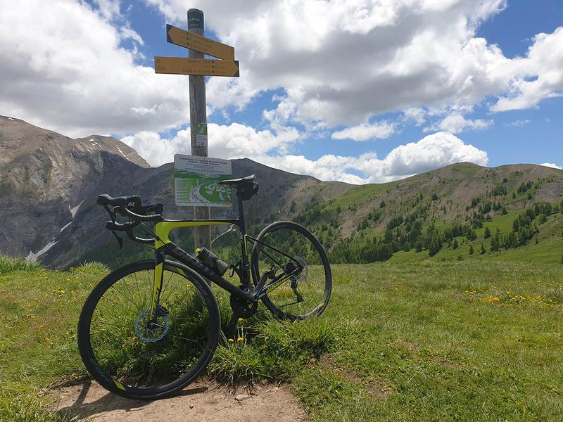
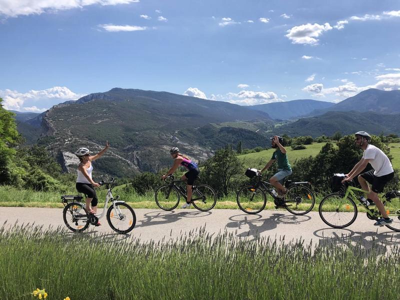
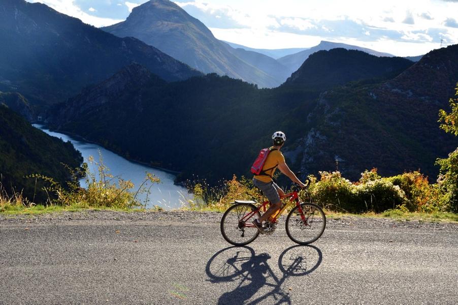
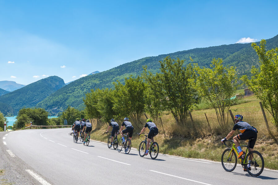
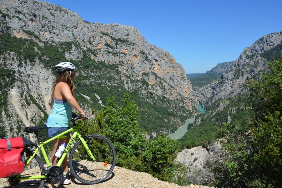
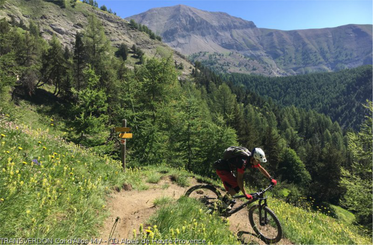
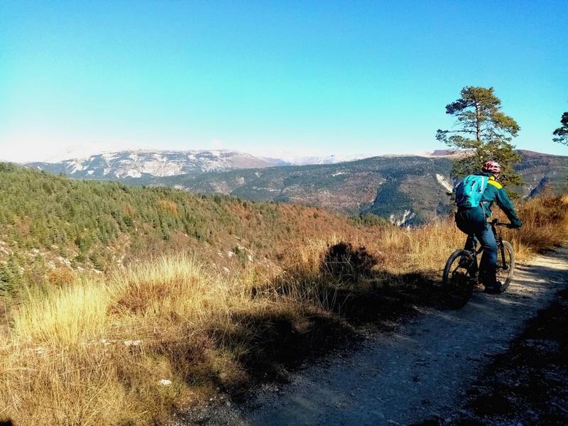
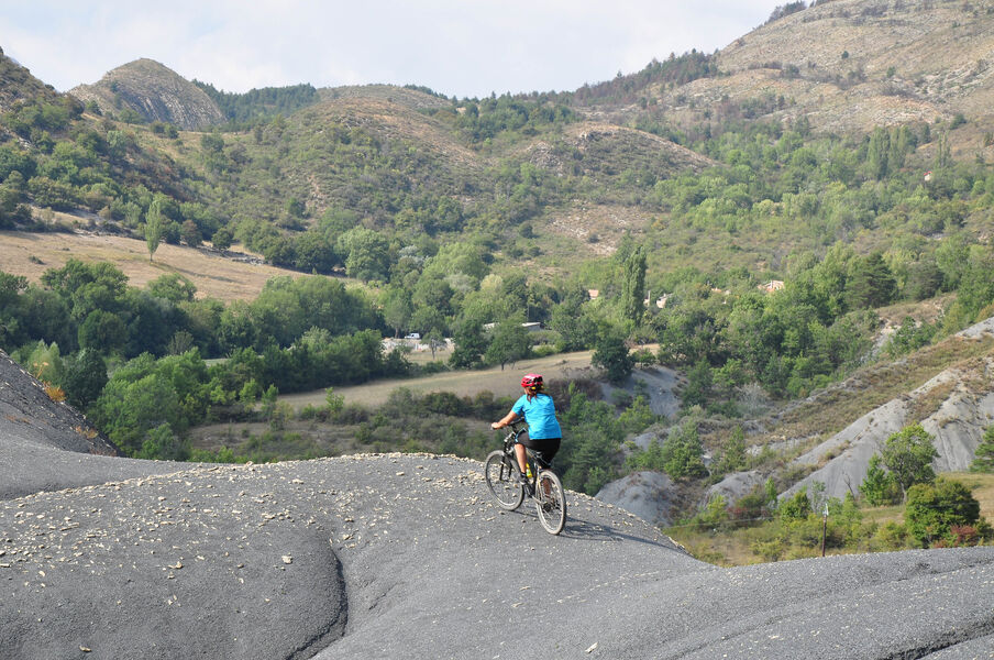
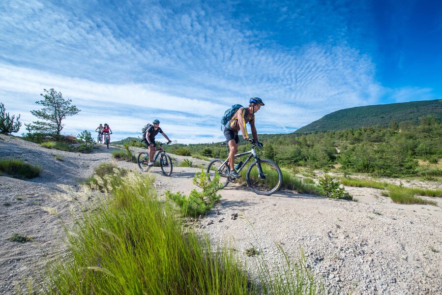
The upper valley of the Verdon offers many opportunities for cycling tours and discoveries. Col d'Allos and Col des Champs are very popular passes for cycling enthusiasts.EQUIPMENTCol d’Allos – Cyclosport areaAllos-en
-
After reaching the village of La Mure along the picturesque "Train des Pignes" railroad line, this circuit climbs along a forest track below the Montagne de Maurel, then plunges into the Isole valley along a shady path.EQUIPMENTLe Travers des GalansSaint-André-les-Alpes-en
-
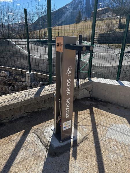
Self-service station equipped with essential tools for small repairs and airing up your bike.EQUIPMENTPublic bike facilitiesVergons-en
-
Itinéraire offrant des points de vue remarquables sur le village de La Palud et les montagnes environnantes ainsi que sur le Grand Canyon. C'est le seul sentier qui permet d'accéder au plus haut point de vue, au dessus des Gorges du Verdon.EQUIPMENTChemin du Belvédère de la Dent d'AireLa Palud-sur-Verdon-en
-
Une randonnée qui vous emmènera sur les hauteurs de Rougon et en point d’orgue la vue sur son point SublimeEQUIPMENTLA PALUD-SUR-VERDON - La Palud - Rougon point sublime + AutocarLa Palud-sur-Verdon-en
-
Le plateau de Suech, cette étendue pierreuse posée là comme une vaste respiration silencieuse parmi les reliefs alentour, vous aurez l’impression d’être dans une contrée lointaineEQUIPMENTROUGON - Rougon - Chasteuil + AutocarRougon-en
-
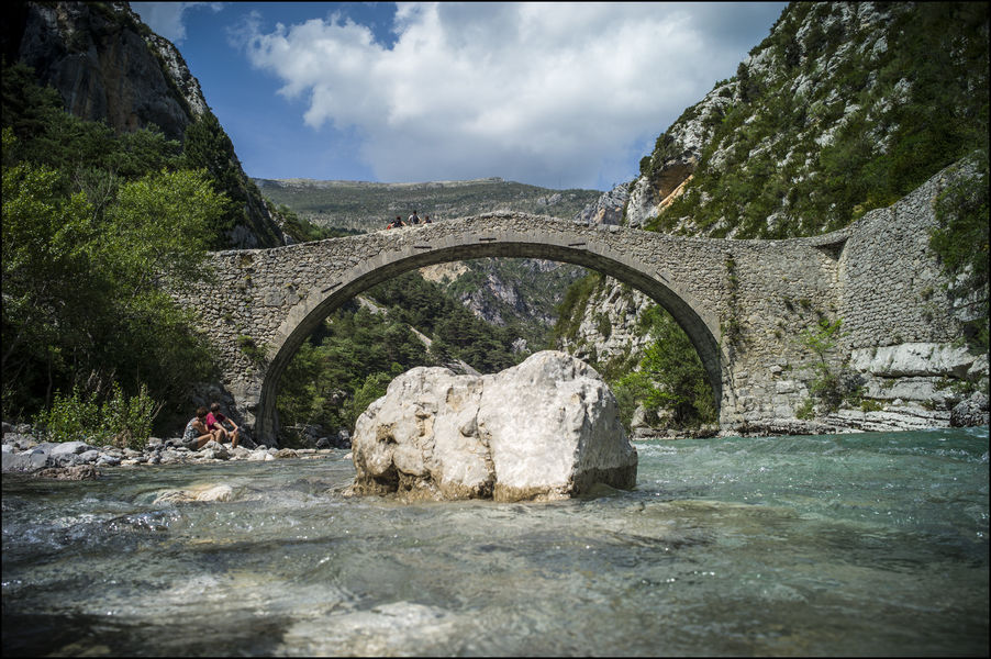
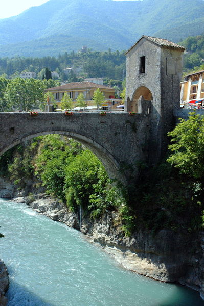
Dating from the 17th century, this pretty bridge over the Verdon is well worth the detour... It's an ideal walk for a special moment in the heart of the Verdon: a calm, unspoilt place, far less crowded than the Gorges.EQUIPMENTPont de TussetRougon-en
-
The tour heads for La Valette, a typical mountain hamlet that has withstood the rigors of the climate. The return journey is a pleasant one along the left bank of the Issole.EQUIPMENTLa ValetteThorame-Basse-en
-
From the Villars-Heyssier bridge, a long loop with beautiful panoramas on the forest track and undergrowth crossings on the left bank of the Verdon.EQUIPMENTLes Balcons de Pinatelle par Villars-HeyssierBeauvezer-en
-
A table on the edge of the forest road, opposite the Roncharel gîte.EQUIPMENTRoncharel picnic areaAnnot-en
-
A pretty trail, much of it shaded, linking the two villages without taking the car. This is a variant of the GR4, and can of course be done as a one-way trip in either direction.EQUIPMENTLa Palud - Rougon par le Pont du BaouLa Palud-sur-Verdon-en
-
Discover the woollen cloth factories, testimony to the village's industrial past.EQUIPMENTCircuit découverte des fabriques de draps de laineSaint-André-les-Alpes-en
-
At the crossroads of Provence and the Alps, the route up to Puy de Rent is a fine example of reforestation work. The scent of thyme and savory and the softness of the larch trees lull the walk, overlooking the Verdon and Vaïre valleys.EQUIPMENTLe Puy de Rent depuis AllonsAllons-en
-
Self-service station equipped with essential tools for small repairs and airing up your bike.EQUIPMENTPublic bike facilitiesRougon-en
-
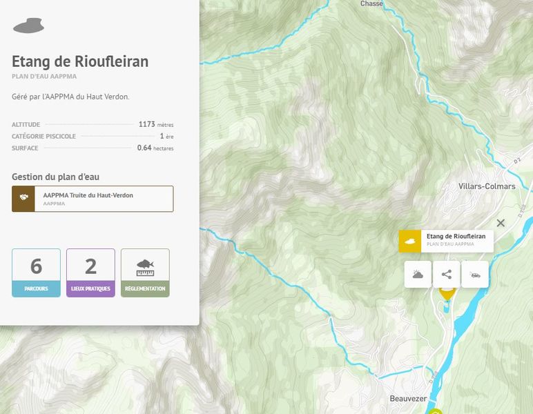
Managed by AAPPMA du Haut Verdon.EQUIPMENTRioufleiran pondBeauvezer-en
-
A physical and technical section, with a long, steady climb to the grassy Champlatte plateau, followed by a pleasant single-track descent to the Verdon, before reaching Thorame-Basse.EQUIPMENT005 TransVerdon Tronçon - De la Colle-Saint-Michel à Thorame BasseThorame-Basse-en
-
The path overhangs and then crosses the Besseuges stream, which marked the ancient border between Provence and the County of Nice, and then you reach the end of the world.EQUIPMENTBesseugesSaint-Pierre-en
-
The route starts in common with circuit no. 10, a section of the Chemins du Soleil and the TransVerdon.EQUIPMENTCourchons - MoriezSaint-André-les-Alpes-en
-
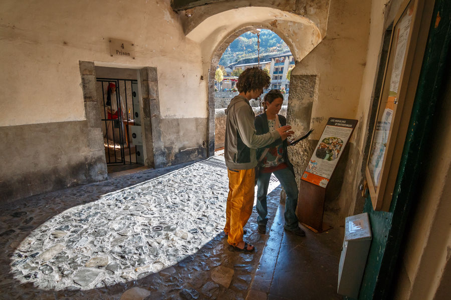
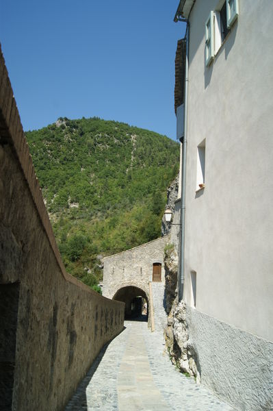
1 Royal Gate, Machicolation Redoubt Main entrance to the village since 1658 with 18th century machicolation redoubt with openings on the road side. The machicolations made it possible to throw all sorts of projectiles at the attackers.EQUIPMENTHeritageEntrevaux-en
-
Set along the river, the buildings and their history await you: the power plant, the wash house and the mills, of course!EQUIPMENTSentier les Moulins d'EntrevauxEntrevaux-en
-
Breathtaking view of Lake Castillon.EQUIPMENTThe peak of Mount CrémonSaint-Julien-du-Verdon-en
-
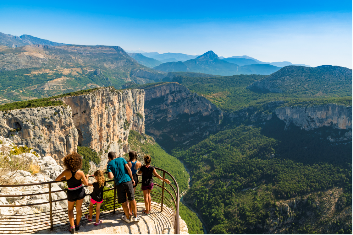
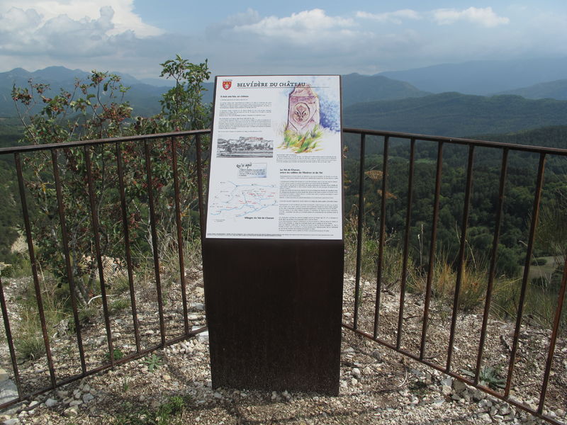
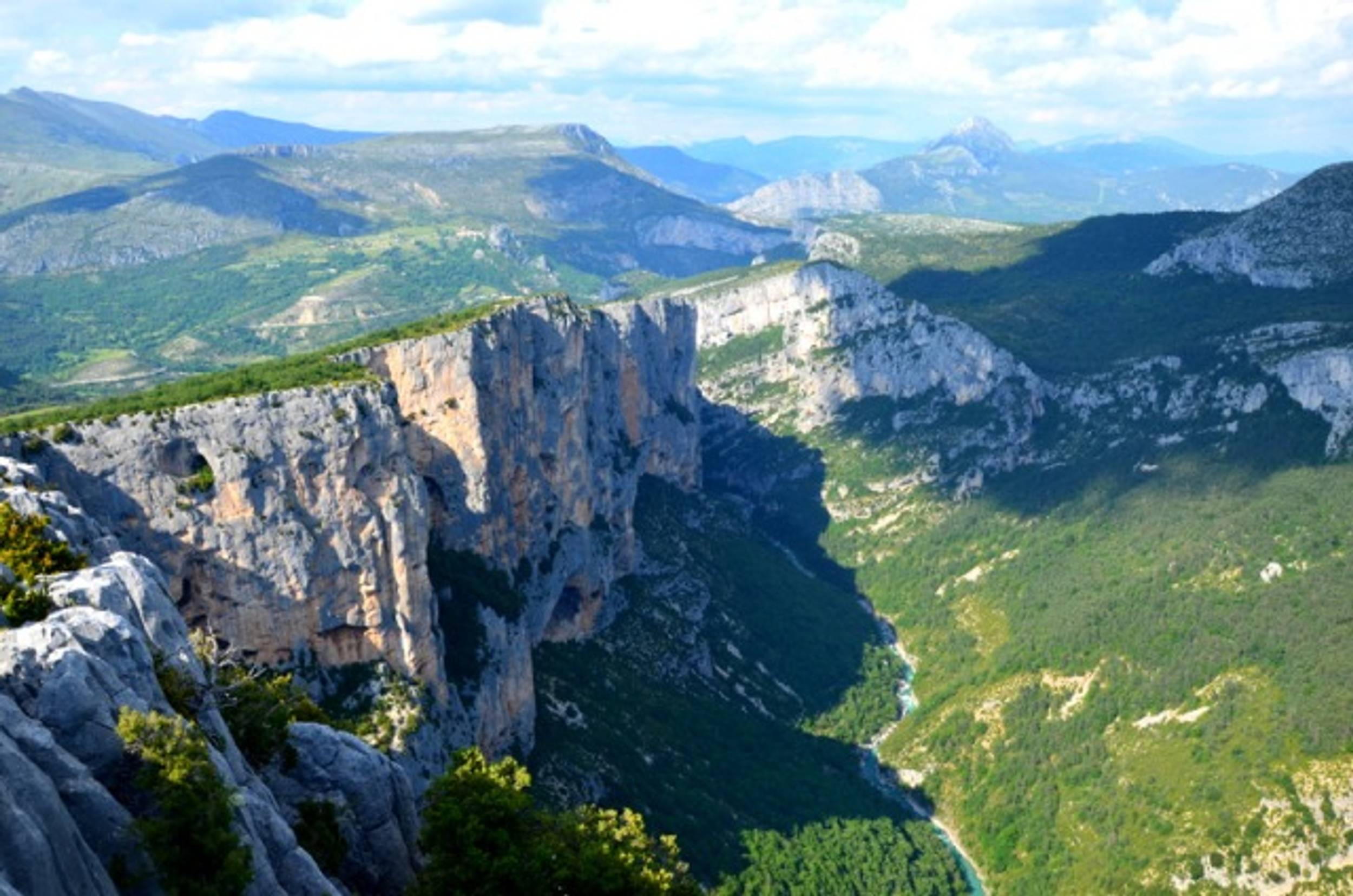
How to discover the Gorges du Verdon without passing by the mythical belvedere of the Point Sublime? It is a must-see.EQUIPMENTBelvédère du Point SublimeRougon-en
-
2h15 circuit - 104 km. A circuit of winding roads, from clues to hilltop villages, playing leapfrog. Ideal for bikers, this tour offers breathtaking scenery of greenery and rocky outcrops.EQUIPMENTCircuit hors du tempsSaint-Julien-du-Verdon-en
-
Itinéraire pédagogique facile qui serpente dans la forêt de mélèzes. Il vous conduira sur un éperon rocheux avec vue panoramique. Le long du sentier, découvrez des silhouettes d’animaux avec des QR codes à flasher pour découvrir leur cri ou leur chant.EQUIPMENTLe Belvédère de la CollettaColmars-en
-
This loop offers a beautiful panorama: gorges, forests, forest huts and finally the village of Ondres. Inhabited in summer, it makes a lovely shady stopover. You may be lucky enough to spot some chamois.EQUIPMENTGorges de Saint-Pierre - Col de l'Orgeas - OndresBeauvezer-en
-
Botanical trail, Moyennageuse tower, Piégut chapelEQUIPMENTSentier Botanique de la TourThorame-Basse-en
-
The climb to the summit of Destourbes is progressive and offers a succession of panoramas on the reservoir of Chaudanne.EQUIPMENTThe summit of DestourbesCastellane-en
-
A sporty hike that crosses the commune of Val de Chavagne to take you to the village of Amirat after passing the Col du Buis.EQUIPMENTWeek-end au Pays d'Entrevaux (1)Entrevaux-en
-
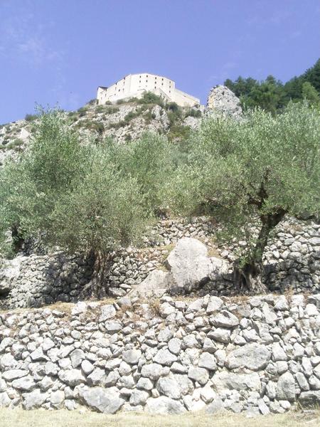
Walk through the narrow winding streets of Entrevaux from Porte Royale to Porte d’Italie, then continue on a high path on a ledge above the Var which runs alongside olive trees cultivated in terraces. The olives are harvested each winter and then transported to the communal oil millEQUIPMENTBalade le long du VarEntrevaux-en
-
This trail leads to the chapel of Saint Martin, erected at the foot of the imposing rock of the same name, the first parish church in the village of La Garde.EQUIPMENTChapelle Saint-MartinLa Garde-en
-
Night fishing authorized from April to December , on weekends only. No carp caught by anglers may be held in captivity or transported overnight.EQUIPMENTNight carp courseCastellane-en
-
Geological curiosities, rare species and biodiversity, a thousand-year-old heritage and mysterious legends: this trail will help you discover the hidden wonders of the Annot sandstone site.EQUIPMENTSentier des Grès d'AnnotAnnot-en
-
This area requires a short, gentle walk, 2km from the Colle Basse parking lot. From the table, you can enjoy a magnificent panorama of the entire valley.EQUIPMENTCrête des Traverses picnic areaAnnot-en
-
Head for the Gorges du Verdon and the magnificent village of Rougon, facing the sublime point. The section follows the ancient Roman road through the hamlet of Chasteuil and the wild plateau of Suech... under the watchful eye of the Verdon vultures. Sensational!EQUIPMENT009 TransVerdon Tronçon - De Castellane à RougonCastellane-en
-
Stroll to the Château Plus Haut, built in the Middle Ages on an eminence south of the village to keep watch over the surrounding area, from the Asse valley to the Col du Corobin.EQUIPMENTChâteau Plus HautChaudon-Norante-en
-
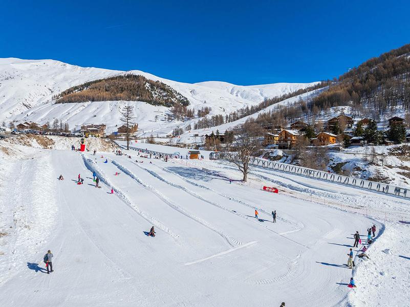
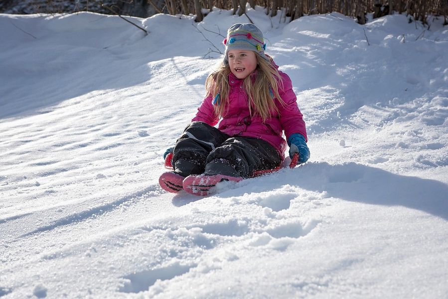
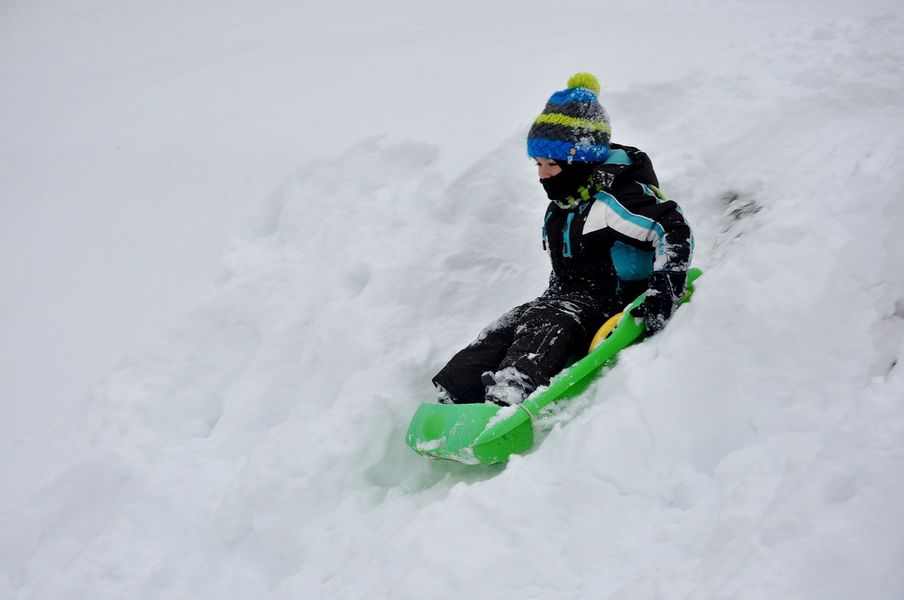
Sledging area 4 downhill lanes and 1 uphill lane to enjoy the pleasures of sliding.EQUIPMENTSledge areaLa Foux d’Allos-en
-
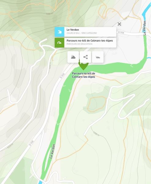
On this course, from the Pont Saint Roch to the Pont de la Buissière, all fish return to the water immediately and in the best possible conditions. All techniques authorized. Single barbless hook or crushed barb mandatory.EQUIPMENTNo-kill fishingColmars-en
-
From the Villars-Heyssier bridge, a magnificent circuit along the mountainside towards the Plan de Beauvezer and the hamlet of Ondres. Return with a beautiful panorama of the Verdon.EQUIPMENTOndresBeauvezer-en
-
A parking area that lets you get to Point Sublime and discover the beauty of the Grand Canyon du Verdon. The parking lot is open from 8 a.m. to 8 p.m. every day during the high season, and free access the rest of the year.EQUIPMENTParking du Point SublimeRougon-en
-
An easy loop along a pleasant shady forest pathEQUIPMENTLes FourchesSaint-André-les-Alpes-en
-
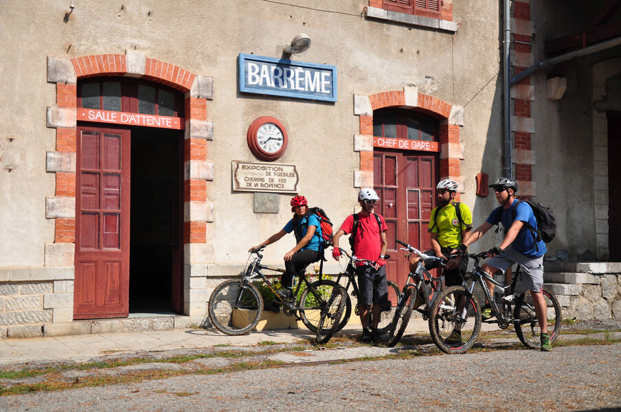
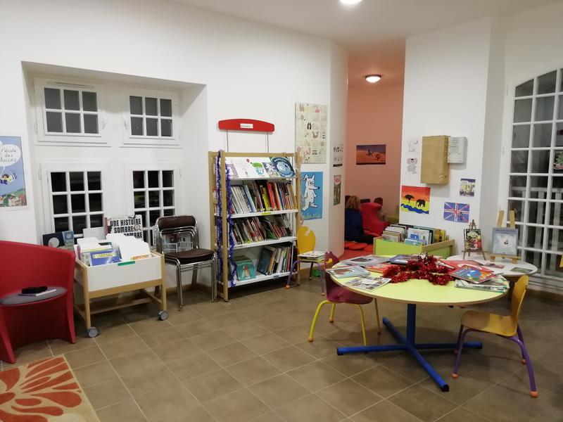
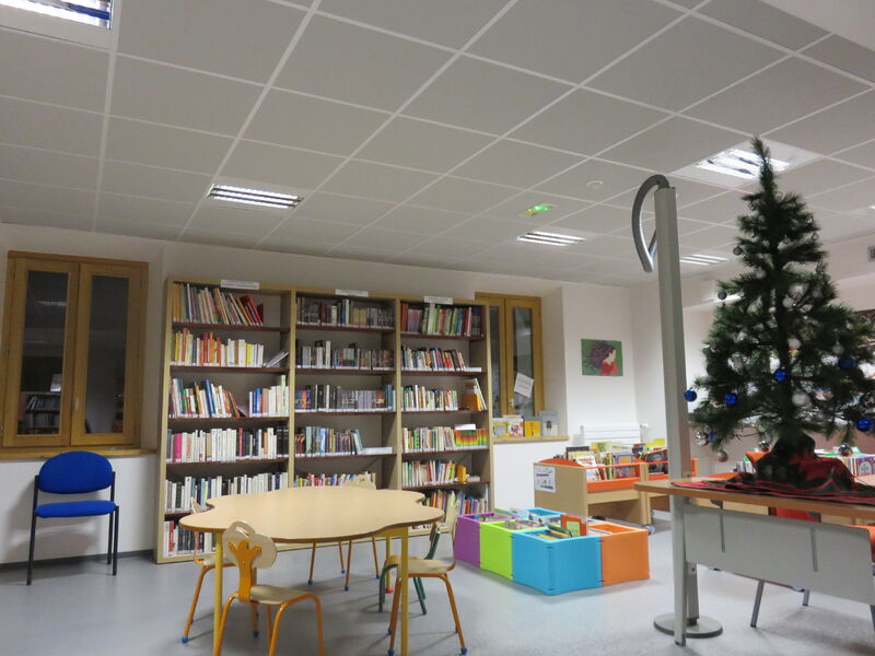
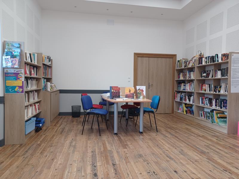
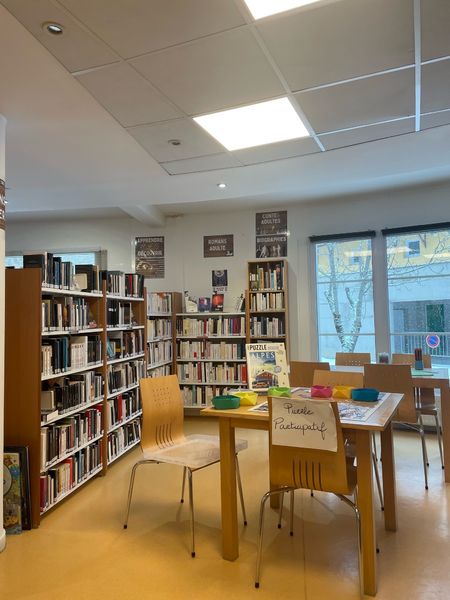
Books, music, movies... for all tastes and needs.EQUIPMENTBarrême multimedia libraryBarrême-en
-
This trail starts at the picturesque hamlet of La Valette, in the commune of Thorame-Basse. Once there, turn right onto the forest track which takes you across the Issole torrent via a ford.EQUIPMENTBoules - ChalufyThorame-Basse-en
-
The route rises on a track, with superb views over Lac de Castillon. The trail then descends to Castellane, alternating between paths and wider tracks. The proximity of Lac de Castillon offers the possibility of a swim.EQUIPMENT008 TransVerdon Tronçon - De Saint-André-les-Alpes à CastellaneSaint-André-les-Alpes-en
-
This trail is unmarked, so we advise you to park at the Couloir Samson parking lot (paying in season) and do either the Couloir Samson hike (1h30) or the Pont de Tusset hike (1h30).EQUIPMENTSentier Découverte du Lézard - CLOSEDRougon-en
-
Site de vol libre mondialement reconnu, le sommet du Chalvet (1613 m) offre un panorama à couper le souffle sur le lac de Castillon.EQUIPMENTSAINT-ANDRÉ-LES-ALPES - Le Chalvet à VTTMoriez-en
-
The Tour du Clap passes through a large pine forest before reaching the ridge. The other slope, also wooded, was once a vast pastoral area used by transhumant herds.EQUIPMENTTour du ClapSaint-Lions-en
-
Des villages uniques et une vallée sauvage menant au célèbre point sublime… De quoi s’évader à quelques coups de pédales des gorges.EQUIPMENTLA PALUD-SUR-VERDON - La vallée du BauLa Palud-sur-Verdon-en
-
After the meadows and forests of Puy du Rent, discover the picturesque villages of the upper Vaïre valley.EQUIPMENTGR de Pays vallée de la Vaïre - Étape 3 - Puy de Rent > FugeretAnnot-en
-
Small forest trail ideal for children.EQUIPMENTTour de MontruvelThorame-Haute-en
-
The Route Napoléon à Cheval© in the Alpes de Haute-Provence is a 140 km route from Peyroules to Sisteron. Altitudes range from 425 m to 1,245 m. The maximum gradient is 20%. Mid-range mountains account for 60% of the route.EQUIPMENTLa Route Napoléon à Cheval© dans les Alpes de Haute-ProvencePeyroules-en
-
A hike that will offer you a breathtaking view of Lake Castillon and Lake Chaudanne.EQUIPMENTThe burnt farmDemandolx-en
-
A hike through terraced olive groves, with beautiful views over the valley and village, to the hamlet of Les Lacs on the border with the Alpes Maritimes.EQUIPMENTLes Balcons d'Entrevaux - FERMETUREEntrevaux-en
-
A varied and fairly sporty route in the Ratery Nordic area. The route passes close to Cabane Vieille.EQUIPMENTLa ReynièreColmars-en
-
A pleasant route to discover chapels and beautiful views of the Haut-Verdon valley.EQUIPMENTLe Tour des ChapellesBeauvezer-en
-
Departing from Digne-les-Bains, set off on the "Terres Noires" mountain bike raid, renowned for its technical and physical trails and astonishing scenery.EQUIPMENTChemins du Soleil - De Digne-les-Bains à Tartonne - Les terres noires à VTTTartonne-en
-
A longer variant of the Chapelle Saint-Pierre itinerary, it also takes in the hamlets of La Sagne, in the Alpes Maritimes, and Les Colettes. The latter, still inhabited, is only accessible on foot.EQUIPMENTLe hameau des ColettesSoleilhas-en
-
A loop with varied landscapes, passing through different biotopes (rhododendron moorland) and a beautiful serpentine.EQUIPMENTLe Lançonnet - La SagneColmars-en
-
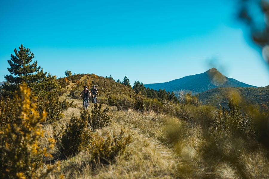
3 legendary Alpine passes to pedal over in the heart of breathtaking mountain scenery: Col des Champs, Col de la Cayolle and the Col d'Allos, a former Tour de France stage.EQUIPMENTLes 3 cols cycling tourColmars-en
-
A pleasant trail along the Coulomp and beneath the impressive chestnut trees, with beautiful views of the sandstone cliffs. The village, with its beautiful sandstone houses, completes the hike.EQUIPMENTLe CoulompBraux-en
-
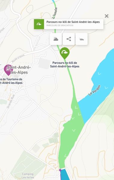
On this course, from the confluence of the Issole to the Méouilles bridge, all fish return to the water immediately and in the best possible conditions. All techniques authorized. Single barbless hook or crushed barb mandatory.EQUIPMENTNo-kill fishingSaint-André-les-Alpes-en
-
Cet itinéraire passe, notamment, par le col de Plein Voir et celui de l'Âne, vous offrant de beaux points de vues sur la fin des Gorges du Verdon et le lac de Sainte-Croix. Il est souvent utilisé lors des itinérances pédestres de plusieurs jours…EQUIPMENTLa Palud-sur-Verdon - Moustiers-Sainte-Marie par le GR4La Palud-sur-Verdon-en
-
An easy circuit on a pretty balcony path offering numerous views of the Saint-André-les-Alpes valley and Lac de Castillon.EQUIPMENTLes Belvédères de la DindièreSaint-André-les-Alpes-en
-
This is a challenging hike to the summit of Teillon, which is also referred to as ‘Quatre Termes’ in reference to the four boundaries of the surrounding municipalities. From this pastoral mountain, at 1,893 metres above sea level, you can see Corsica on the horizon when the Mistral wind blowsEQUIPMENTSommet du TeillonLa Garde-en
-
After traversing the upper Verdon valley, starting from Clumanc, the "Les 3 Asses" itinerary is a small loop for the general public, accessible to families and more athletic hikers with limited time.EQUIPMENTLes 3 Asses VAE - Espace cyclosportClumanc-en
-
A forest trail, ideal for families to discover the winter environment.EQUIPMENTCabane Vieille, la Balade à JPColmars-en
-
The route starts from the Gorges de Saint-Pierre parking lot in Beauvezer. To reach this starting point by car, drive to the Villars-Heyssier bridge parking lot in Beauvezer.EQUIPMENTLes Gorges de Saint-Pierre - Congerman - ChabanalBeauvezer-en
-
A beautiful alpine itinerary that takes you to the heart of the Mercantour National Park. From the top of the pass, views of Lac d'Allos.EQUIPMENTCols et Lacs de l'Encombrette - Panorama du Lac d'AllosColmars-en
-
This 24 km bike trail in La Palud sur Verdon takes you on a tour of the Grand Canyon ridges. The 14 Belvederes reveal the mythical cliffs of the Verdon and offer unforgettable views of the Grand Canyon.EQUIPMENTLa Route des Crêtes - Le Grand Canyon VAE - Espace CyclosportLa Palud-sur-Verdon-en
-
On the Chemins du Soleil circuit, heading towards the plateau, you can admire the St Thomas chapel with its remarkable 12th-century frescoes.EQUIPMENTSéouneThorame-Basse-en
-
This cyclosportif circuit, in the heart of the hills and massifs of Moyen-Verdon, reveals some of the most beautiful views of the Verdon region.EQUIPMENTBoucle des Belvédères du VerdonCastellane-en
-
Petanque courtEQUIPMENTBoulodromeLa Palud-sur-Verdon-en
-
Saint-Julien du Verdon, a 1,500-year-old village ... Notre-Dame Chapel As early as the 5th century, monks from the Abbey of Lérins (off the coast of Cannes) built a small priory at the top of today's village. Their mission: to Christianize the region.EQUIPMENTHeritage trailSaint-Julien-du-Verdon-en
-
A family walk along the water's edge, from one bank of the Combes and Champons streams to the other.EQUIPMENTLeTour des ChamponsAllons-en
-
A hike through undergrowth, rich in forest species (black pines, atlas cedars, maples...), it leads to a pass used since prehistoric times to link Saint-Lions to Moriez.EQUIPMENTTour de ClavouneSaint-Lions-en
-
Easy, fun and interactive, this discovery trail winds through the chestnut grove along a canal, in the heart of a pastoral landscape. You’ll be able to learn about the distinctive features of this place from the information boards at 11 sites along the path.EQUIPMENTSentier Découverte de la ChâtaigneBraux-en
-
The Tennis Club manages two courts and offers hourly, weekly, monthly and annual rentals. It also organizes training courses during the school vacations.EQUIPMENTTennis courtsAnnot-en
-
A hike that combines superb views of the surrounding mountains with the discovery of Ubraye and Le Touyet, with their beautiful stone houses set on slopes, and the Palud plateau.EQUIPMENTLe Plateau de La PaludUbraye-en
-
Books, music, films and board games. For toddlers, small children, medium-sized children, older children, those who love a good story, those who prefer bubbles or those who are looking for something specific.EQUIPMENTEntrevaux multimedia libraryEntrevaux-en
-
Stroll through the hamlet of Le Champ, offering lovely views of Entrevaux village and its Citadel.EQUIPMENTLe ChampEntrevaux-en
-
A sustained hike through the imposing Chiran massif, culminating in a 360° view and an astronomical observatory.EQUIPMENTSommet du Chiran par BlieuxBlieux-en
-
A long stage exploring old villages and Roman remains. Lodging under the Col du Fam or extend the stage to Braux.EQUIPMENTGR de Pays vallée de la Vaïre - Étape 4 - Fugeret > Col du FamLe Fugeret-en
-
Easy forest loopEQUIPMENTLes Cabanes du PuyVillars-Colmars-en
-
From the top of la Barre du Pidanoux there is an incredible view of Castillon Lake, the village of Saint-Julien-du-Verdon and the surrounding peaks.EQUIPMENTBarre le PidanouxSaint-Julien-du-Verdon-en
-
Itinerary to discover a wild site where the Saint-Pierre chapel is hidden. The ruins of Véraillon are the remains of an ancient fortified village abandoned in the 15th century.EQUIPMENTChapelle Saint-Pierre, les ColettesSoleilhas-en
-
From the church in Barrême, this tour combines plant and mineral elements on Saint-Jean hill. This viewpoint overlooking the Asse and its tributaries bears witness to the collapse of a limestone cliff during the Tertiary era.EQUIPMENTCircuit des senteursBarrême-en
-
A pleasant, sunny route linking Thorame-Haute and Thorame-Basse, passing through the hamlet of Mousteir.EQUIPMENTLiaison des ThoramesThorame-Haute-en
-
Cet itinéraire permet de joindre la Palud-sur-Verdon au Chalet de la Maline sans faire appel à la navette Blanc-Martel ou aux taxis. Attention : une bonne partie (environ 90%) se fait sur route goudronnée et la moitié de l'itinéraire est en plein soleil.EQUIPMENTLa Palud-sur-Verdon - Chalet de la Maline par le GR4La Palud-sur-Verdon-en
-
This hike takes you to the hamlet of Courchons (1350 m), whose school still had 20 pupils at the beginning of the last century. The village is mostly in ruins, and pastoralism is the main activity in the area.EQUIPMENTTour de CourchonsSaint-André-les-Alpes-en
-
Lovely forest loop on a hot summer's day, overlooking the beautiful Verdon valley.EQUIPMENTLa Croix du PuyVillars-Colmars-en
-
Vous trouverez à la bibliothèque un large éventail d’ouvrages : romans policiers, romans variés, livres larges visions, de nombreux livres pour enfants de tous âges, des bandes dessinées, des ouvrages historiques, de la documentation régionale, etc.EQUIPMENTBibliothèque intercommunale à AllonsAllons-en
-
After a short descent to the Notre Dame de la Rivière chapel, the climb is a little steep, but pleasant and shady. At the Col St Jean (1326m), enjoy the magnificent panorama before reaching the chapel of St Jean du Désert.EQUIPMENTLa Chapelle Saint-Jean-du-Désert depuis UbrayeUbraye-en
-
Located at the foot of the ramparts of the fortified town, 2 fully refurbished courts with mountain views.EQUIPMENTColmars Tennis CourtsColmars-en
-
From Rougon to La Palud-sur-Verdon, you'll ride over the bubbling gorges of the Verdon and its emerald waters. The route then takes you to the beautiful abandoned hamlet of Châteauneuf les Moustiers, then to the hamlet of Les Chauvets, via the Roman road.EQUIPMENT10 TransVerdon Tronçon - De Rougon à Les ChauvetsRougon-en
-
Discover the riches of the Parc Naturel Régional des Préalpes d'Azur in this 5-day itinerary.EQUIPMENTSAINT-AUBAN - GRASSE - La Maralpine en 5 joursGrasse-en
-
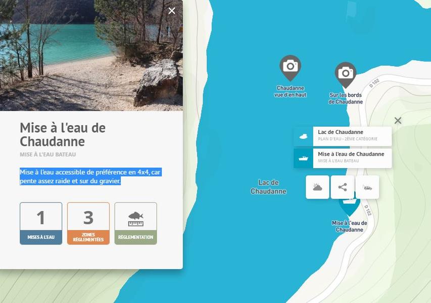
Launching is best done in a 4x4, as the slope is steep and gravelly.EQUIPMENTChaudanne launchCastellane-en
-
Découvrez Chaudon au fil de son patrimoine et de ses récits, entre chapelle, vie villageoise d’autrefois et sans oublier le passage de Napoléon !EQUIPMENTParcours patrimoine de ChaudonChaudon-Norante-en
-
Lovely loop in the undergrowth with panoramic views towards Thorame-Haute and the Val d'Allos. Refreshing break by the small Chastelas stream.EQUIPMENTLa CollettaColmars-en
-
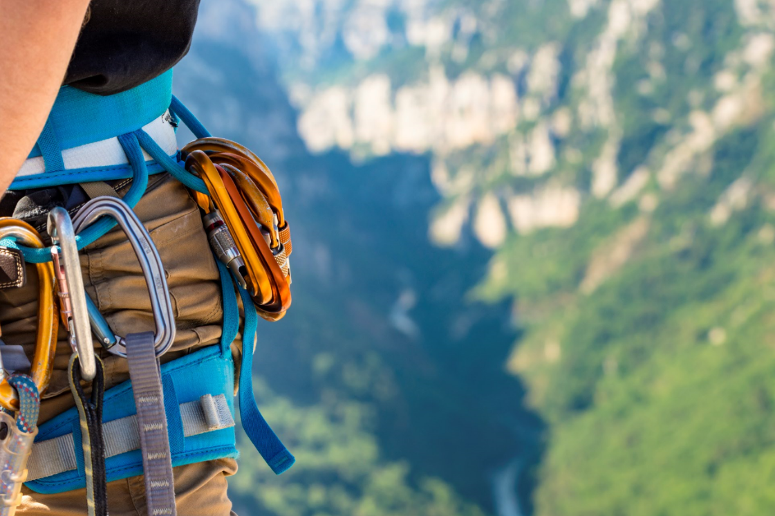
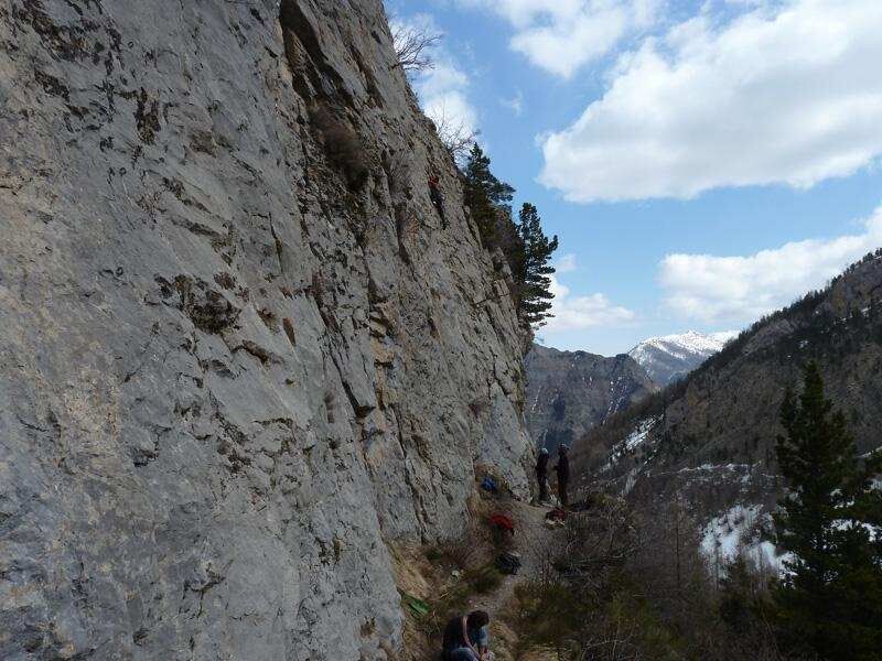
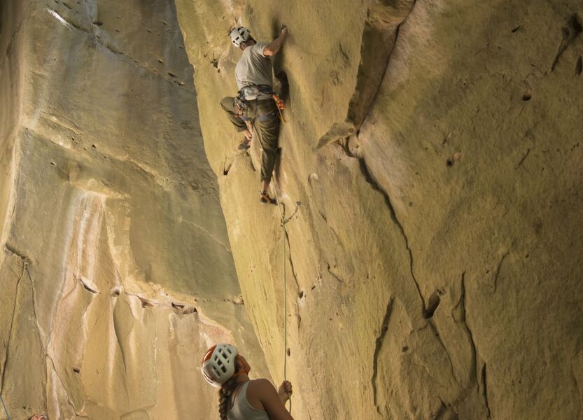
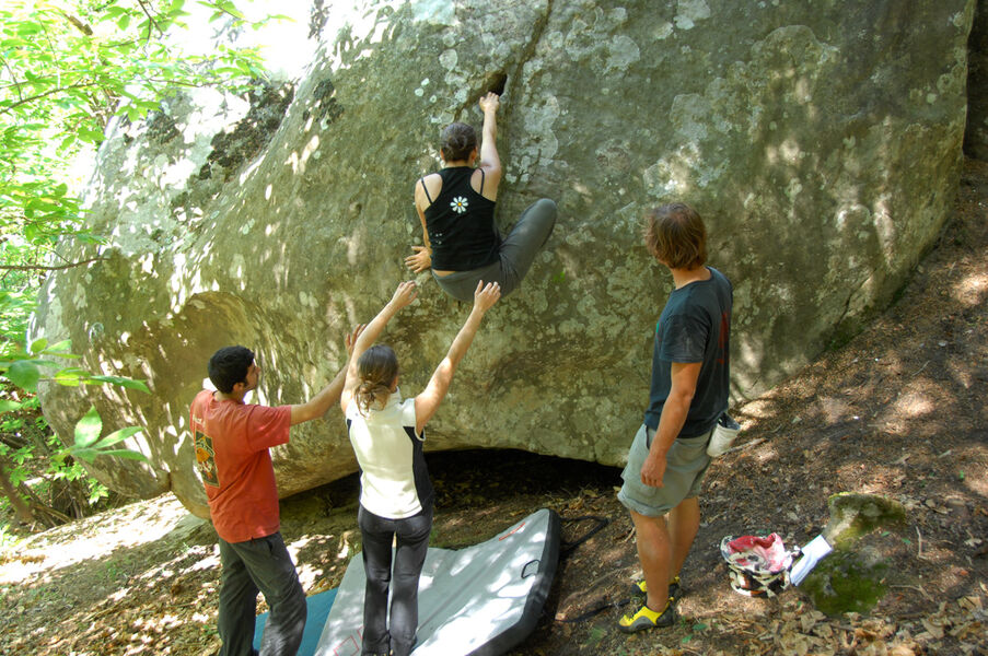
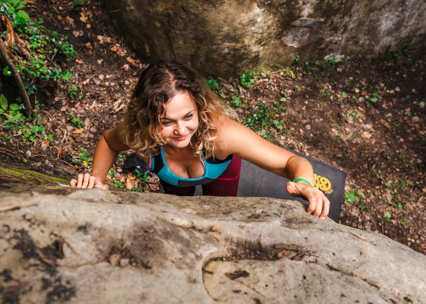
With more than 1500 climbing routes on limestone rock, the Canyon des Gorges du Verdon is an internationally renowned climbing site.EQUIPMENTClimbing site of the Gorges du VerdonLa Palud-sur-Verdon-en
-
A walk through a larch forest, not far from the village of Colmars. The path crosses a former forestry area where Swiss pines have established themselves along with blueberry and raspberry bushes.EQUIPMENTForêt du LançonnetColmars-en
-
A relaxing break on the shores of Lac des Sagnes, 3 km from the pastoral village of Thorame-Haute.EQUIPMENTLac des SagnesThorame-Haute-en
-
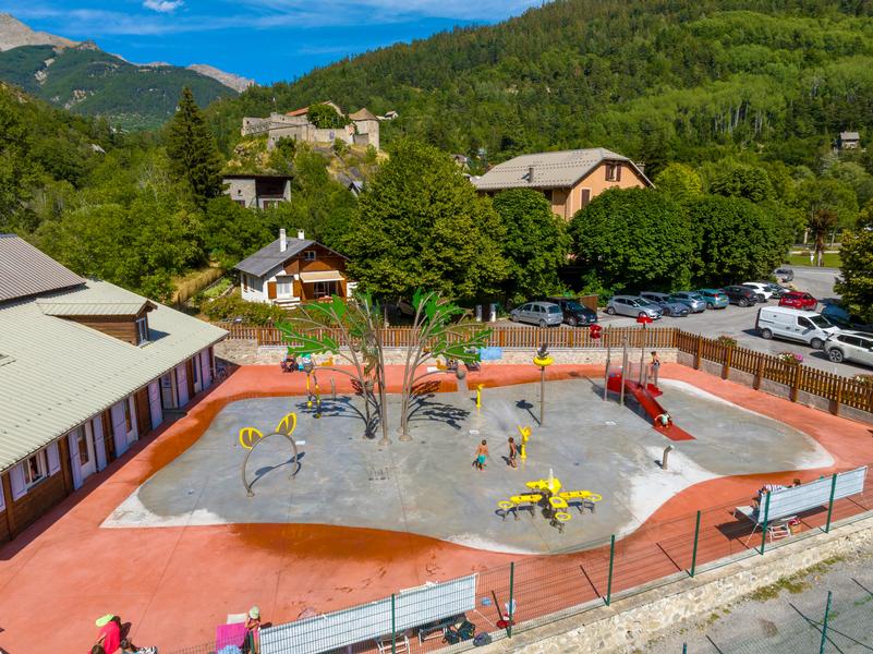
A new aquatic leisure area at the foot of the ramparts, themed around mountain flora and fauna, with modules for young and old alike. Bordered by a solarium, this activity promises plenty of laughs for the whole family.EQUIPMENTOutdoor water play areaColmars-en
-
This 24 km panoramic route in La Palud sur Verdon takes you on a tour of the Grand Canyon ridges. The 14 Belvederes reveal the mythical cliffs of the Verdon and offer unforgettable views of the Grand Canyon.EQUIPMENTLa Route des CrêtesLa Palud-sur-Verdon-en
-
Un circuit panoramique vous élevant au-dessus du Verdon et ses lacs aux eaux émeraudes, niché au cœur des montagnes du Moyen-Verdon.EQUIPMENTCASTELLANE - Le tour des lacsCastellane-en
-
The road is fairly shaded and offers a fine view of the Entrevaux citadel from the first hairpin bends. The climb is pleasant, with steady gradients (5%-6%) except for the first kilometer, when they are closer to 8-9%.EQUIPMENTCol des Félines cycling tourEntrevaux-en
-
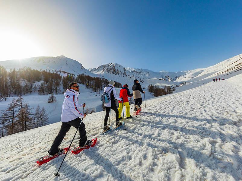
La Lumineuse snowshoe itineraryEQUIPMENTThe lumineuseLa Foux d’Allos-en
-
In the heart of the Dourbes forest, in the middle of the UNESCO Geopark of Haute-Provence, Domaine de la Clappe offers an exceptional setting for your wedding, seminar, sports or cultural event.EQUIPMENTDomaine de La ClappeChaudon-Norante-en
-
Accessible by mountain bike, this easy circuit near the village winds its way around the hill of La Grau on small roads and dirt tracks.EQUIPMENTTour de la GrauLa Palud-sur-Verdon-en
-
Located in the heart of a small shady garden, opposite the avenue de la gare, this picnic area is the ideal spot for Train des Pignes passengers.EQUIPMENTAire du Jardin du souvenirAnnot-en
-
Un sommet aux panoramas remarquablesEQUIPMENTALLONS - La crête des SerresAllons-en
-
A forest trail for a Nordic adventure from glade to glade.EQUIPMENTForêt de RateryColmars-en
-
The 2nd stage of the weekend in Entrevaux country takes you back to Entrevaux via Ubac d'Amirat and the village of Castellet-Saint-Cassien.EQUIPMENTWeek-end au Pays d'Entrevaux (2)Entrevaux-en
-
1,2,3,4 , up, down, left, right!!! you jump, on one foot, with your arms... A little fitness in the calm of the forest and with the sound of the river La Chasse to accompany you.EQUIPMENTChristian Marty sports trailVillars-Colmars-en
-
Another itinerary takes you to Chapelle Saint Jean du Désert. Right from the start, you can discover the Château de Villevieille, then follow a ridge line to admire the panoramic view over the Ubraye valley and the Bernarde summit.EQUIPMENTDe Villevieille à Saint-Jean-du-DésertVal-de-Chalvagne-en
-
For toddlers, small children, medium-sized children, older children, those who love a good story, those who prefer bubbles or those who are looking for something specific.EQUIPMENTSaint-Pierre Media LibrarySaint-Pierre-en
-
Self-service station equipped with essential tools for small repairs and airing up your bike.EQUIPMENTPublic bike facilitiesSaint-Benoît-en
-
Departing from Colmars, a picturesque fortified village, this challenging route takes you along the Col des Champs road, which winds its way to the start of the Noncière trail. Serious climbs with exceptional views over the Haut-Verdon valley.EQUIPMENTLa traversée des BausséesColmars-en
-
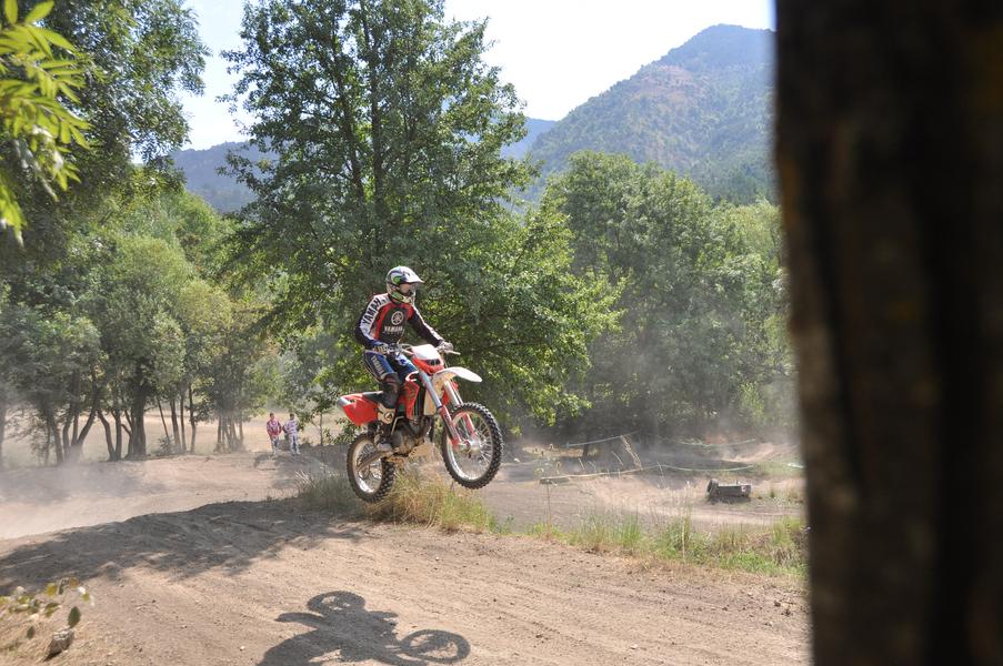
Espace Loisirs Boade is not only a motocross, quad and trial school, but also a 600-hectare site dedicated to off-road riding in complete freedom, and the organization of motorcycle sporting events (extreme enduro).EQUIPMENTEspace Loisirs BoadeSenez-en
-
This hike around the Pied Marcellin hill allows you to discover a portion of the Voie Impériale itinerary, as well as the wilder paths of Saint Jacques between broom, lavender, juniper, saskatoon bushes and a few geological sites.EQUIPMENTBalade de Pied MarcellinSaint-Jacques-en
-
Leaving from the picturesque town of Annot, this is a real sawtooth circuit with many passes to climb.EQUIPMENTL'Alpes Provence Verdon - Espace CyclosportAnnot-en
-
You'll straddle the 1860 border before the Comté de Nice became part of Provence. A milestone marking this boundary can still be seen at Col St Pons.EQUIPMENTPas de BelonSausses-en
-
4 h 45 - 201 km tour. Follow the silver thread of the Issole river to the Ht Verdon valley, which opens out into a wide agricultural basin in the heart of a mountainous setting. At every bend, a cameo of greens greets you.EQUIPMENTCircuit Val d'Issole Haut Verdon "Camaieu de verts"Saint-André-les-Alpes-en
-
Discovery tour of 2 fortified towns built by Vauban in the 17th c. They have a Provencal feel, but look like impregnable sentinels, with beautiful military architecture that you'll enjoy contemplating. Beautiful panoramic views along the way.EQUIPMENTCircuit des Places Fortes VaubanColmars-en
-
Hike to the foot of Cup Mountain and visit an exceptional volcanic geological site, and stroll through the peaceful Asse Valley.EQUIPMENTTour de ClouetClumanc-en
-
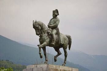
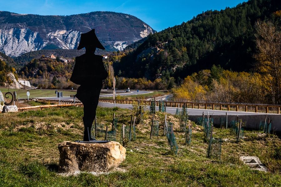
The Route Napoléon runs from Golfe Juan through Haute Provence to Grenoble.EQUIPMENTRoute Napoléon en Haute ProvenceBarrême-en
-
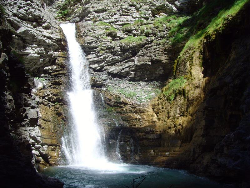
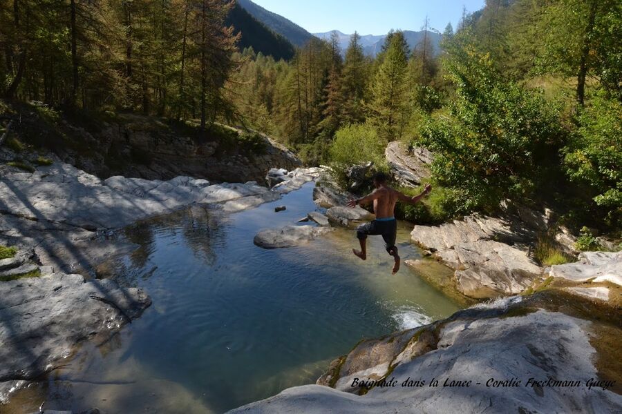
Listed natural site. Easy walk to the waterfall, where you might spot a beautiful mountain bird, the tichodrome échelette.EQUIPMENTCascade de la LanceColmars-en
-
The route is signposted to help you discover the landscape and the village of Braux.EQUIPMENTLes portes de la châtaigneraieBraux-en
-
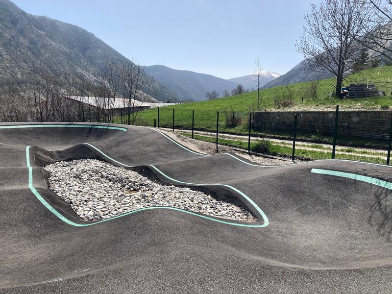
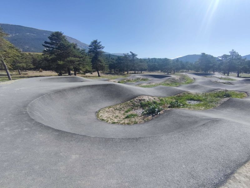
Pump track accessible à tous. Viens t'éclater avec ton vélo sur ce circuit fermé et réalise d'incroyables sauts ! N'oublie pas ton casque et tes protections pour une sécurité maximale.EQUIPMENTPumptrackThorame-Haute-en
-
As you walk along the trail, discover a glimpse of the local flora and fauna and the habitats in which they thrive.EQUIPMENTSentier découverte de la CouesteSaint-Julien-du-Verdon-en
-
The trail offers beautiful panoramic views over the Vaïre valley and takes you through a varied forest, including a magnificent beech grove.EQUIPMENTClot RoubaudAnnot-en
-
Une montée sèche pour les sportifs.EQUIPMENTKMVBeauvezer-en
-
Departure from Colmars-les-Alpes, a town of character on the banks of the Verdon, one of the most beautiful towns fortified by Vauban with its two forts protecting the valley entrances.EQUIPMENTCol des champs VAE - Espace CyclosportColmars-en
-
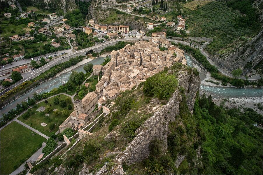
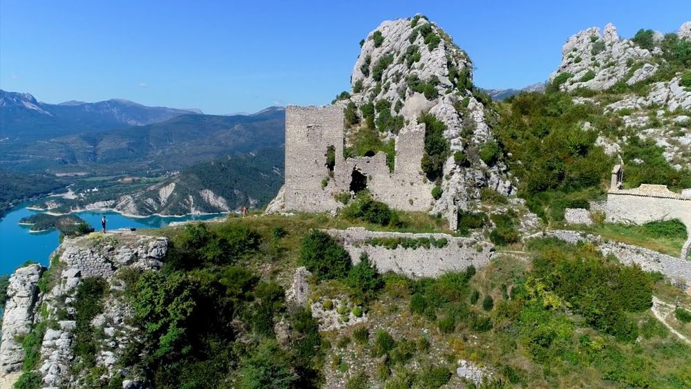
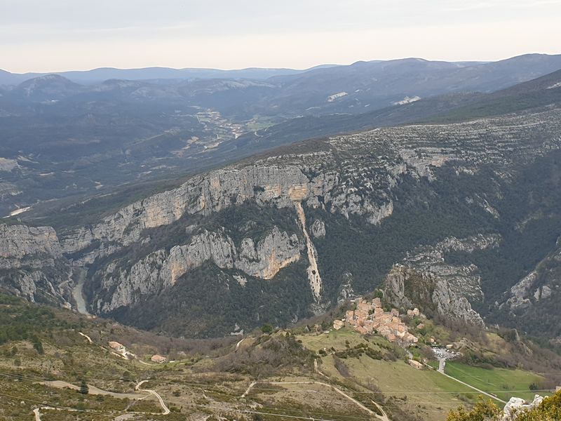
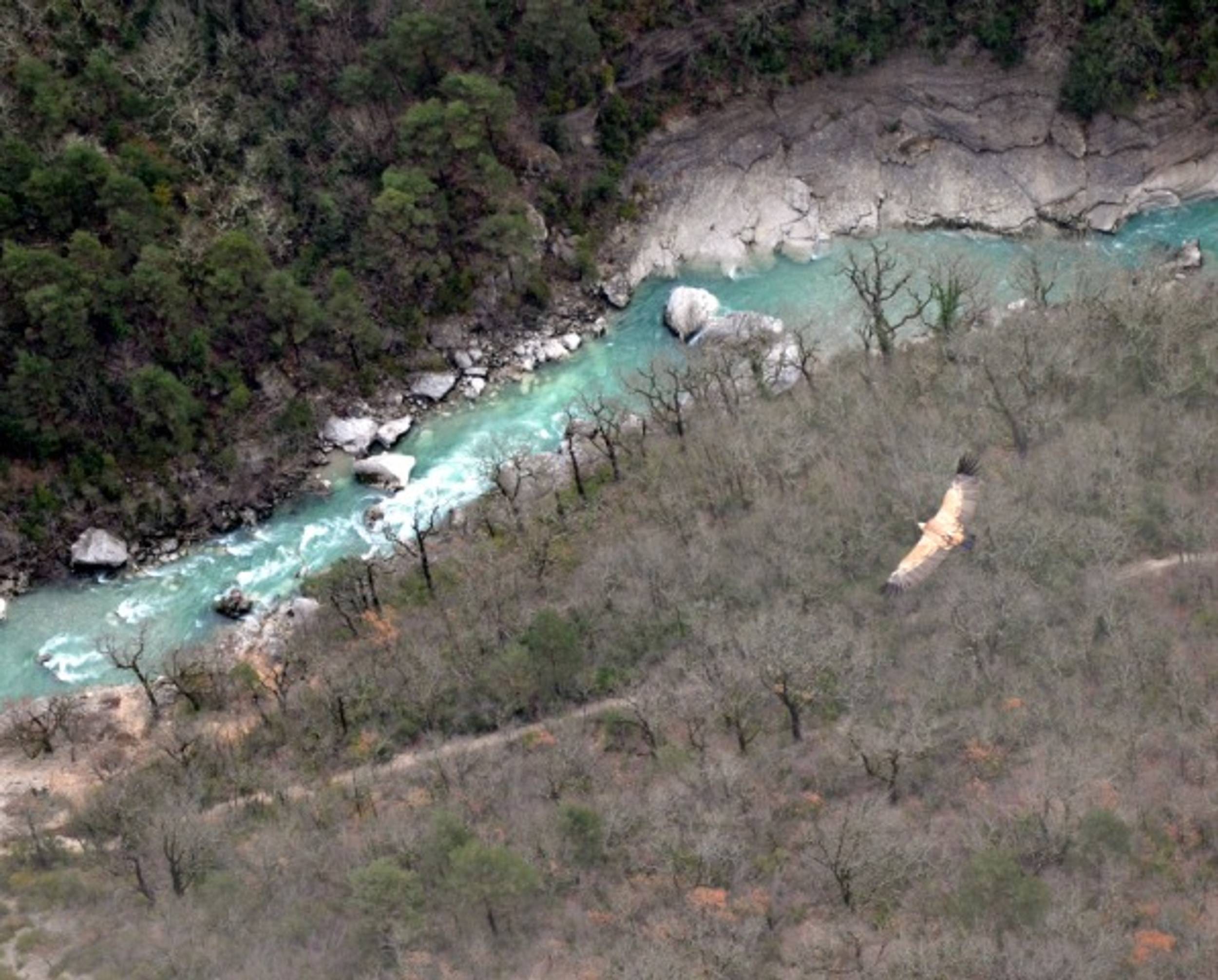
Perched more than 1,200m above sea level, overlooking the village of Rougon, this is a unique area with a view over the entrance to the Grand Canyon. This vast wild plateau is distinguished by pastoralism (low walls and dry stone sheepfolds). As a summer pasture site, it is advisable to stay away from the flocks supervised by protection dogs (patous). This hike is better mid-season because of the south-facing sun exposure. Alternate option: If you turn right a bit before the plateau you will reach the Barre des Catalans for breathtaking views over Rougon with a panoramic viewpoint. If you are lucky you could see vultures flyingEQUIPMENTLe Plateau de SuechRougon-en
-
Une randonnée qui vous emmènera sur les hauteurs de Rougon et en point d'orgue la vue sur son point SublimeEQUIPMENTLA PALUD-SUR-VERDON - La Palud - Rougon point sublime + AutocarLa Palud-sur-Verdon-en
-
From Haute-Savoie to the Alpes-Maritimes, the "P'tites Routes du Soleil" already have all the makings of a great cycling itinerary: 890 kilometers punctuated by 44 affordable "p'tits" passes. Welcome to the great cycling journey through the Pre-Alps.EQUIPMENTLes P'tites Routes Du Soleil ®France
-
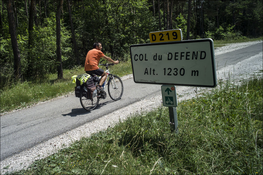
A pleasant, easy route. This cycling itinerary will take you to the Col du Défend at 1267m, then along the Issole, a green valley winding through a beautiful forest.EQUIPMENTCol du Défend cycling tourSaint-André-les-Alpes-en
-
Along country lanes and small roads, this walk allows you to discover some of the heritage features of the Asse valley : the Château des Périers, castel built in the 17th century and Notre Dame church.EQUIPMENTCircuit du ChâteauClumanc-en
-
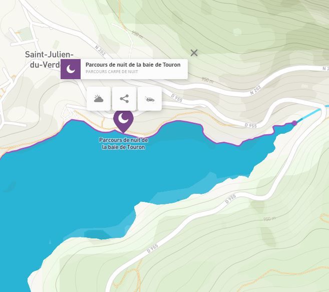
Mise à l'eau d'embarcations ayant une puissance supérieure à 6 cv autorisée. Jet ski interdit.EQUIPMENTMise à l'eau de la baie du TouronSaint-Julien-du-Verdon-en
-
You'll find a wide selection of adult and children's novels, comics and non-fiction books, regularly updated.EQUIPMENTBibliothèque de MoriezMoriez-en
-
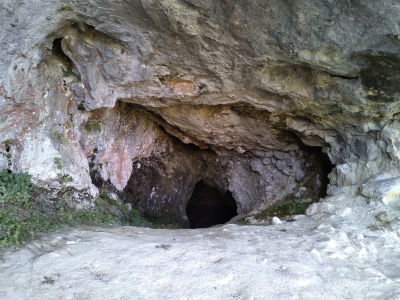
From Méailles, the route runs along the cliffs at the northern exit of the village and enters a sparse pine forest until the entrance of the cave. Several basins are carved out in the cave’s limestone ground, and the ceiling is adorned with splendid stalactites. Warning: This is an unsecured cave only to be visited with speleological equipment; not recommended for beginners after 100m. Only undertake this visit in good weather conditionsEQUIPMENTLa Grotte de MéaillesMéailles-en
-
A forest walk through the little Siberia of the Southern Alps.EQUIPMENTMiolansLa Rochette-en
-
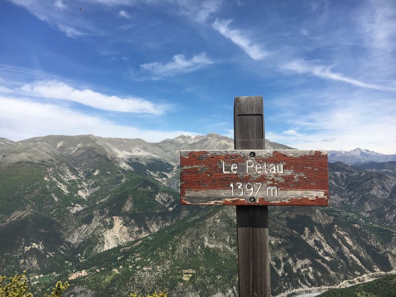
Fabulous views of the Var valley and Mercantour peaks. Hiking along ridges and forests, via the Pelau summit and the Lette ridge.EQUIPMENTPelauCastellet-lès-Sausses-en
-
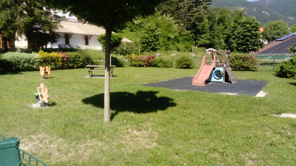
Jardin pour les enfants entièrement clôturé.EQUIPMENTPlaygroundThorame-Haute-en
-
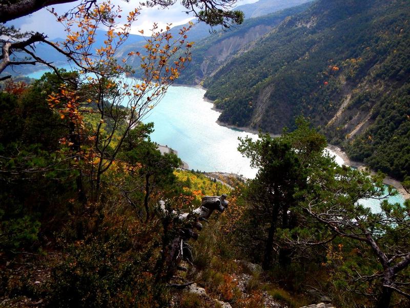
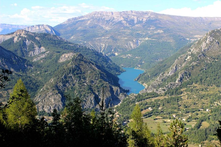
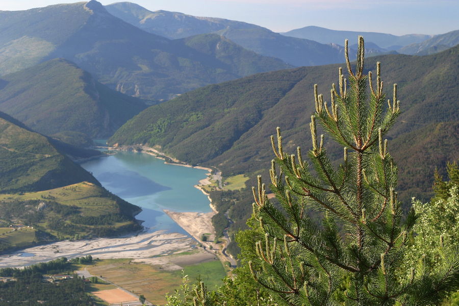
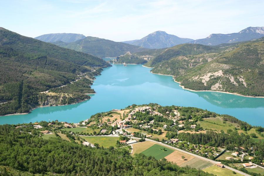
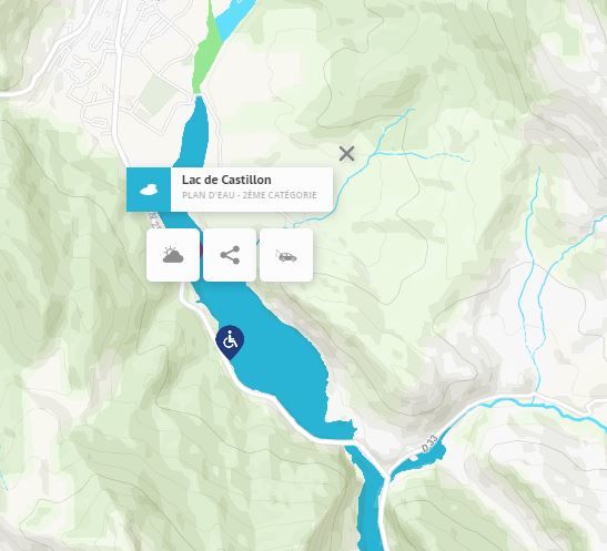
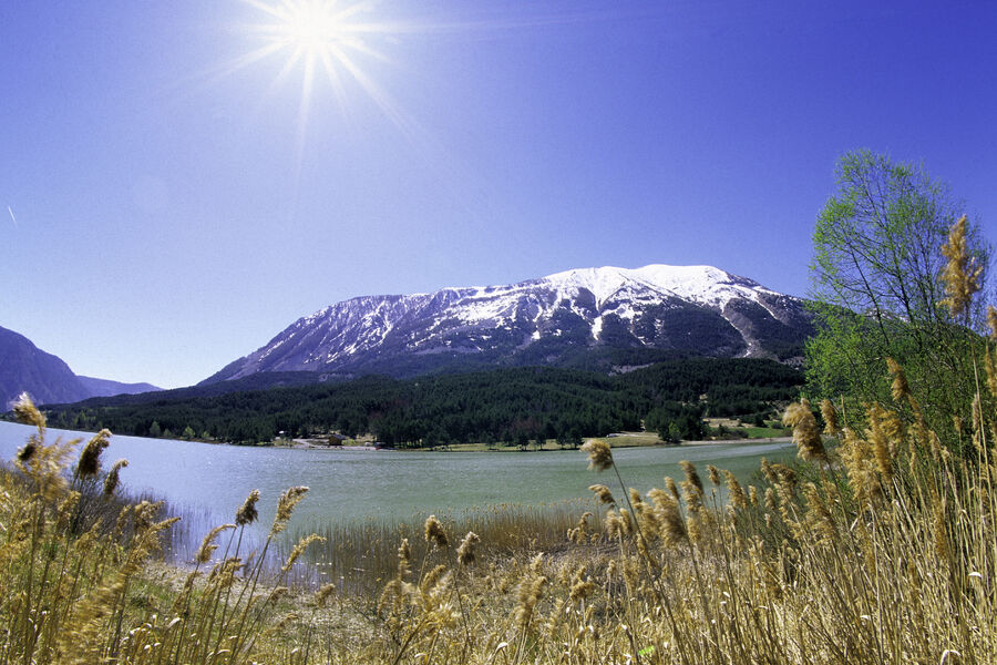
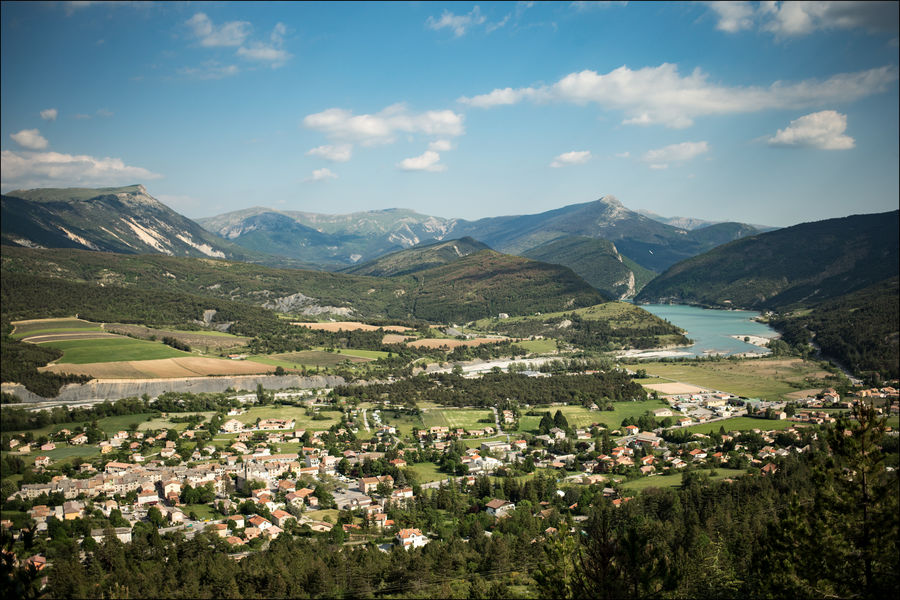
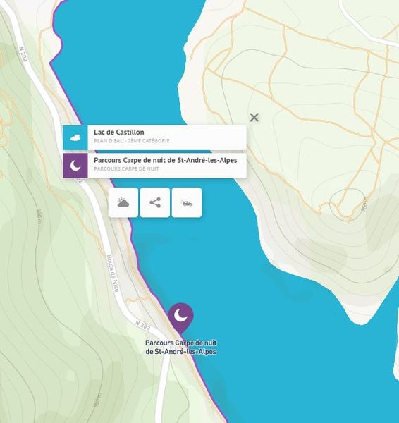
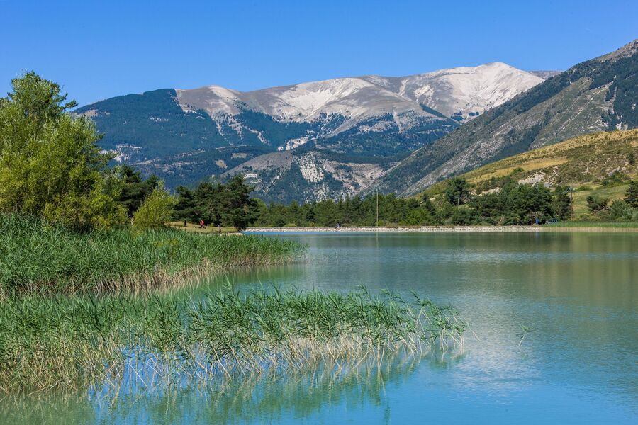
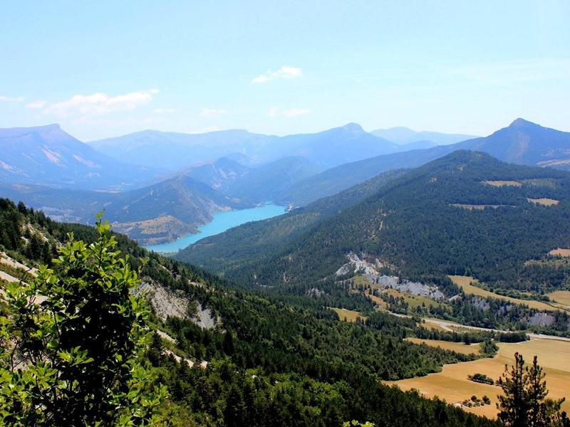
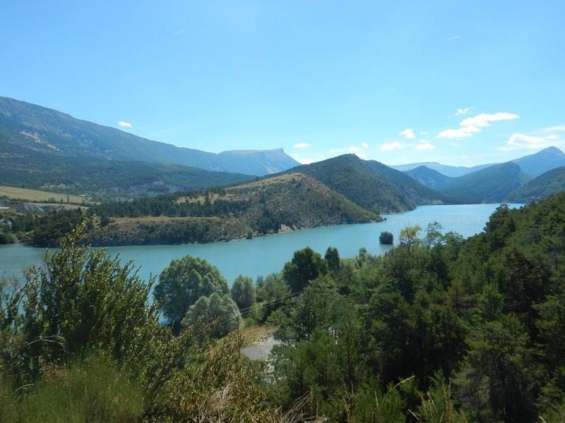
The first dammed lake on the Verdon, the Castillon reservoir stretches from Saint-André-les-Alpes, passing through St-Julien-en-Verdon, to end 8 km further on at the Castillon dam, 90 m high and 200 m wide.EQUIPMENTLake CastillonSaint-André-les-Alpes-en
-
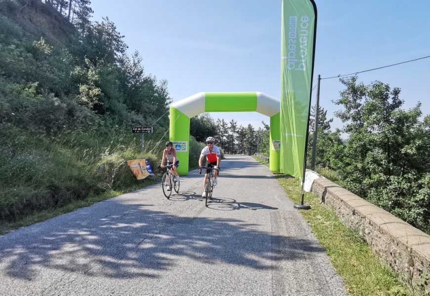
Starting from Chaudon-Norante, very sunny side. Fairly steady climb, apart from a few brief sections above 10% at the start and then around the halfway point. It can be completed by electric bike in 1 hr.EQUIPMENTCol du CorobinChaudon-Norante-en
-
This pass, at the foot of the imposing Cheval Blanc mountain, is a historic crossing point between the valleys. To reach it, a tunnel was carved out of the clue de la Peine using picks and blasting.EQUIPMENTLa Barre des DourbesTartonne-en
-
Cette promenade vous invite à vivre un véritable moment de ressourcement au cœur de la forêt. Un parcours alliant découverte, bien-être et émerveillement, à partager en famille, en solo ou entre amis.EQUIPMENTSentier découverte du Mélè'zenColmars-en
-
From Val d'Allos - Seignus, you will take a forest path which will bring you up to the "maison forestière" under crest of Valdemars.EQUIPMENTMaison Forestière de ValdemarsLe Seignus-en
-
This section takes you to the gateway to the Verdon Regional Nature Park, after a long, steady climb to the summit of Montagne de Maurel. Take the opportunity to contemplate the wealth of flora and fauna found here.EQUIPMENT006 TransVerdon Tronçon - De Thorame-Basse à la Montagne de MaurelThorame-Basse-en
-
Le plateau de Suech, cette étendue pierreuse posée là comme une vaste respiration silencieuse parmi les reliefs alentour, vous aurez l’impression d’être dans une contrée lointaineEQUIPMENTROUGON - Rougon - Chasteuil + AutocarRougon-en
-
A long-distance adventure trail through forests and vast plateaus.EQUIPMENTChamplatteThorame-Haute-en
-
Starting from the Villars-Colmars kiosk, through the larch trees, this loop follows a forest track to the cabanes du Puy. The trail descends to the hamlet of Chasse and returns via the hamlet access road.EQUIPMENTChasseVillars-Colmars-en
-
40 climbing routes from 5a to 7c+.EQUIPMENTClimbing in JuanVillars-Colmars-en
-
Venture deep into the bowels of the Gorges du Verdon, from Moustiers-Sainte-Marie to La Palud-sur-Verdon. Follow the Route des Crêtes and its many viewpoints over the gorges. A spectacular itinerary to discover out of season.EQUIPMENTBoucle du Grand CanyonMoustiers-Sainte-Marie-en
-
Come and stroll from tree to tree, with over 90 workshops. There's something for everyone: "Parcours Kid", "Super Kid", "Grand Parcours" and, for the brave, the "Galère" course. A little surprise awaits you in 2025.EQUIPMENTParc Aventure du Haut-VerdonBeauvezer-en
-
Bien que ne proposant pas de points de vues direct sur la rivière, ce sentier est très beau et propose une grande variété de paysage.EQUIPMENTSentier du Bastidon en aller-retourLa Palud-sur-Verdon-en
-
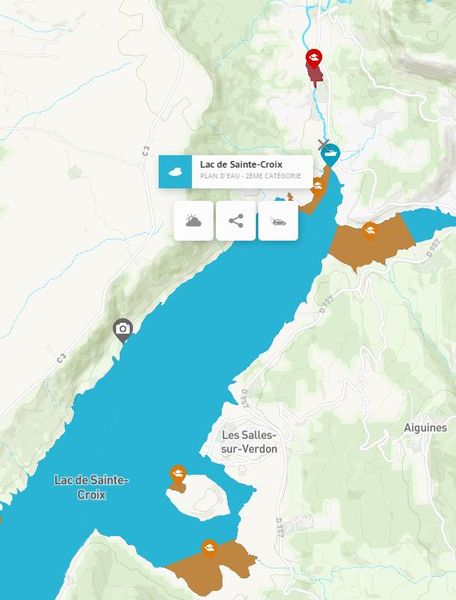
The emblematic lake of the Verdon region is renowned for both its fishing and its exceptional setting.EQUIPMENTLake Sainte-CroixLa Palud-sur-Verdon-en
-
Exceptional views of where Lac de Sainte-Croix meets the Gorges du Verdon. A beautiful, steep, sporty and aerial circuit via the Col de l'Âne and Col de Plein Voir, located on the ridge overlooking the terminal part of the Verdon canyon.EQUIPMENTPlein Voir par le Col de l’Âne et les Hauteurs de Saint MaurinLa Palud-sur-Verdon-en
-
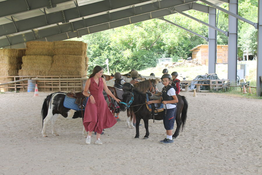
State-certified instructors Nelly and Jacques welcome you to the centre for lessons, courses, preparation for federal examinations, vaulting and dressage. They accompany you on rides lasting between one hour and one hour 30 minutes.EQUIPMENTCentre équestre de VérimandeAnnot-en
-
EQUIPMENTCity stadeColmars-en
-
Après l'ascension principale qui se concentre au début, vous rejoignez un sentier en balcon pour une vue panoramique sur Annot et la vallée avant de redescendre sur le village, via une agréable forêt de hêtres.EQUIPMENTParcours 12 - VérimandeAnnot-en
-
EQUIPMENTCity stadeThorame-Haute-en
-
You'll find a wide selection of novels, comics and non-fiction books.EQUIPMENTBibliothèque de SenezSenez-en
-
Things get serious with this spectacular mountain stage leading from the Verdon valley to the high plateau of the Lignin lakes. Sumptuous scenery, but well worth the effort!EQUIPMENT003 TransVerdon Tronçon - De Colmars-les-Alpes aux Lacs de LigninColmars-en
-
From the kiosk, follow route 23 and before the huts, head for the Croix du Puy, where you'll enjoy a remarkable view of the valley and Verdon villages.EQUIPMENTLa Croix du PuyVillars-Colmars-en
-
Magnificent panorama of Entrevaux village, the Citadel and surrounding peaks. Return via La Seds, where the first inhabitants settled during the Roman Empire.EQUIPMENTLes TuvesEntrevaux-en
-
Ombragé sur la première moitié du parcours, le sentier offre, à travers quelques trouées, une belle vue sur toute la vallée de la Vaïre. Il rejoint ensuite une piste forestière et redescend vers le village par la route forestière.EQUIPMENTParcours 11 - Combe RenardAnnot-en
-
The Col des Champs is a mountain pass at an altitude of 2,045 m, on the border between the Alpes-de-Haute-Provence and Alpes-Maritimes departments, linking Colmars to Saint Martin d'Entraunes in the Ht Var.EQUIPMENTRoute du Col des ChampsColmars-en
-
You will need to be in good physical condition if you want to marvel at the Cirque de l'encombrette, which is remarkable for its geology, its lakes and its rocks which were polished by the former glacier. The Pas de l'Échelle, a rocky guardian which protEQUIPMENTCirque de l'encombretteAllos-en
-
The first part of the trail runs under the cover of a chestnut forest and along the "Roman Way".EQUIPMENTAnnot - Le Fugeret par la voie romaine d'ArgentonAnnot-en
-
2 fully renovated courts in a quiet area with mountain views. Open without reservation.EQUIPMENTCourts de tennis de BeauvezerBeauvezer-en
-
A beautiful walk overlooking the Riou d'Ourgeas ravine, which narrows into deep, narrow gorges shortly before reaching the chapelle de la Melle and the Bergerie de Haute Melle, a major Resistance site in the Alpes de Haute-Provence.EQUIPMENTLa Clue de la MelleSenez-en
-
A superb view of the surrounding mountains: Grand Coyer and Saint Honorat to the east, Pic de Chamatte to the south, the Haut Verdon mountains to the west, and the villages of Méailles and Allons in the valley.EQUIPMENTLe Puy de Rent depuis AnnotAnnot-en
-
On the trail of the Tour of Défens des Colettes, you will reach old plasterwork remains of a craft no longer practised, near the travertin waterfalls.EQUIPMENTThe Tour of Défens des ColettesSoleilhas-en
-
For young, medium and old, for those who like a good story, those who prefer bubbles or those who are looking for something specific. Not forgetting those who don't know what they like and need a little guidance.EQUIPMENTThorame-Basse multimedia libraryThorame-Basse-en
-
Starting from the village of Peyroules, this loop trail takes you on an exploration of the ridges and ravines of the hinterland, through scrubland and forests of oak and conifer treesEQUIPMENTPeyroulesPeyroules-en
-
Alternating forest and ridge sections. Beautiful views of the village of La Colle-Saint-Michel and the Pic du Rent.EQUIPMENTCabane de Colle BaudetThorame-Haute-en
-
Partez à la découverte des richesses du Parc Naturel Régional des Préalpes d'Azur dans cette itinérance de 5 jours.EQUIPMENTSAINT-AUBAN - VENCE - La Maralpine en 5 joursVence-en
-
The Vallée de Chasse is one of the Haut-Verdon's must-see secret spots. You'll discover a beautiful variety of landscapes with numerous pastures and meadows bordered by thick forests, but also torrents that sometimes form delightful little gorges.EQUIPMENTCabane de JoyeuxVillars-Colmars-en
-
The Champlatte mountain bike route is located on the heights of the hamlet of La Colle Saint-Michel, offering unobstructed views of the surrounding peaks overlooking the Vaïre and Haut-Verdon valleys.EQUIPMENTChamplatte par la Colle Saint MichelThorame-Haute-en
-
Le village de Rougon s’ouvre sur un paysage grandiose, véritable balcon sur les célèbres Gorges du Verdon, qui a su garder son âme et son caractère.EQUIPMENTParcours patrimoine de RougonRougon-en
-
This relatively easy family hike can be started from the villages of Thorame-Haute or Thorame-Basse.EQUIPMENTLiaison des ThoramesThorame-Haute-en
-
Route through the larch forest of Ratéry, passing through the mountain pastures and then the robines (black earth). Arrival at the pass with splendid panoramic views in all directions (including the Aiguilles de Pelens in the Alpes Maritimes). Theme trail to the top of the passEQUIPMENTCol des Champs GR52AColmars-en
-
moyenEQUIPMENTA roud-trip to PeyroulesPeyroules-en
-
For young, medium and old, for those who like a good story, those who prefer bubbles or those who are looking for something specific. Not forgetting those who don't know what they like and need a little guidance.EQUIPMENTLa Palud-sur-Verdon multimedia libraryLa Palud-sur-Verdon-en
-
Departing from the village of Thorame-Haute, this mountain bike loop takes in forest tracks and paths. It runs alongside cultivated plots, pastures and coniferous forests, far from the hustle and bustle.EQUIPMENTLac des SagnesThorame-Haute-en
-
The Tennis Club manages two courts and offers hourly, weekly, monthly and annual rentals. It also organizes training courses during the school vacations.EQUIPMENTCourt de tennisEntrevaux-en
-
This hike takes in the ancient hamlet of Ville and its chapel of Saint Fortunat. A medieval castle once stood on the ridge overlooking the site. The Notre Dame de Conche chapel, the destination of the hike, offers a superb panorama.EQUIPMENTLe Hameau de VilleDemandolx-en
-
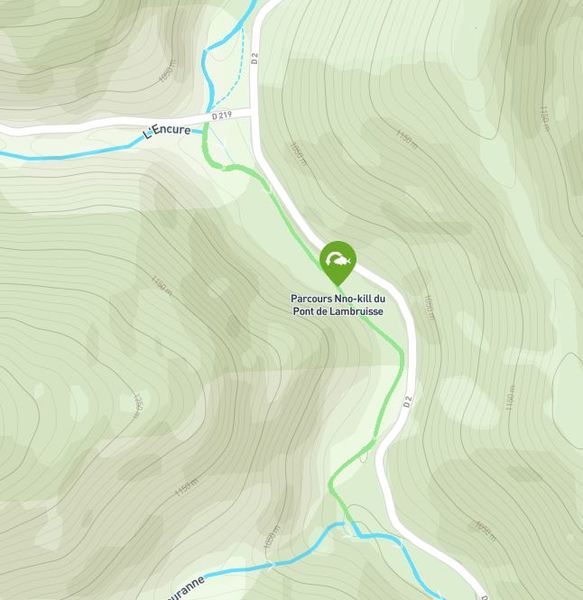
On this course, from the Lambruisse bridge to the confluence with the Fouranne ravine, all fish return to the water immediately and in the best possible conditions. All techniques authorized. Single barbless hook or crushed barb mandatory.EQUIPMENTLambruisse bridge no-kill fishing courseLambruisse-en
-
Dating from the 17th century, this pretty bridge over the Verdon is well worth the detour... It's an ideal walk for a special moment in the heart of the Verdon: a calm, unspoilt place, far less crowded than the Gorges.EQUIPMENTLe Pont de Tusset - EntrevergesRougon-en
-
At Val d'Allos - Le Village, at the departure of village hall, you will follow a path which will bring you to la Forêt de la Vacheresse where you will be on the limit of Mercantour national park.EQUIPMENTVacheresse ForestAllos-en
-
With several sections in common with the TransVerdon, this magnificent circuit winds around the unspoilt Baou valley.EQUIPMENTTour du Baou par la voie RomaineLa Palud-sur-Verdon-en
-
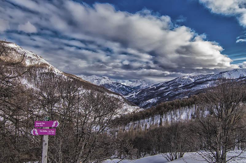
At Val d'Allos - La Foux, starting from Pont de Labrau, you will take an ungroomed snowshoes trail, and discover the Auriac area.EQUIPMENTGrand PrèsLa Foux d’Allos-en
-
The route is divided between forests of various species and high-altitude mountain pastures. The stage ends with accommodation in Annot or Roncharel.EQUIPMENTGR de Pays vallée de la Vaïre - Étape 2 - Carrefour du Faït > Puy de RentAnnot-en
-
For toddlers, medium-sized and older children, those who like a good story, those who prefer bubbles or those who are looking for something specific. Not forgetting those who don't know what they like and need a little guidance.EQUIPMENTPeyroules multimedia libraryPeyroules-en
-
Refreshing walk to the foot of the waterfall. Beautiful views over the valley.EQUIPMENTCascade de ChaumieColmars-en
-
Empruntez le train d'Annot à Thorame-Haute pour effectuer ce trail en aller simple qui culmine au Puy de Rent à 1996 m. Sur près de 6 km, il offre une vue à 360 ° sur les vallées de la Vaïre et de l'Ivoire et les sommets du Mercantour et de Provence.EQUIPMENTParcours 10 - Rail'N'TrailAnnot-en
-
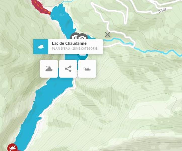
A 61.88-hectare lake classified as 2nd category for fish at this location. Please note: The management of this lake has not yet been determined. We strongly advise you to ask the owner for fishing rights.EQUIPMENTLake ChaudanneCastellane-en
-
Winter and summer alike, the lifts take you to the summitEQUIPMENTSki liftsLe Seignus-en
-
A loop starting from the hamlet of Peyresq, this sporting circuit follows a cross-country ski trail.EQUIPMENTChamplatte par le hameau de PeyresqThorame-Haute-en
-
Cycling loop in the Gorges du Verdon, quite difficult with 2 passes to cross, so a good pedal stroke is recommended!EQUIPMENTLa Vallée de la Baou cycling tourLa Palud-sur-Verdon-en
-
Hunting loop enhanced. Cross the hamlet, a living testimony to a mountain village that has withstood the test of time. The circuit takes in the left bank of the Chasse through the hazelnut trees, with a surprising view of the hamlet.EQUIPMENTChassetteVillars-Colmars-en
-
Leave the village of Val d'Allos for Colmars-les-Alpes, via a balcony crossing in the heart of the mountain pastures. The route begins with a short ascent on the road, but ends with a gentle descent.EQUIPMENT002 TransVerdon Tronçon - De Val d’Allos à Colmars-les-AlpesAllos-en
-
A change of scenery between vast high-altitude lawns and rushing waters! From Colmars, follow the forest track to Pont de la Serre (with an adapted vehicle) for around 40 minutes. Follow on foot the superb basins of La Lance.EQUIPMENTLes Lacs de LigninColmars-en
-
Start of the pedestrian / snowshoes walk at the departure of the road Col d'Allos , at the district "quartier les étoiles", at the resort of Val d'Allos - La Foux.EQUIPMENTCabane de la SestrièreLa Foux d’Allos-en
-
Along the way, you'll discover ancient rock shelters in the heart of a magnificent chestnut forest, beautiful views from the plateau and an extraordinary rocky chaos on the descent to the village.EQUIPMENTSentier de Baume LongeAnnot-en
-
Sporty cycle tour around the Verdon and Vaïre rivers.EQUIPMENTBoucle du Verdon et VaïreSaint-André-les-Alpes-en
-
In the foothills of the Gourdan mountain, you can discover the small Saint Saturnin chapel and a magnificent panoramic view of the Chanan valley, the mountains of Miolans, Cheiron and Mount Vial.EQUIPMENTLes Balcons de La RochetteLa Rochette-en
-
After traversing the upper Verdon valley, starting from Clumanc, the "Les 3 Asses" itinerary is a small loop for the general public, accessible to families and more athletic hikers with limited time.EQUIPMENTLes 3 Asses - Espace CyclosportClumanc-en
-
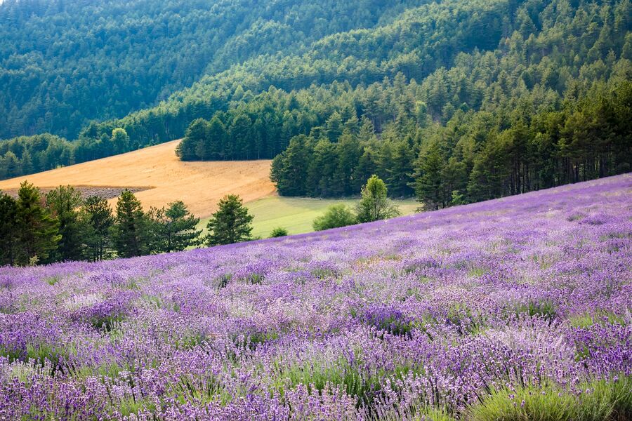
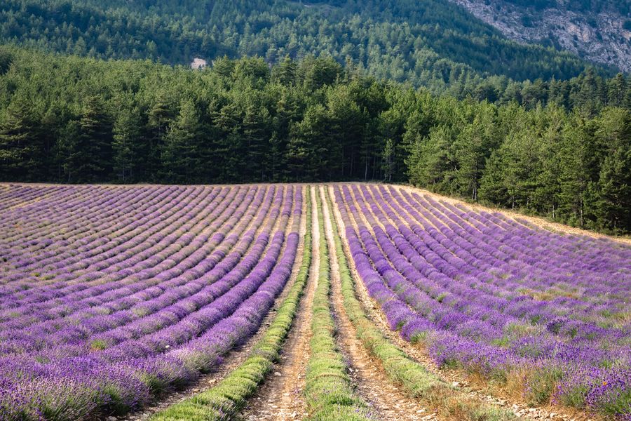
From the hamlet of Argens, renowned for its fine lavender and the distillery that can be visited, follow a road that smells of Provence to St André, where lavender fields overlook the Verdon, then head for the distillery museum in Barrême.EQUIPMENTRoute de la Lavande Argens - St André-les-Alpes - BarrêmeSaint-André-les-Alpes-en
-
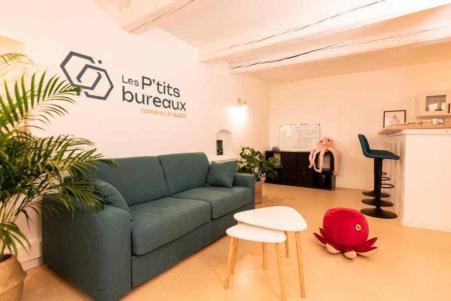
Welcome to Les Ptits Bureaux! Les Ptits Bureaux is a third-party space nestled in the heart of Saint-André-les-Alpes, where associations, city-dwellers and workers can come together to work and exchange ideas.EQUIPMENTLes Ptits BureauxSaint-André-les-Alpes-en
-
This ancient path linking Blieux to Chasteuil leads to Colle Basse, overlooking the Verdon valley at 1446 m.EQUIPMENTColle BasseBlieux-en
-
Easy walk starting from the road (C 2) leading to Demandolx. Suitable for baby carriages and people with reduced mobility.EQUIPMENTBalade au Hameau de VilleDemandolx-en
-
Alternating between beech and pine forests and panoramic views over the valley, this hike leads to the Roncharel refuge.EQUIPMENTRoncharelAnnot-en
-
The Spa by Cinq Mondes is a 250 m² space dedicated to well-being and relaxation. It offers two massage rooms (one double), hammam, sauna, swimming pool, chromotherapy shower, herbal tea room and fitness room.EQUIPMENTSpa des Gorges du VerdonLa Palud-sur-Verdon-en
-
Faites une halte à Norante et découvrez son histoire et son patrimoine, entre église, fontaine et ancien château.EQUIPMENTParcours patrimoine de NoranteChaudon-Norante-en
-
Self-service station equipped with essential tools for small repairs and airing up your bike.EQUIPMENTPublic bike facilitiesLa Rochette-en
-
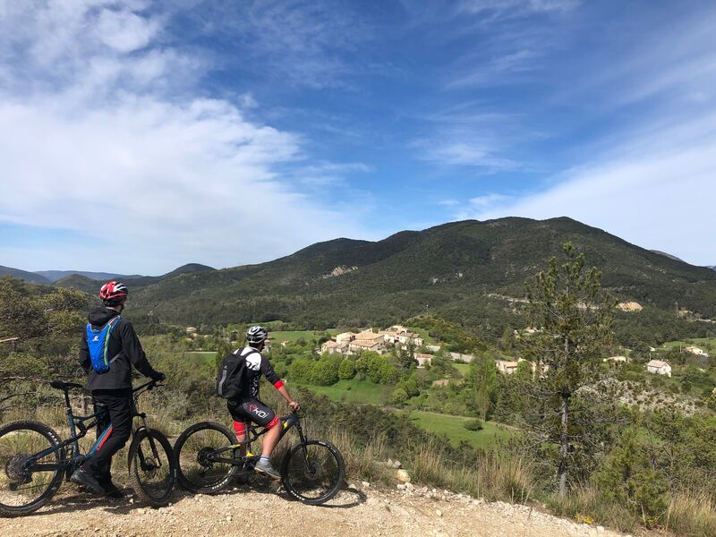
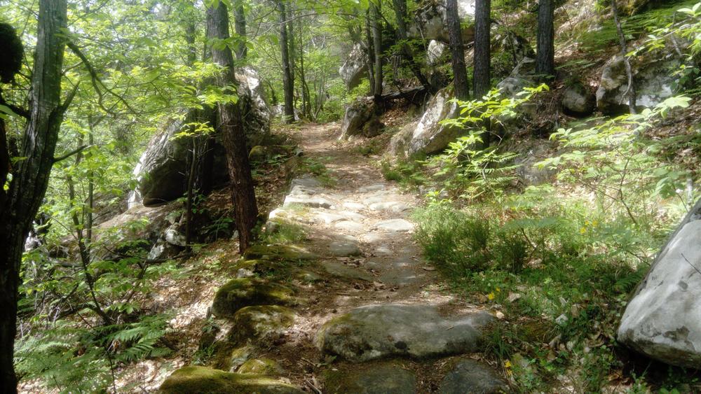
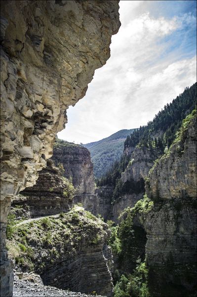
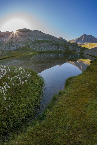
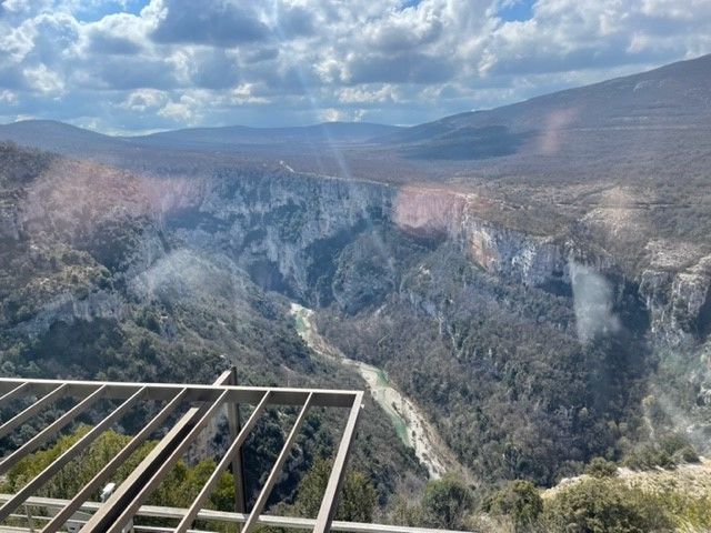
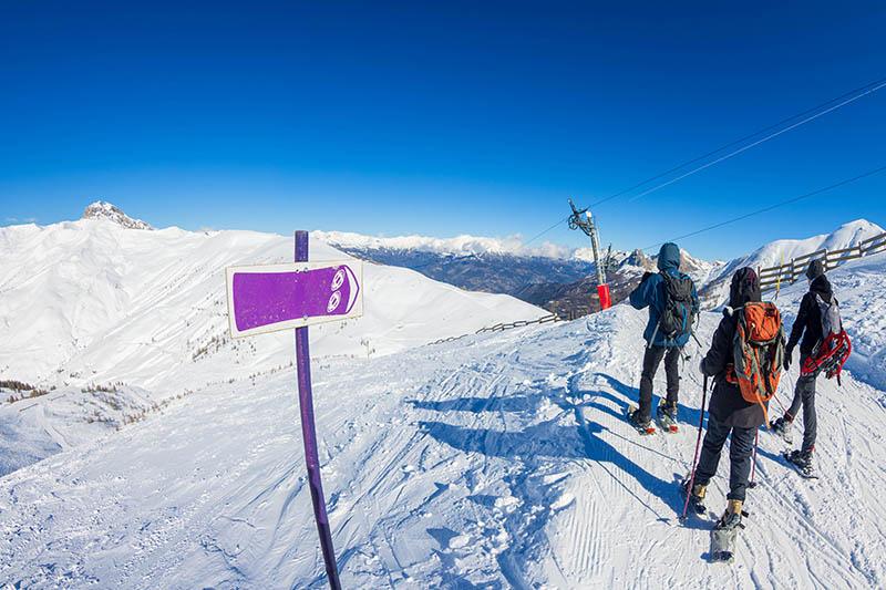
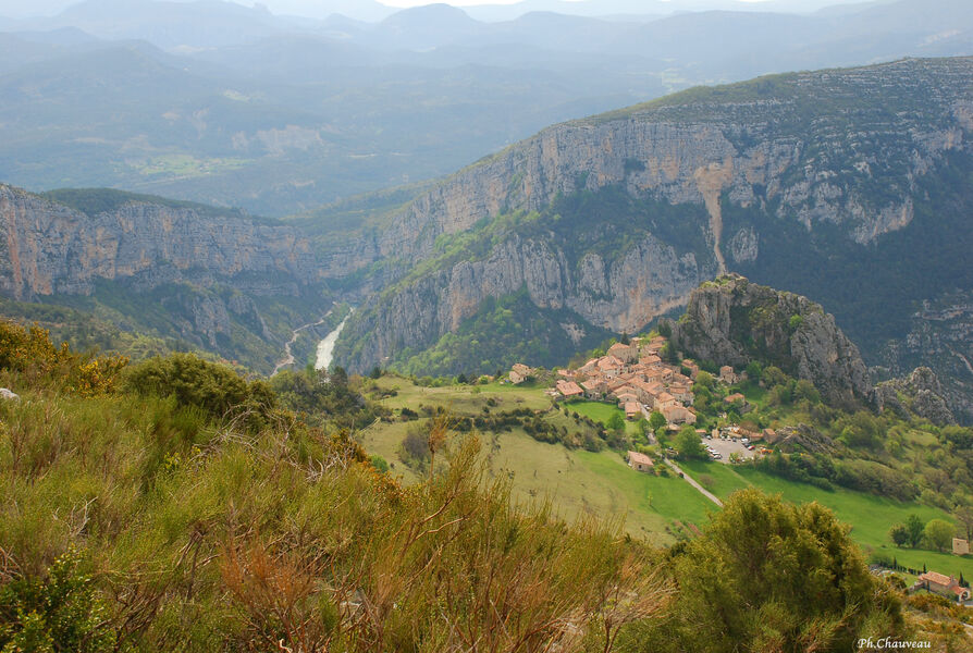
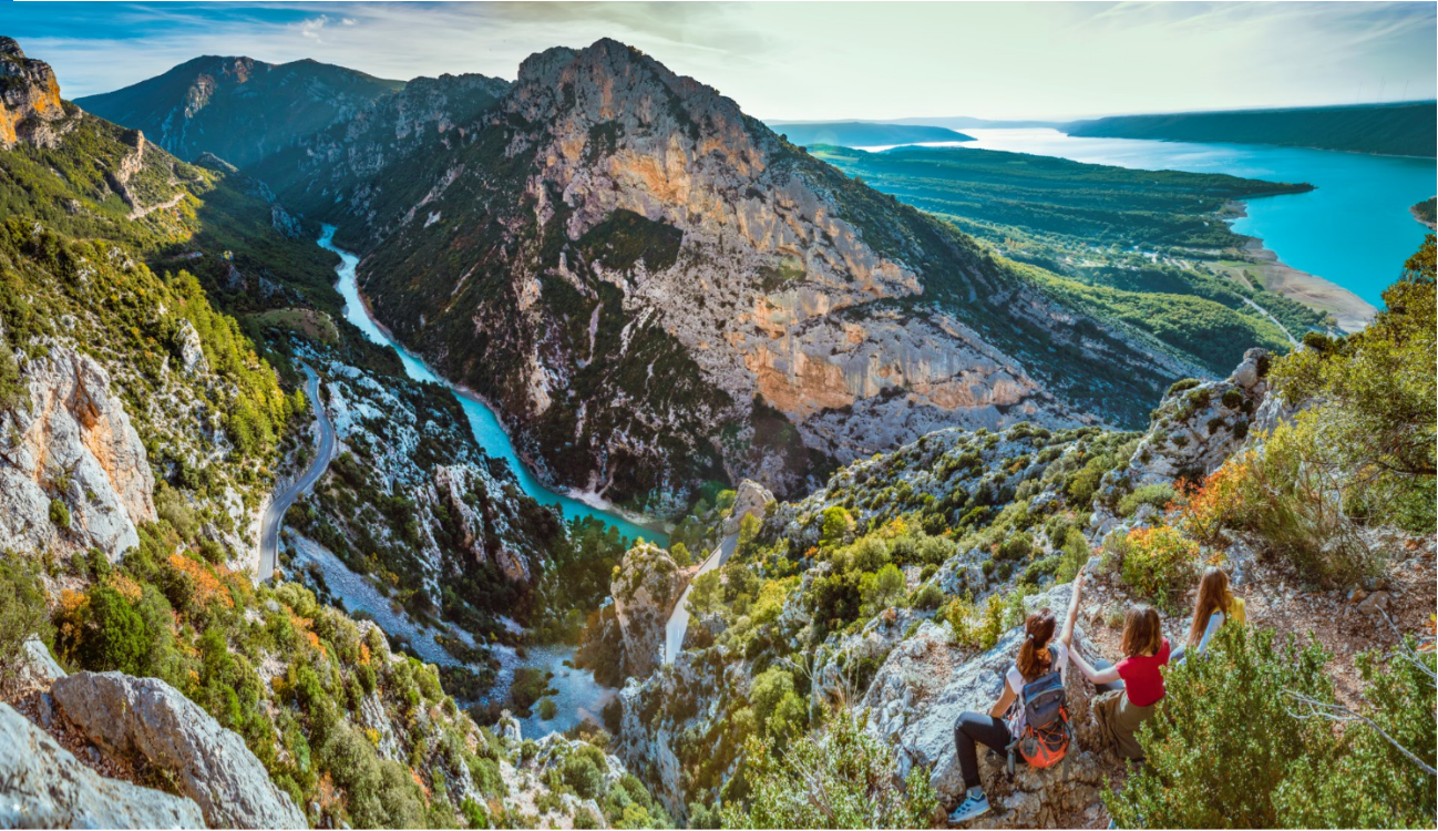
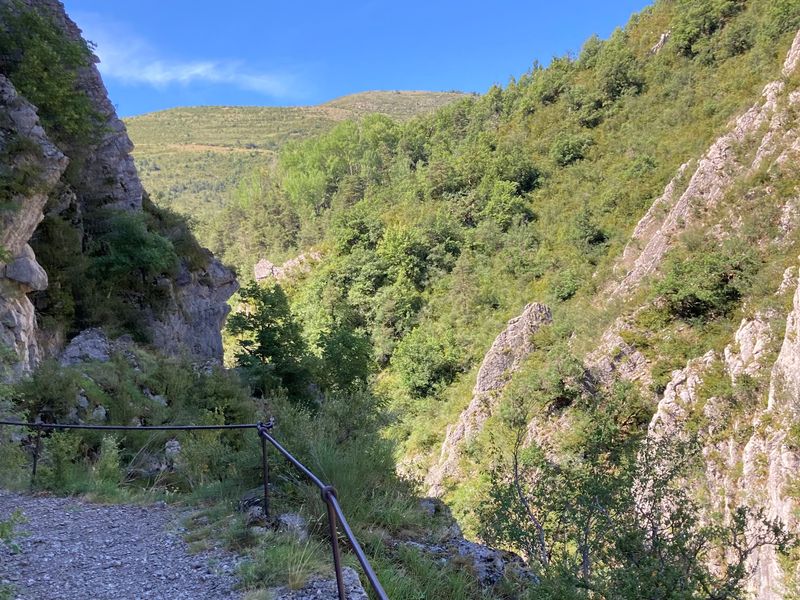
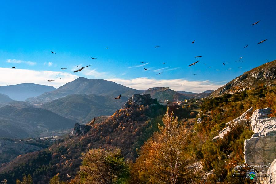
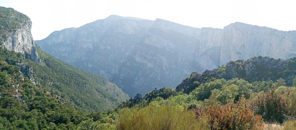
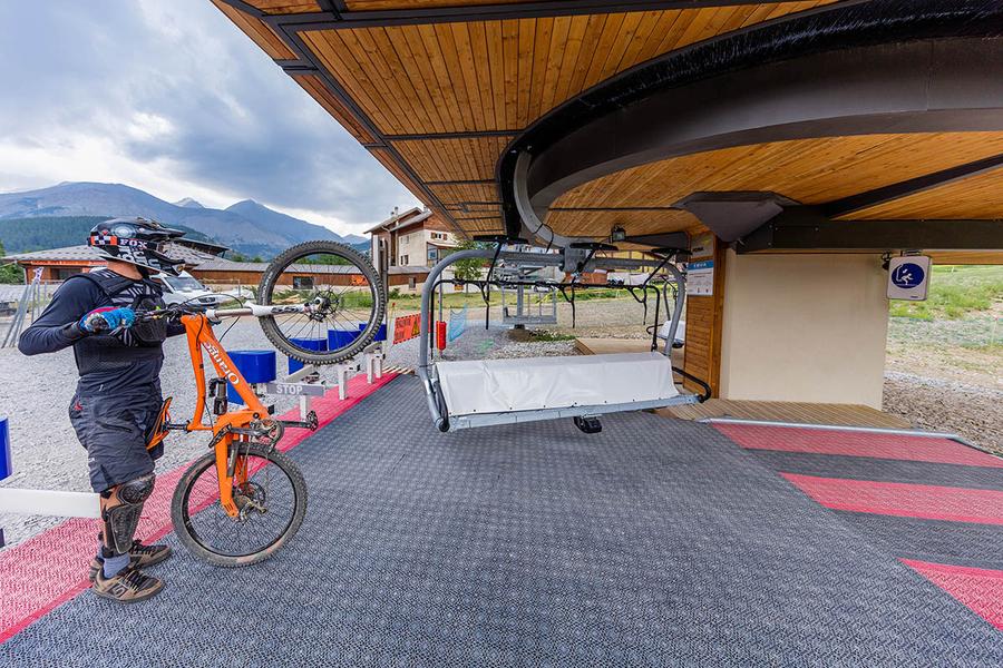
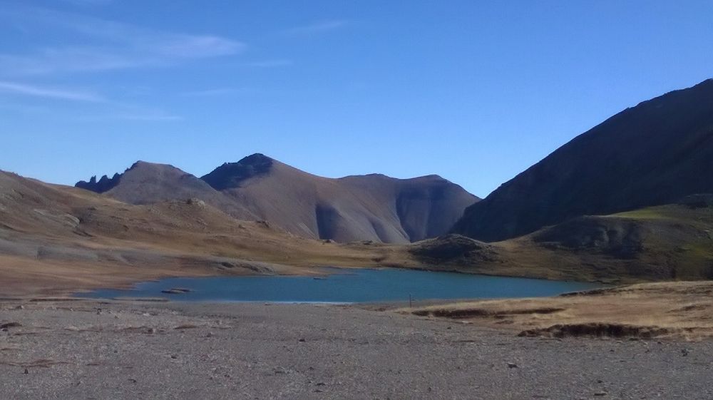
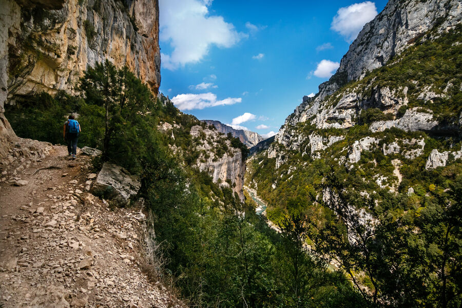
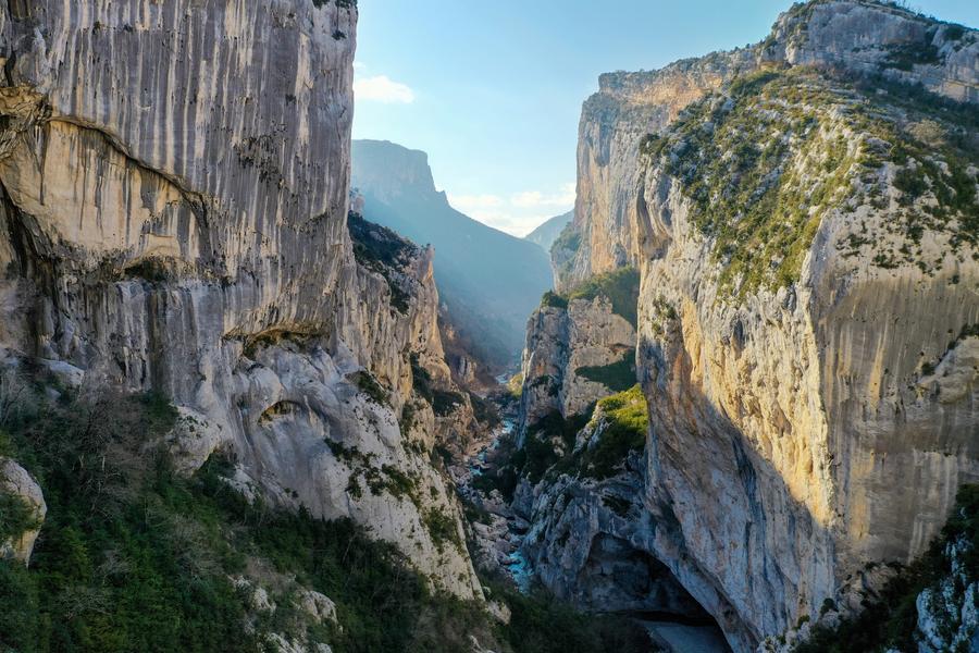
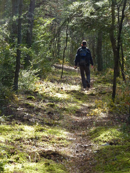
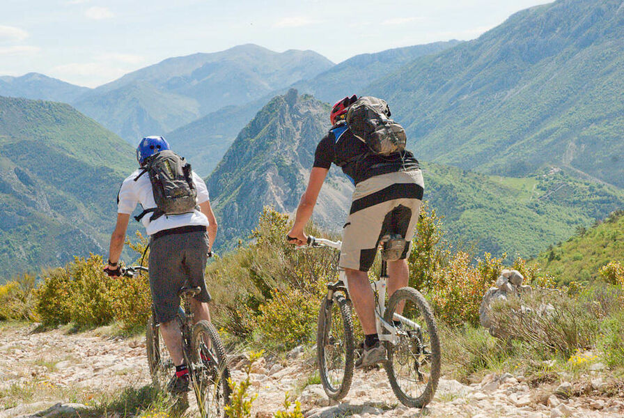
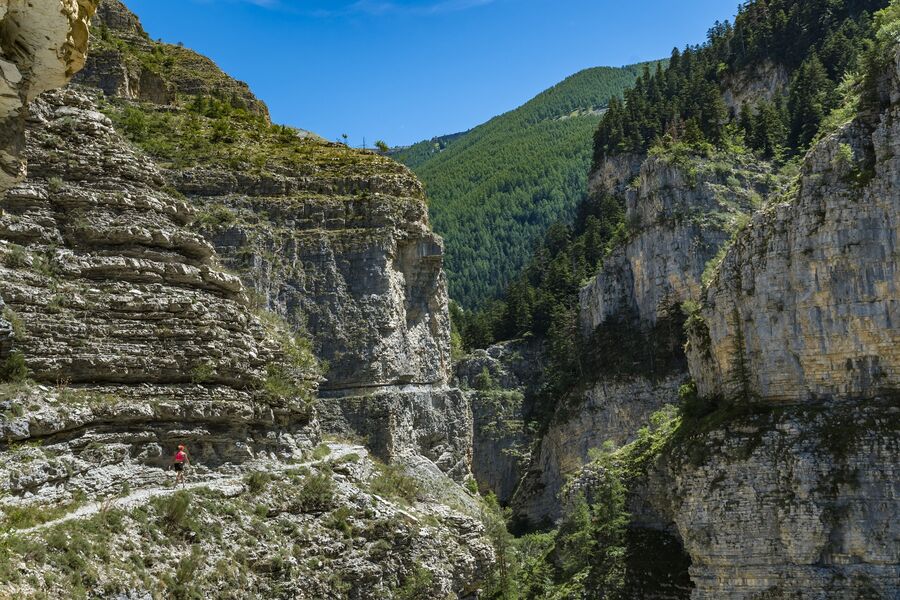
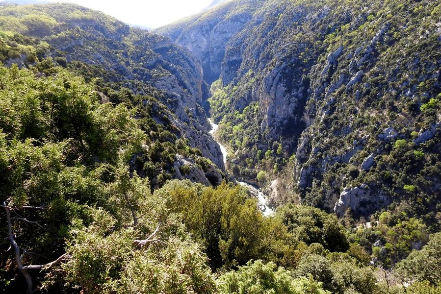
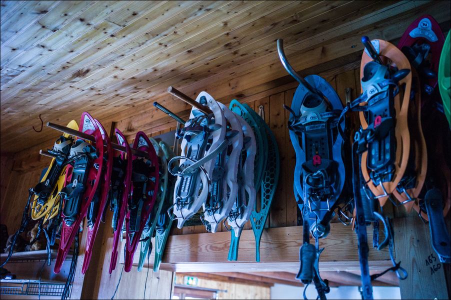
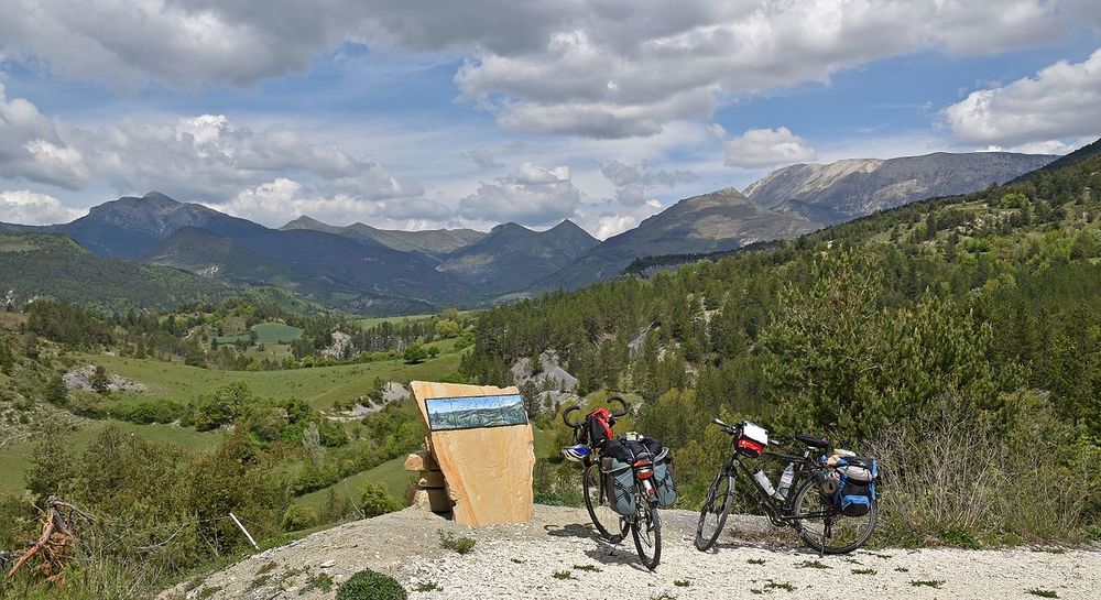
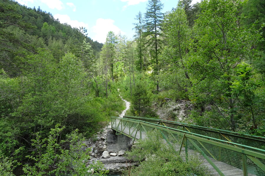
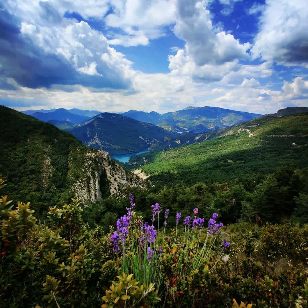
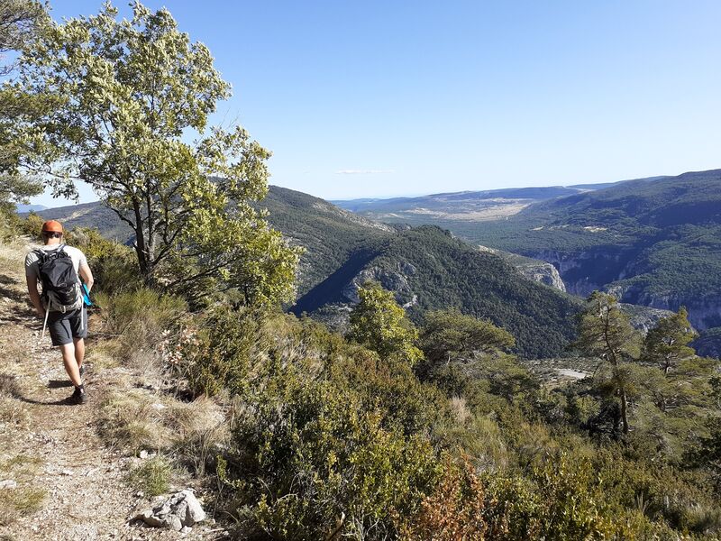
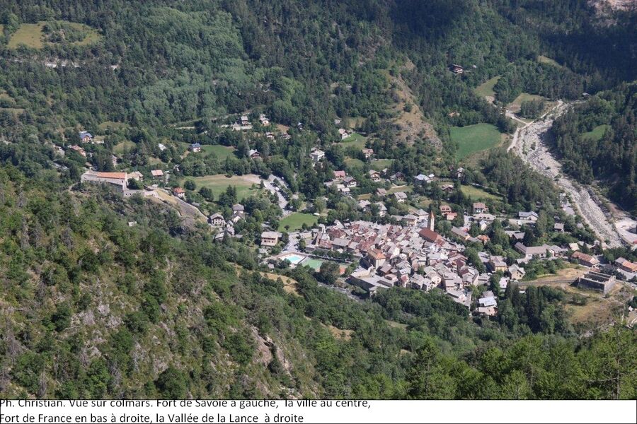
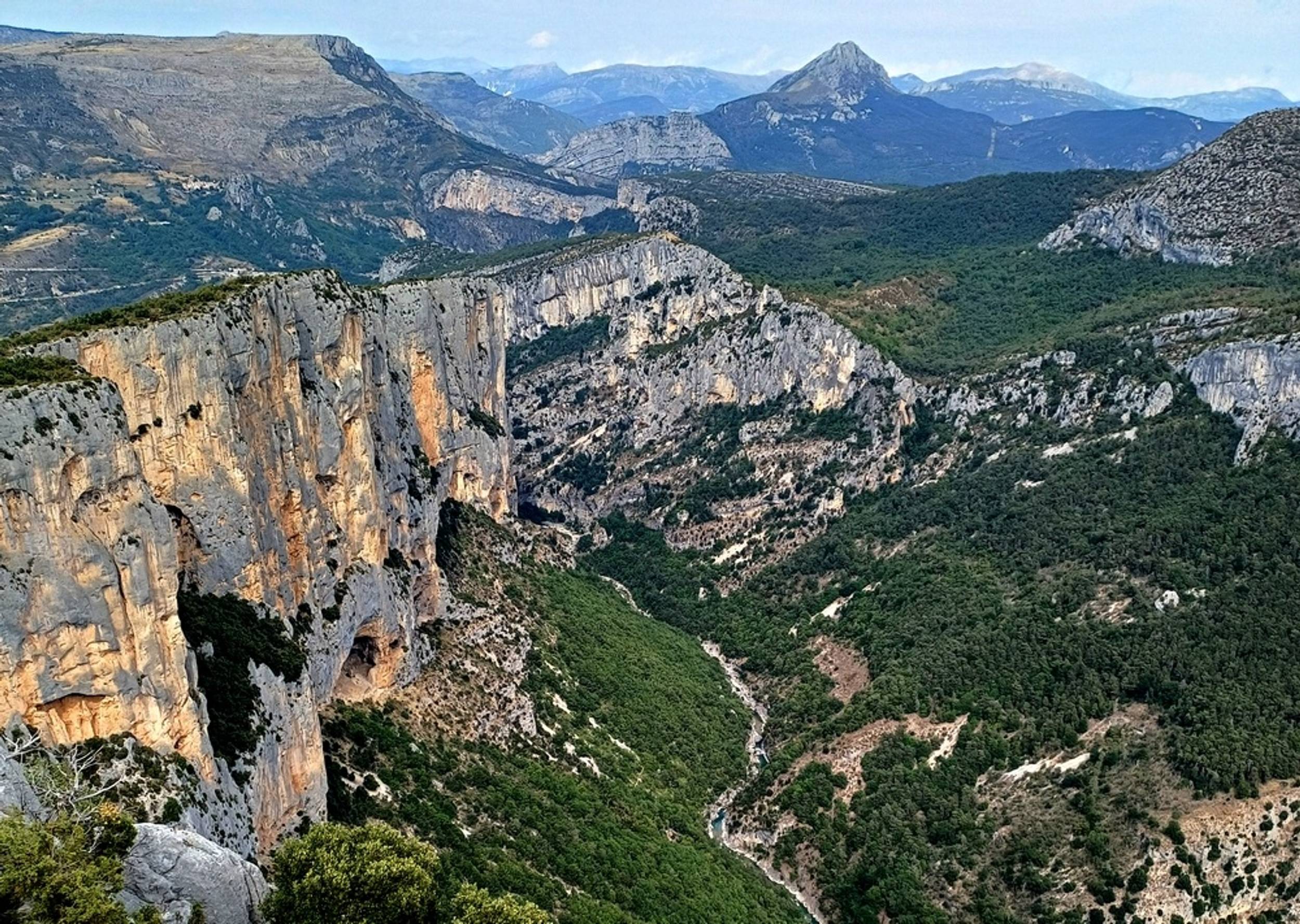
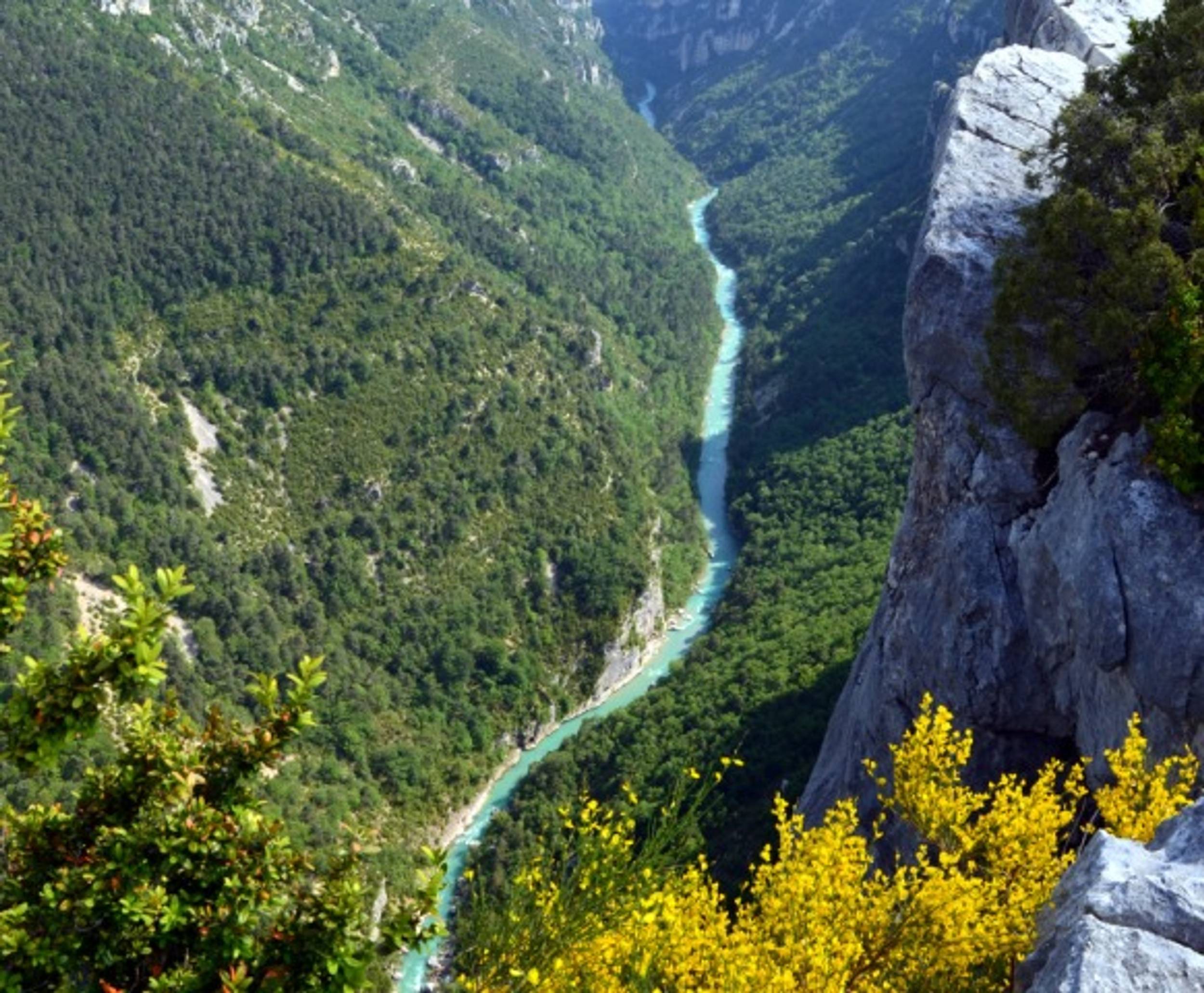
In the heart of the Gorges du Verdon, the Blanc-Martel trail is the best-known hike in the Canyon, and the only one that allows you to walk along the river at the bottom of the Gorges. It takes its name from Alfred-Edouard Martel and Isidore Blanc.EQUIPMENTSentier Blanc-MartelLa Palud-sur-Verdon-en
-
From the Issole to the Verdon via the drailles des moutons and the Jassaud plain. Possibility of extending to Pic de Mal Ubac.EQUIPMENTLa Valette - Plaine de JassaudThorame-Basse-en
-
La salle des fêtes peut vous accueillir à l’occasion de réunions familiales ou de groupes. Sont mis à disposition tables et bancs et une petit cuisine.EQUIPMENTSalle des fêtesBeauvezer-en
-
This 24 km bike trail in La Palud sur Verdon takes you on a tour of the Grand Canyon ridges. The 14 Belvederes reveal the mythical cliffs of the Verdon and offer unforgettable views of the Grand Canyon.EQUIPMENTLa Route des Crêtes - Le Grand Canyon - Espace cyclosportLa Palud-sur-Verdon-en
-
Discovery trail of pastoralism and transhumance in the Haut-Verdon, Villars - Colmars. Shepherd's life, mountain pastures, transhumance, mountain huts. Discover pastoralism and transhumance.EQUIPMENTL'AmountagnaVillars-Colmars-en
-
From Val d'Allos - the Village, the path will make you join farm Sainte Brigitte, to arrive then at the farm of La Haute Perrière.EQUIPMENTLa Haute PerrièreAllos-en
-
On this course, from the confluence with the Chabaud to the confluence with the Juan, all fish return to the water immediately and in the best possible conditions. All techniques permitted. Single barbless hook or crushed barb obligatory.EQUIPMENTNo-kill fishingVillars-Colmars-en
-
Self-service station equipped with essential tools for small repairs and airing up your bike.EQUIPMENTPublic bike facilitiesThorame-Haute-en
-
Depuis les gorges jusqu'au sources du Verdon, embarquez sur un itinéraire unique, conforme aux standards des Ultra-Trails, qui traverse les 4 secteurs de l’Espace Trail du territoire.EQUIPMENTGrand Verdon - Itinérance trailLa Palud-sur-Verdon-en
-
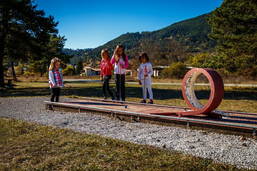
The miniature golf course is open all year round (outdoors). For half-day rentals of clubs and balls, please visit the Tourist Office during opening hours.EQUIPMENTMini GolfSaint-André-les-Alpes-en
-
This pass, at the foot of the imposing Cheval Blanc mountain, is a historic crossing point between the valleys. To reach it, a tunnel was carved out of the clue de la Peine using picks and blasting.EQUIPMENTCol de la CineTartonne-en
-
Discovering a little-frequented valleyEQUIPMENTCabane de CordoeilThorame-Haute-en
-
No carp caught by anglers may be held in captivity or transported overnight.EQUIPMENTNight carp courseSaint-André-les-Alpes-en
-
This loop passes through a forest of hooked pines and pastures. You'll enjoy remarkable views of the village of Peyresq and the peak of Rent.EQUIPMENTLes CouletsThorame-Haute-en
-
Walk to the abandoned hamlet of Ville overlooking the Jabron valley and the village of PeyroulesEQUIPMENTA round-trip to PeyroulesPeyroules-en
-
A short stroll from La Mure-Argens along paths leading to the heart of the Issole national forest.EQUIPMENTLe Tour du Clos de CombesLa Mure-Argens-en
-
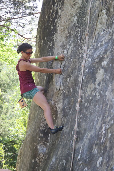
If you hear the word sandstone blocks in a chestnut forest, you'll answer.... Annot! A site with a variety of routes to suit all levels of climber.EQUIPMENTLes Grès d'Annot climbing siteAnnot-en
-
Attractive shaded pitch with 2 tables, in the children's garden. Water point and public toilets nearby. However, there are no garbage cans, so bring a bag!EQUIPMENTKindergarten picnic areaLa Palud-sur-Verdon-en
-
After a shady climb through undergrowth, the route reaches the mountain pastures of Montagne de Maurel, entering the Verdon Regional Nature Park. Panoramic views of the highest peaks in the Verdon and Mercantour regions.EQUIPMENTLe Sommet de MaurelLa Mure-Argens-en
-
A contrast of the superheated garrigue of the Verdon from the shady and cool forest of the ubac of Barbin, you will walk in a wild and grand place.EQUIPMENTThe Bastidon TrailLa Palud-sur-Verdon-en
-
A short hike to take in the view! The orientation table will guide you through the 360° panorama of the Mercantour and Provence peaks.EQUIPMENTLe Sommet du RoncheretAnnot-en
-
Leaving from Saint-André-les-Alpes, an easy and very pleasant loop along the river.EQUIPMENTVerdon - Issole - Espace CyclosportSaint-André-les-Alpes-en
-
Leaving Castellane, forget everyday life and saddle up for a mid-mountain itinerary, with an unusual route along the Chaudanne and Castillon lakes.EQUIPMENTPays de Castellane - Espace CyclosportCastellane-en
-
A sledge run on rail and multi-season nearby verdon river . An attraction for all family in the Val d'allos resort !EQUIPMENTSledge on trailLa Foux d’Allos-en
-
For young, medium and old, for those who like a good story, those who prefer bubbles or those who are looking for something specific. Not forgetting those who don't know what they like and need a little guidance.EQUIPMENTSaint André les Alpes multimedia librarySaint-André-les-Alpes-en
-
In a peaceful setting of 15 hectares, the Domaine des Sources offers an exceptional setting for unforgettable memories.EQUIPMENTDomaine des Sources reception areaSaint-Benoît-en
-
The hike offers fine views of the pre-Alpine Verdon mountains, with interesting contrasts in vegetation between the adret and ubac of Barbin.EQUIPMENTTour de BarbinLa Palud-sur-Verdon-en
-
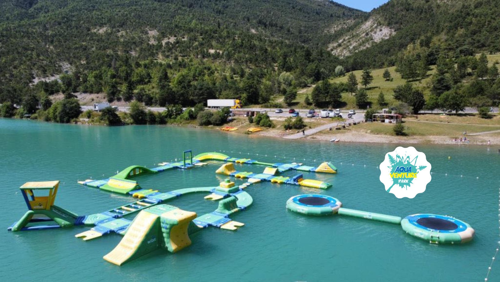
Come and challenge your friends and family on a giant inflatable water course! Trampolines, rollerblading, climbing wall, catapult... Aquaventure Park is the place to be!EQUIPMENTAquaventure ParkSaint-André-les-Alpes-en
-
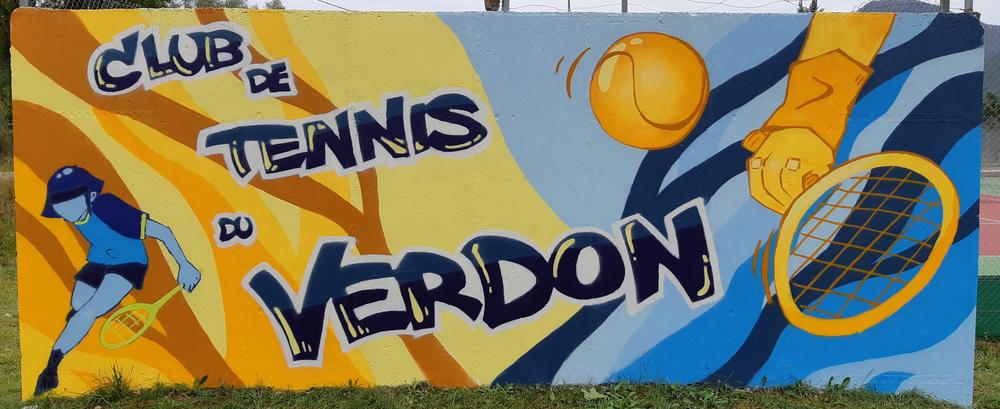
The Club de Tennis du Verdon (CTV) offers tennis court rentals by the hour or by the week.EQUIPMENTCourts de tennisSaint-André-les-Alpes-en
-
Self-service station equipped with essential tools for small repairs and airing up your bike.EQUIPMENTPublic bike facilitiesLambruisse-en
-
La Grande Bastide offers you a place of calm and relaxation, whether you're on your own or with your family, with horse boarding, horseback riding for children and adults, training courses, horseback riding with gallops and hand-rides for the little ones.EQUIPMENTCentre équestre la Grande BastidePeyroules-en
-
The Chasse plateau and its mountain pastures Pastoral. itinerary featuring the Sagnes and Marie-Louise hutsEQUIPMENTPlateau des Chasts, Cabane Marie-LouiseVillars-Colmars-en
-
Located on the Dourbes bar at an altitude of 1,622 m, the Pas de Labaud, like the Pas de Tartonne and Pas de la Faye, has long been used by the inhabitants of the Asse valley to reach the Bléone valley and the Digne-les-Bains region.EQUIPMENTLa barre des Dourbes, Pas de LabaudClumanc-en
-
Through the hills, this hike links the villages of Senez and Blieux (fine views over the Asse de Blieux valley) and follows in the footsteps of the historic route taken by Napoleon in 1815 between Castellane and Digne les Bains.EQUIPMENTLa Colle de BlieuxBlieux-en
-
Following the "Tour des Sources", you'll climb up the Coutails torrent to its source.EQUIPMENTLe Tour des SourcesAngles-en
-
The Subis walk takes in the hillsides, along pretty, shady forest paths.EQUIPMENTLes SubisSaint-André-les-Alpes-en
-
A pleasant, family-friendly route with a low gradientEQUIPMENTTour de MontruvelThorame-Haute-en
-
Mount Chalvet is a sunny mountain overlooking the village of Saint André les Alpes, where rare species made it their home.EQUIPMENTThe Chalvet peakSaint-André-les-Alpes-en
-
A walk among the traces of the past with Carlon the soldier. This path will help you explore the natural and cultural resources of Colmars-les-Alpes before leading you into a forest of Austrian pines.EQUIPMENTCanal de l'AdroitColmars-en
-
Variant proposed for section 3, when the plateau of the Lignin lakes and the Détroit drop are still snow-covered. The route winds along the Verdon. Climb up to Colle Saint-Michel for a beautiful descent into the valley.EQUIPMENT003B TransVerdon Tronçon - Colmars-les-Alpes à Thorame-HauteColmars-en
-
This sporty circuit, which can be completed in one or two days, starting from Castellane or Saint-André-les-Alpes, takes you around the Lac de Castillon from the heights, offering splendid views.EQUIPMENTLe Tour du Lac de Castillon par Saint-André-les-AlpesSaint-André-les-Alpes-en
-
In summer, take a shady walk along the banks of the Verdon, overlooking the village of Beauvezer. You can also visit the pretty village of Villars - Heyssier.EQUIPMENTLe Plan - Acco de ChalveBeauvezer-en
-
Self-service station equipped with essential tools for small repairs and airing up your bike.EQUIPMENTPublic bike facilitiesSenez-en
-
Discover Barrême's natural and cultural heritage with the whole family. A 14-stage orienteering course starting from the distillery museum, to be completed independently. Punch-in map supplied.EQUIPMENTCourse d'orientation patrimoine de BarrêmeBarrême-en
-
From Colmars, you can enhance route no. 12 by heading towards the hamlet of Villars-Heyssier. Be sure to stay on the MTB trail and do not take the Saint-Pierre Gorges trail, which is prohibited for mountain bikes.EQUIPMENTLes Balcons de Pinatelle par ColmarsColmars-en
-
This itinerary passes by the remarkable church of Notre Dame d'Entraigues, continues to the surprising Tartonne saltwater spring, and returns over the hills, across fields and open landscapes to the Asse and Clumanc valleys.EQUIPMENTCircuit de la Salaou, Le Puits SaléTartonne-en
-
At the northern end of the Barre des Dourbes, the summit of Couar rises to almost 2,000m. On a clear day, you can see all the way to the Ecrins and the Dévoluy massif!EQUIPMENTLe Sommet de Couar (1988 m)Tartonne-en
-
Une randonnée en itinérance dans le plus beau Canyon d’EuropeEQUIPMENTTour des Gorges du VerdonMoustiers-Sainte-Marie-en
-
A beautiful trail opened up during the period of reforestation in the mountains. In the Chabanal forest, the undergrowth is filled with raspberry bushes as far as the Congerman forest huts.EQUIPMENTGorges de Saint-Pierre - Congerman - Le CouguyonBeauvezer-en
-
A short climb to the chapel, in the shade of the cypress trees in the middle of the forestEQUIPMENTChapelle Saint-JeanColmars-en
-
In the shade of the larches, a varied circuit on the red trail of the Ratery Nordic area. The loop is a little more challenging in some parts of the forest. See the lily, emblem of the valley. In autumn, come and listen to the bellowing of the stag.EQUIPMENTAiguinesColmars-en
-
Domaine de Glandève, the former summer residence of the bishops of Glandève, is a charming mountain island that welcomes you to an authentic, unspoilt setting just 60 kilometers north of Nice, in Entrevaux.EQUIPMENTDomaine de GlandèveEntrevaux-en
-
Soccer pitchEQUIPMENTMunicipal StadiumLa Palud-sur-Verdon-en
-
From the Serres crest, you can see the Mercantour Massif to the east, and beyond it the closer massifs (Grand Coyer...), with the Pic de Chamatte at the end of the crest. A natural forest of beech and Scots pine grows beneath the pastures.EQUIPMENTLa Crêtes des SerresAllons-en
-
This easy loop allows you to discover several remarkable elements of Tartonne's heritage: Notre Dame d'Entraigues, a listed 12th-century church, and the Château de Maladrech, second home of the Gassendi family.EQUIPMENTLe Puits SaléTartonne-en
-
The 1st part of the trail crosses a Sensitive Natural Area, and is equipped with a wooden pathway and an interpretation trail on the protected and remarkable environment. It runs along the left bank of the lake, leading from the village to the Plan beach.EQUIPMENTLe Sentier des PêcheursSaint-André-les-Alpes-en
-
Easy walk in a hedged landscape. Lac des Sagnes wetlandEQUIPMENTPromenade du lac des SagnesThorame-Haute-en
-
Protected and regulated sledging area. The slopes are adapted to the age of the children: baby sledging for 2 to 6 year-olds and a sledging area for over 6 year-olds.EQUIPMENTSledge areaAllos-en
-
Equipped with your headphones, mobile phone or MP3 player, let your ears guide you on a stroll through testimonies and collected sounds, on the links that local people have with water, the Verdon river and its tributaries.EQUIPMENTHistoire(s) d'eau - Sound walkSaint-André-les-Alpes-en
-
In a very characteristic environment of sandstone and blue marl, this hike takes in two pretty villages. Saint Benoît, perched on a rocky knoll, and Braux, surrounded by chestnut trees.EQUIPMENTAncien Chemin de Saint Benoît à BrauxSaint-Benoît-en
-
A shady table, a 5-minute walk from the village square.EQUIPMENTAire du ComteAnnot-en
-
From Entrevaux, the climb is steady through the pines, with magnificent views of the citadel. After the Col de Félines, a magnificent road takes you up to the pass with ease. The maximum gradient is around 8.3%.EQUIPMENTBoucle cyclotouristique Col du TrébuchetEntrevaux-en
-
Departing from the Chalet de Ratery, a Nordic center in winter, the trails run through a large larch forest, following the "La Reynière" loop to Cabane Neuve.EQUIPMENTCabane NeuveColmars-en
-
A lovely hike from the fortified village deep into the forest, where you can hear the stag bellowing in autumn.EQUIPMENTBas SumaureEntrevaux-en
-
Departure from Colmars-les-Alpes, a town of character on the banks of the Verdon, one of the most beautiful towns fortified by Vauban, with its two forts protecting access to the valley.EQUIPMENTCol des Champs - Espace CyclosportColmars-en
-
This walk takes you up into the hills, through former farmland, to the abandoned hamlet of Ville, overlooking the Jabron valley and the village of La Rivière.EQUIPMENTLa Circulaire de PeyroulesPeyroules-en
-
Forest and alpine route. Alternative route: Le Cheval Blanc via the ridges. Its summit offers an exceptional panorama (+ 3 h + 560 m ascent).EQUIPMENTCabane du Cheval BlancThorame-Basse-en
-
This refreshingly simple and accessible trail offers lovely views over the village of La Palud-sur-Verdon. Pass through the wetlands that gave the village its name: in old French, Palud means marsh.EQUIPMENTTour de la Fontaine des PrésLa Palud-sur-Verdon-en
-
With its large sandstone boulders under chestnut trees, it's one of the most beautiful bouldering sites in France. Its 1500 passages will satisfy all tastes and levels.EQUIPMENTBouldering siteLe Fugeret-en
-
Two bouldering sectors open for the 2022 and 2023 editions of Annot à bloc. Accessible directly from the village, these sites are ideal for children, beginners and experts alike.EQUIPMENTSite de blocs de la gareAnnot-en
-
As this discovery trail is on a high ledge, it offers an impressive view of the fortifications. On this trail you will find information boards describing the architectural heritage. Starting from the centre of the village, this trail goes along the old irrigation canal and then descends onto the Espiniers road. To return you have to walk along the main road D908 for 500 metresEQUIPMENTCanal de l'Adroit Interpretation TrailColmars-en
-
Departing from the former Mairie in Montblanc, this loop takes in the upper Chalvagne valley and the Pic de Chamatte in the distance. A forest atmosphere is present throughout the hike.EQUIPMENTCourouclousVal-de-Chalvagne-en
-
Picnic area with four large tables ideally located on the edge of the verdon in the shade of the trees. You can reach Colmars in 10 minutes on foot.EQUIPMENTpicnic areaColmars-en
-
You'll find a wide selection of adult and children's novels, comics and non-fiction books, regularly updated.EQUIPMENTBibliothèque de BlieuxBlieux-en
-
Site de vol libre mondialement reconnu, le sommet du Chalvet (1613 m) offre un panorama à couper le souffle sur le lac de Castillon.EQUIPMENTSAINT-ANDRÉ-LES-ALPES - Le Chalvet à VTTSaint-André-les-Alpes-en
-
The Annot sandstones are a paradise for hikers and climbers. This geological formation is responsible for the beautiful architecture of our villages, and the rock's enigmatic shapes have forged our legendary tales.EQUIPMENTGR de Pays vallée de la Vaïre - Étape 5 - Col du Fam > AnnotCastellet-lès-Sausses-en
-
On this course, from the railway bridge to the confluence with the Verdon, all fish return to the water immediately and in the best possible conditions. All techniques permitted. Single barbless hook or crushed barb obligatory.EQUIPMENTNo-kill fishingSaint-André-les-Alpes-en
-
Site de vol libre mondialement reconnu, le sommet du Chalvet (1613 m) offre un panorama à couper le souffle sur le lac de Castillon.EQUIPMENTParcours VTT : La Chalvet et sa forêtSaint-André-les-Alpes-en
-
Follow in the footsteps of the Romans along the ancient Roman road to the Château de Castellet-Saint-Cassien, once the summer residence of the Lords of Glandèves d'Entrevaux.EQUIPMENTCastellet Saint CassienEntrevaux-en
-
Leaving from Entrevaux, an exceptional medieval town, this challenging itinerary combines the beauty of man-made scenery with olive-growing terraces and physical exertion.EQUIPMENTLe Pays d'Entrevaux - Espace CyclosportEntrevaux-en
-
Enjoy the shady forests on the way up. Admire and appreciate the surrounding mountains, the vast meadows, the herds of cattle, the breathtaking view of the village of Colmars.EQUIPMENTRateryVillars-Colmars-en
-
The summit of Chiran, its astronomical observatory and its panoramic views of the Alpine peaks.EQUIPMENTThe peak of the Chiran MountainBlieux-en
-
A long loop that allows you to discover the natural site of the clues de la Melle, as well as the ruins of the hamlet of Chast and the bergerie de la Melle, an example of pastoral heritage.EQUIPMENTBoucle Senez - BlieuxSenez-en
-
Une randonnée sportive au-dessus du Grand canyonEQUIPMENTLA PALUD SUR VERDON - Le Bastidon en aller retourLa Palud-sur-Verdon-en
-
A family loop leading to the Verdon river and the fitness trail laid out by the little ones in the Plan district. Suitable for mountain bikes.EQUIPMENTLe Plan de Saint André les AlpesSaint-André-les-Alpes-en
-
The Serres family walk will introduce you to the village of Angles' heritage, as well as its farming and forestry activities.EQUIPMENTLe Tour des SerresAngles-en
-
A hike that will take you to Courchons, an abandoned village in the commune of Saint André, overlooking Lake Castillon.EQUIPMENTCourchons hamletSaint-André-les-Alpes-en
-
The ascent takes place along the route des crêtes, with a few stops to contemplate the breathtaking panoramas of the Grand Canyon from the Escalès lookouts.EQUIPMENTTour des Belvédères de l'EscalèsLa Palud-sur-Verdon-en
-
The route starts at the charming hamlet of Peyresq, which has been restored by scientists and remains a popular summer resort for lecturers from Belgian universities.EQUIPMENTLe Tour du CourradourThorame-Haute-en
-
Set in a glacial valley, this itinerary offers a breathtaking panorama. Over the course of time, the torrent has carved out natural pools and waterfalls, or "marmites de Géants", where you can take a refreshing dip. Please note access conditionsEQUIPMENTPont de la Serre, Les Vasques de la LanceColmars-en
-
No carp caught by anglers may be held in captivity or transported overnight.EQUIPMENTTouron Bay night carp courseSaint-Julien-du-Verdon-en
-
An unexpected ride by train and then on foot! A well-maintained trail through the Vaïre valley to the original village of Peyresq.EQUIPMENTPeyresqThorame-Haute-en
-
Self-service station equipped with essential tools for small repairs and airing up your bike.EQUIPMENTPublic bike facilitiesThorame-Basse-en
-
Rougon petanque groundEQUIPMENTRougon BoulodromeRougon-en
-
Cet itinéraire passe, notamment, par le plateau de Suëch, le hameau de Chasteuil, vous offrant de beaux points de vues. Il est souvent utilisé lors des itinérances pédestres de plusieurs jours.EQUIPMENTRougon - Castellane par le GR4Rougon-en
-
Shaded for the first half of the trail, it offers a fine view over the entire Vaïre valley. It then joins a forest track along which the spring will cool you down a little.EQUIPMENTLa Source de Combe RenardAnnot-en
-
This rolling, technically straightforward circuit offers a chance to see the countryside and visit unsuspected places, unspoilt witnesses to rural life in Haute-Provence.EQUIPMENTLe Tour de la SapéeTartonne-en
-
Just like the pilgrims of Saint John the Baptist who follow this trail every year in June, you will reach the Saint-Jean du Désert chapel located on the old road between Entrevaux and Castellane. This chapel is likely to have been built by the Knights Templar to offer hospitality to travelers and to help them find their wayEQUIPMENTSaint-Jean-du-DésertEntrevaux-en
-
This trail winds its way around the hamlet of La Foux, through meadows and forests.EQUIPMENTLa Foux de PeyroulesPeyroules-en
-
Leaving Entrevaux, classified as one of France's most beautiful villages, the trail passes the hermitage of St Jean du Désert, before reaching the hamlet of Ourges via the St Jean ravine. Past the St Joseph bridge, you reach Le Feït via a balcony.EQUIPMENTGR de Pays vallée de la Vaïre - Étape 1 - Entrevaux > Carrefour du FeïtEntrevaux-en
-
At the summit is a pyramid that served as a sighting point for the Train des Pignes tunnel. Enjoy views over the villages of La Colle-Saint-Michel and Peyresq, and the summits of Grand Coyer, Ruch, Rent and Grand Cordoeil.EQUIPMENTMontruvel 1Thorame-Haute-en
-
A forest trail on a balcony, winding through pines and larches, takes the walker back to Thorame-Basse to the sound of rustling water.EQUIPMENTVal d'IssoleThorame-Basse-en
-
Family outing to Europe's oldest known salt mining site, the Moriez saltwater spring, first developed in the Neolithic period, around 5700 BC.EQUIPMENTLe Puits d'Eau SaléMoriez-en
-
The circuit offers a wonderful opportunity to discover the magnificent Thorame-Basse region. As you follow the trail, you'll be enchanted by the picturesque scenery and panoramic views of the surrounding hamlets.EQUIPMENTLayon - Château-GarnierThorame-Basse-en
-
Rampe de mise à l'eau d'embarcations, thermiques uniquement, dont la puissance est inférieure à 6 cv. Motonautisme interdit.EQUIPMENTMise à l'eau plage du PlanSaint-André-les-Alpes-en
-
Entre alpages et Provence, l’Espace Trail Des Sources aux Gorges du Verdon propose un ensemble de parcours variés et originaux au sein d’une nature préservée. Partez à la découverte du territoire et de ses sites emblématiques.EQUIPMENTEspace Trail - Des sources aux gorges du VerdonSaint-André-les-Alpes-en
-
Partez à la découverte du circuit des chapelles d’Annot et explorez un patrimoine unique mêlant géologie, histoire et traditions populaires.EQUIPMENTParcours patrimoine - Chapelle de VérimandeAnnot-en
-
This hike offers a superb and impressive view of the Galange gorges, the Annot sandstones and the Coyer.EQUIPMENTChapelle Notre-Dame des NeigesAnnot-en
-
A varied route with Alpine passes and an emerald-green lake on the horizon. This cycling route takes in La Colle St Michel, Annot, the Col de Toutes Aures, the outskirts of St Julien du Verdon and the lake as far as St André-Les-Alpes.EQUIPMENTLa Colle Saint Michel cycling tourThorame-Haute-en
-
Cycling in the Verdon and Asse valleys, between the Cheval Blanc and Coupe mountain ranges.EQUIPMENTBoucle des Hautes ValléesThorame-Haute-en
-
From the Charvet mountain, a magnificent panorama unfolds from Cheval Blanc to the Barre des Dourbes. On the way back, it's not unusual to spot golden eagles, chamois and black grouse.EQUIPMENTTour de CharvetLambruisse-en
-
The Val d'Allos tennis courts are available to players in the heart of the resort and at the village leisure park.EQUIPMENTTennis courtAllos-en
-
Une montée sèche qui offre à l'arrivée un panorama à 360 ° sur les sommets du Mercantour et de Provence.EQUIPMENTParcours 14 - Le RoncheretAnnot-en
-
Public children's play area.EQUIPMENTKindergartenLa Palud-sur-Verdon-en
-
Self-service station equipped with essential tools for small repairs and airing up your bike.EQUIPMENTPublic bike facilitiesTartonne-en
-
Nearly 1,000m of vertical drop awaits you on the way down to the Issole valley and then Saint-André-les-Alpes, on a fast, technical and, above all, fun descent. A real treat for mountain bikers!EQUIPMENT007 TransVerdon Tronçon - De la Montagne de Maurel à Saint-André-les-AlpesLa Mure-Argens-en
-
Starting out from Thorame-Basse or Château Garnier, the Chemins du Soleil trails take you to the hamlets of Château Garnier and La Bâtie, which have developed a sheep farming industry suited to the area's farmland.EQUIPMENTChâteau GarnierThorame-Basse-en
-
Discover the heritage of the Middle Verdon through the sundials....EQUIPMENTLa Route des Cadrans solairesSaint-André-les-Alpes-en
-
Des villages uniques et une vallée sauvage menant au célèbre point sublime... De quoi s'évader à quelques coups de pédales des gorges.EQUIPMENTLA PALUD-SUR-VERDON - La vallée du BauRougon-en
-
Come and experience an aerial adventure in an exceptional site, planted with pine and deciduous trees and bordered by cliffs overlooking the Verdon.EQUIPMENTAdventure ForestCastellane-en
-
Departing from the Clumanc town hall, this itinerary combines the discovery of an exceptional volcanic geological site with a walk in the heart of the peaceful Asse valley.EQUIPMENTCircuit de la Coulette (1701 m)Clumanc-en
-
This circuit takes you to the village of Angles via a track and then a path on the left bank of the Verdon, on the slopes of the Serres ridge.EQUIPMENTLe village d'AnglesAngles-en
-
Un espace luge au départ des pistes nordiques, face au parking. Glissades et fous rires garantis ! Location de luges et casques sur place.EQUIPMENTPiste de lugeThorame-Haute-en
-
In the shade of the reforested slopes, the walk takes you to the hamlet of Coulet, from where you have a fine view of the Maurel mountain.EQUIPMENTLe CouletSaint-André-les-Alpes-en
-
A beautiful route through chestnut groves and, in places, among sandstone boulders. It crosses the abandoned hamlets of Collet Gouiran and La Rate, and passes by the ruins of St. Peter's chapel, built on a sandstone boulder.EQUIPMENTClot Bernard - La RateLe Fugeret-en
-
Have you been hesitating between the TransVerdon adventure and the Chemins du Soleil? This section is shared by the two Grandes Traversées VTT, for a grandiose entry into the Parc Naturel Régional du Verdon!EQUIPMENTChemins du Soleil - De Tartonne à Saint-André-les-Alpes - Le Haut Verdon à VTT (A17)Tartonne-en
-
A bucolic walk to the hamlet of Thon. Superb Romanesque stone bridge over the Asse de Blieux and its waterfalls.EQUIPMENTTour du TouchardBlieux-en
-
Profitez d'une piste débutant et d'une piste intermédiaire et confirmé au Pumptrack de Saint-André.EQUIPMENTPumptrackSaint-André-les-Alpes-en
-
Fitness center specializing in generalized muscle training and strengthening. Cardio, strength training, fitness.EQUIPMENTOpus Sport - Salle de sport connectéeColmars-en
-
The Vallée de Chasse is one of the Haut-Verdon's must-see secret spots, located above the village of Villars Colmars. The eponymous hamlet is a real highlight!EQUIPMENTChasseVillars-Colmars-en
-
This family trail, which winds through undergrowth, overlooks the valley and the Chemins de fer de Provence railway line. Old houses, bridges, wash-houses, churches and chapels in Méailles and Le Fugeret are also among the attractions of this hike.EQUIPMENTSentier du Fugeret à MéaillesLe Fugeret-en
-
The Touron beach in Saint Julien du Verdon is 100m from the village center.EQUIPMENTTouron beach in Saint Julien du VerdonSaint-Julien-du-Verdon-en
-
This trail takes you into the foothills of the Teillon mountain, amidst the colorful landscapes of Provence. A medium-level hike, with lovely views of the Castillon and Chaudanne lakes (orientation table).EQUIPMENTLa Ferme BrûléeDemandolx-en
-
If you hear the word sandstone blocks in a chestnut forest, you'll answer.... Annot! A site with a variety of routes to suit all levels of climber.EQUIPMENTLes Grès d'Annot bouldering climbing siteAnnot-en
-
This round-trip route links the villages of Sausses and Castellet-lès-Sausses.EQUIPMENTLes SelvesSausses-en
-
The corniche sublime is an 83 km loop around the Gorges du Verdon, offering stunning views of Lac de Sainte-Croix and the canyon.EQUIPMENTCorniche sublime cycling tourLa Palud-sur-Verdon-en
-
Family walk to the promontory of Chapelle Saint Jean, marking the first site of Barrême.EQUIPMENTChapelle Saint-JeanBarrême-en
-
The routes vary in difficulty (from 3b to 7c/8a), inclination (from slab to overhang) and type of hold: holes, cracks, rulers. The site adjoins the 10th-century chapel.EQUIPMENTRocher St Martin climbing siteLa Garde-en
-
A beautiful, shady itinerary that takes in the villages of Annot and Le Fugeret and offers magnificent views over the valley, with the option of returning via the Chemins de Fer de Provence.EQUIPMENTAnnot - Le Fugeret par RoncharelAnnot-en
-
Books, music, sheet music, films... and also puzzles and a grain library. For toddlers, small children, medium-sized children, older children, those who love a good story, those who prefer bubbles or those who are looking for something specific.EQUIPMENTAnnot multimedia libraryAnnot-en
-
Contrast the overheated garrigue of the Verdon with the cool, shady forest of the Barbin ubac, and you'll be walking through a wild and grandiose landscape.EQUIPMENTSentier du BastidonLa Palud-sur-Verdon-en
-
Un espace luge situé au cœur de la forêt de Ratéy, juste à côté du chalet d’accueil. Location de luges sur place.EQUIPMENTPiste de lugeColmars-en
-
In the heart of the Issole valley, along the way you'll discover the history of its reforestation dating back to the late 19th century. The route continues to climb steadily and yawingly up to the hamlet of Seuil.EQUIPMENTLe hameau de SeuilSaint-André-les-Alpes-en
-
Located at the foot of La Sapée, this tour follows a forest track up to the cime des Faïsses. After crossing an area of black earth, known as "robines", the descentEQUIPMENTLe Tour des FaïssesTartonne-en
-
In April 2023, artists from La Bouillonnante took over the commune of Rougon. For several days, two authors, a sound producer and a photographer wandered around the village, meeting local residents.EQUIPMENTPortraits d'ici de Rougon - Sound walkRougon-en
-
You will take a route from the Clos Bertrand chairlift arrival point that will take you down to the centre of the Seignus ski resort.EQUIPMENTLe Clos BertrandLe Seignus-en
-
A pleasant walk through a forest planted by humans. A panoramic view over the Colmars' fortified enclosure.EQUIPMENTRatery ForestColmars-en
-
In the 5th century, Eturamina, the capital of a Roman city, became the seat of a bishopric. Although traces of this period are known, much of its history remains to be discovered.EQUIPMENTChemins du patrimoineThorame-Haute-en
-
Panoramic view of the entire Haut-Verdon regionEQUIPMENTCrête de la GardetteColmars-en
-
Ce joli chemin permet de joindre le village de Rougon depuis le Point Sublime. Il est court mais la montée est raide!EQUIPMENTPoint Sublime - Rougon par le GR4Rougon-en
-
A permanent exhibition on reforestation in the Haut Verdon valley, open all year round. A dozen educational panels with representations and pencil drawings by P. Séréna.EQUIPMENTKiosque DémontzeyVillars-Colmars-en
-
This sporting route, several sections of which were part of the Raid VTT des Terres Noires program, climbs under the Pic de Couar to reach the Barre des Dourbes, a natural boundary between the Asse de Clumanc and Bléone valleys.EQUIPMENTLe Pas de la FayeTartonne-en
-
Départ de la Maison de Pays de Beauvezer, où vous pouvez acheter des produits locaux de la haute vallée du Verdon. Dirigez vous vers la place de la chapelle Notre-Dame.EQUIPMENTBeauvezer - Pic de Mal-UbacBeauvezer-en
-
This family-friendly walk takes you on a surprising discovery of the remains of this village, where you can enjoy a timeless moment with a panoramic view of the surrounding mountains.EQUIPMENTSentier Découverte de Châteauneuf-lès-MoustiersLa Palud-sur-Verdon-en
-
Path along the left bank of a bubbling torrent, with views of the pretty hamlet of Chasse and Villars-Colmars.EQUIPMENTPanoramique de ChasseVillars-Colmars-en
-
Découvrez le circuit des chapelles d’Annot et explorez le charme authentique de ses placettes et de ses ruelles !EQUIPMENTParcours patrimoine - Chapelle Notre-Dame de Vers la VilleAnnot-en
-
Self-service station equipped with essential tools for small repairs and airing up your bike.EQUIPMENTPublic bike facilitiesDemandolx-en
-
For young, medium and old, for those who like a good story, those who prefer bubbles or those who are looking for something specific. Not forgetting those who don't know what they like and need a little guidance.EQUIPMENTColmars multimedia libraryColmars-en
-
After a rural start along the Brusquet ravine, this loop passes over the Col de la Croix, from where a long climb begins along the Vénarelle forest track, under the pines and then in the shade of a magnificent beech forest.EQUIPMENTTour de BarbinLa Palud-sur-Verdon-en
-
To get to Villars-Colmars by car, you can take the tarmac road to the hamlet of Chasse. Once there, head for the Chapelle Saint-Raphaël, one of the region's historic jewels.EQUIPMENTCabane de Chabaud-JoyeuxVillars-Colmars-en
-
At the summit, a breathtaking 360° view of the Verdon relief and the Digne Pre-Alps, with the peaks of the Ecrins and Mercantour massifs silhouetted against the horizon.EQUIPMENTSommet du Chiran par les ChauvetsLa Palud-sur-Verdon-en
-
After a long verdant valley, climb the final alpine pasture. In the spring it is an enchantment of flowers dotting the mountain.EQUIPMENTThe summit of TeillonLa Garde-en